Shubuta Topo Map Mississippi
To zoom in, hover over the map of Shubuta
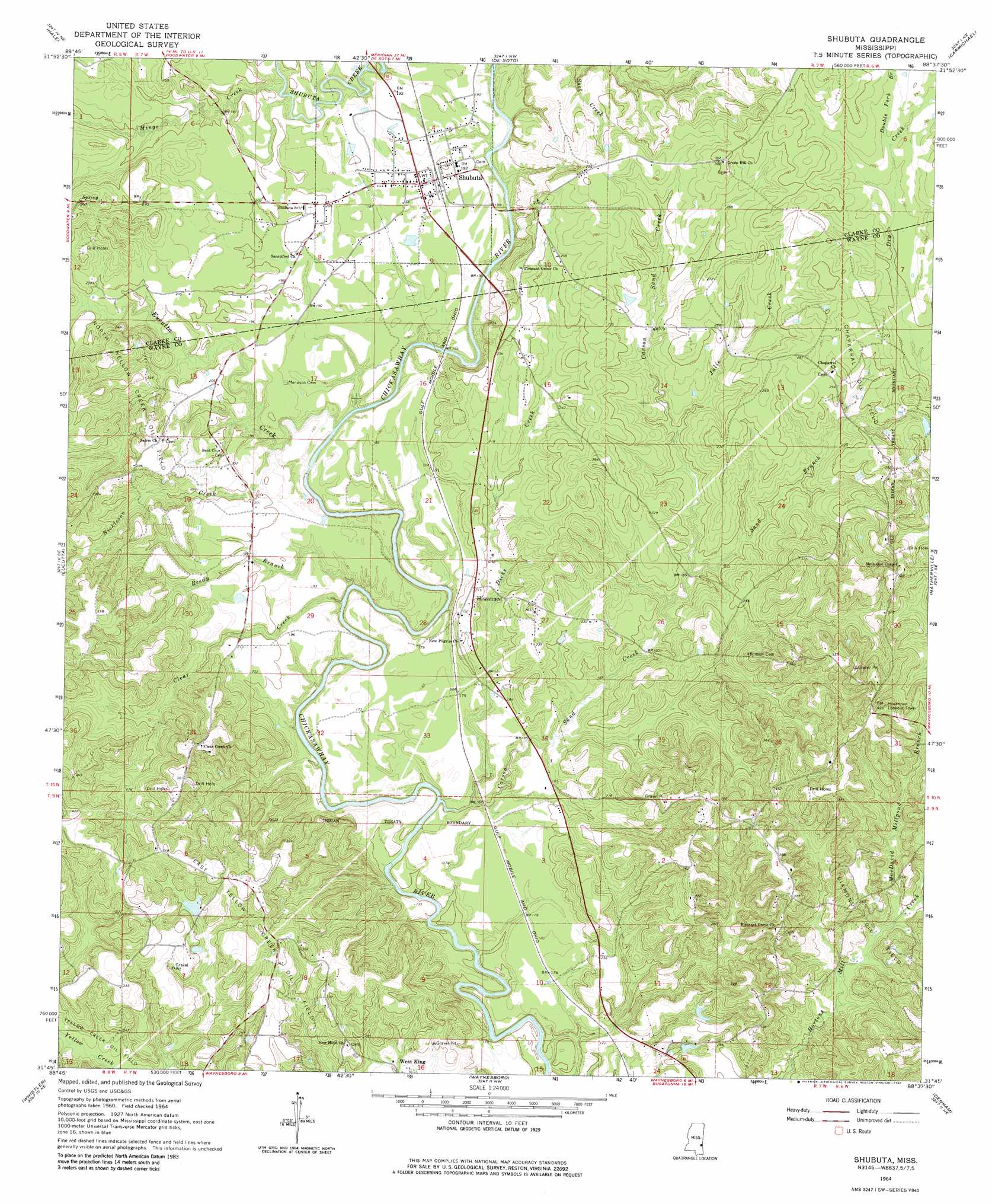
USGS Topo Quad 31088g6 - 1:24,000 scale
| Topo Map Name: | Shubuta |
| USGS Topo Quad ID: | 31088g6 |
| Print Size: | ca. 21 1/4" wide x 27" high |
| Southeast Coordinates: | 31.75° N latitude / 88.625° W longitude |
| Map Center Coordinates: | 31.8125° N latitude / 88.6875° W longitude |
| U.S. State: | MS |
| Filename: | o31088g6.jpg |
| Download Map JPG Image: | Shubuta topo map 1:24,000 scale |
| Map Type: | Topographic |
| Topo Series: | 7.5´ |
| Map Scale: | 1:24,000 |
| Source of Map Images: | United States Geological Survey (USGS) |
| Alternate Map Versions: |
Shubuta MS 1964, updated 1965 Download PDF Buy paper map Shubuta MS 1964, updated 1981 Download PDF Buy paper map Shubuta MS 2012 Download PDF Buy paper map Shubuta MS 2015 Download PDF Buy paper map |
1:24,000 Topo Quads surrounding Shubuta
Pachuta |
Wautubbee |
Quittman |
Sykes |
Hinton |
Heidelberg |
Hale |
De Soto |
Carmichael |
Melvin |
Heidelberg Sw |
Eucutta |
Shubuta |
Matherville |
Isney |
Myrick |
Whistler |
Waynesboro |
Denham |
Aquilla |
Strengthford |
Water Oak |
Clara |
Buckatunna |
Copeland |
> Back to 31088e1 at 1:100,000 scale
> Back to 31088a1 at 1:250,000 scale
> Back to U.S. Topo Maps home
Shubuta topo map: Gazetteer
Shubuta: Dams
Graham Pond Dam elevation 89m 291′Shubuta: Lakes
Silver Lake elevation 98m 321′Shubuta: Oilfields
Chaparral Oil Field elevation 78m 255′Diamond Oil Field elevation 91m 298′
East Yellow Creek Oil Field elevation 92m 301′
Garland Creek Oil Field elevation 73m 239′
North Yellow Creek Oil Field elevation 72m 236′
Shubuta Oil Field elevation 64m 209′
Shubuta: Populated Places
Hiwannee elevation 66m 216′Shubuta elevation 58m 190′
West King elevation 62m 203′
Shubuta: Streams
Carson Sand Creek elevation 43m 141′Clear Creek elevation 45m 147′
Dicks Creek elevation 43m 141′
Double Fork Branch elevation 80m 262′
Eucutta Creek elevation 47m 154′
Julie Creek elevation 58m 190′
MacDavid Millpond Branch elevation 70m 229′
Mingo Creek elevation 53m 173′
Nickleson Creek elevation 50m 164′
Reedy Branch elevation 46m 150′
Sand Branch elevation 54m 177′
Shubuta digital topo map on disk
Buy this Shubuta topo map showing relief, roads, GPS coordinates and other geographical features, as a high-resolution digital map file on DVD:
Gulf Coast (LA, MS, AL, FL) & Southwestern Georgia
Buy digital topo maps: Gulf Coast (LA, MS, AL, FL) & Southwestern Georgia
 & Southwestern Georgia map DVD")