Heidelberg Sw Topo Map Mississippi
To zoom in, hover over the map of Heidelberg Sw
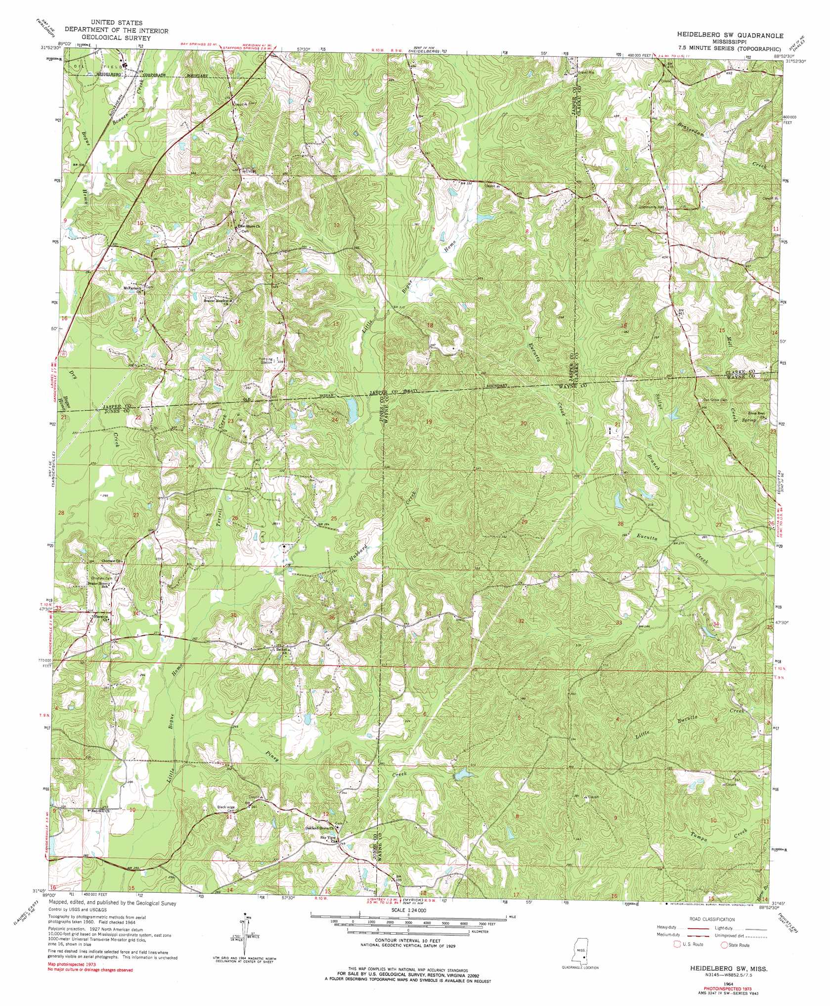
USGS Topo Quad 31088g8 - 1:24,000 scale
| Topo Map Name: | Heidelberg Sw |
| USGS Topo Quad ID: | 31088g8 |
| Print Size: | ca. 21 1/4" wide x 27" high |
| Southeast Coordinates: | 31.75° N latitude / 88.875° W longitude |
| Map Center Coordinates: | 31.8125° N latitude / 88.9375° W longitude |
| U.S. State: | MS |
| Filename: | o31088g8.jpg |
| Download Map JPG Image: | Heidelberg Sw topo map 1:24,000 scale |
| Map Type: | Topographic |
| Topo Series: | 7.5´ |
| Map Scale: | 1:24,000 |
| Source of Map Images: | United States Geological Survey (USGS) |
| Alternate Map Versions: |
Heidelberg SW MS 1964, updated 1965 Download PDF Buy paper map Heidelberg SW MS 1964, updated 1978 Download PDF Buy paper map Heidelberg SW MS 1964, updated 1978 Download PDF Buy paper map Heidelberg SW MS 2012 Download PDF Buy paper map Heidelberg SW MS 2015 Download PDF Buy paper map |
1:24,000 Topo Quads surrounding Heidelberg Sw
Montrose South |
Paulding |
Pachuta |
Wautubbee |
Quittman |
Lake Como |
Waldrup |
Heidelberg |
Hale |
De Soto |
Moss |
Sandersville |
Heidelberg Sw |
Eucutta |
Shubuta |
Laurel West |
Laurel East |
Myrick |
Whistler |
Waynesboro |
Ellisville |
Lanham |
Strengthford |
Water Oak |
Clara |
> Back to 31088e1 at 1:100,000 scale
> Back to 31088a1 at 1:250,000 scale
> Back to U.S. Topo Maps home
Heidelberg Sw topo map: Gazetteer
Heidelberg Sw: Bridges
McGills Bridge (historical) elevation 87m 285′Heidelberg Sw: Dams
Brownley Lake Dam elevation 89m 291′Heidelberg Sw: Oilfields
Bryan Oil Field elevation 103m 337′West Eucutta Oil Field elevation 98m 321′
Heidelberg Sw: Streams
Beaver Creek elevation 89m 291′Hubbard Creek elevation 89m 291′
Piney Creek elevation 76m 249′
Sallys Branch elevation 82m 269′
Terrell Creek elevation 89m 291′
Heidelberg Sw digital topo map on disk
Buy this Heidelberg Sw topo map showing relief, roads, GPS coordinates and other geographical features, as a high-resolution digital map file on DVD:
Gulf Coast (LA, MS, AL, FL) & Southwestern Georgia
Buy digital topo maps: Gulf Coast (LA, MS, AL, FL) & Southwestern Georgia
 & Southwestern Georgia map DVD")