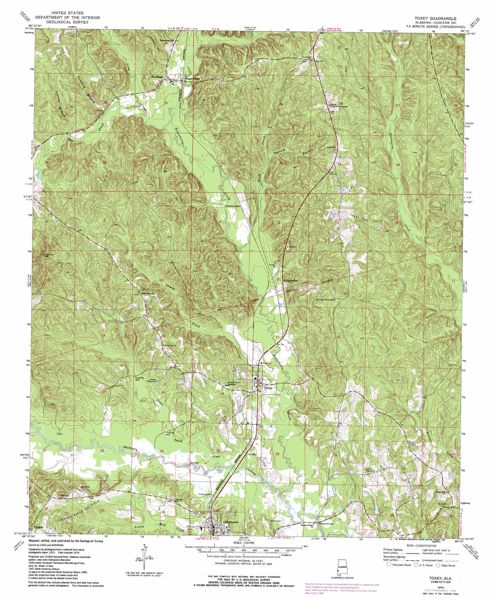
Toxey Topo Map Alabama
To zoom in, hover over the map of Toxey
USGS Topo Quad 31088h3 - 1:24,000 scale
| Topo Map Name: | Toxey |
| USGS Topo Quad ID: | 31088h3 |
| Print Size: | ca. 21 1/4" wide x 27" high |
| Southeast Coordinates: | 31.875° N latitude / 88.25° W longitude |
| Map Center Coordinates: | 31.9375° N latitude / 88.3125° W longitude |
| U.S. State: | AL |
| Filename: | o31088h3.jpg |
| Download Map JPG Image: | Toxey topo map 1:24,000 scale |
| Map Type: | Topographic |
| Topo Series: | 7.5´ |
| Map Scale: | 1:24,000 |
| Source of Map Images: | United States Geological Survey (USGS) |
| Alternate Map Versions: |
Toxey AL 1974, updated 1977 Download PDF Buy paper map Toxey AL 1974, updated 1987 Download PDF Buy paper map Toxey AL 2011 Download PDF Buy paper map Toxey AL 2014 Download PDF Buy paper map |
1:24,000 Topo Quads surrounding Toxey
Snell |
Yantley |
Lisman |
Jachin |
Pennington |
Sykes |
Hinton |
Land |
Butler |
Putnam |
Carmichael |
Melvin |
Toxey |
Ararat |
Woods Bluff |
Matherville |
Isney |
Silas |
Coffeeville Lock And Dam |
Coffeeville |
Denham |
Aquilla |
Millry North |
Bladon Springs |
Tattlersville |
> Back to 31088e1 at 1:100,000 scale
> Back to 31088a1 at 1:250,000 scale
> Back to U.S. Topo Maps home
Toxey topo map: Gazetteer
Toxey: Bridges
Mosley Bridge elevation 19m 62′Toxey: Oilfields
Choctaw Ridge Oil Field elevation 63m 206′North Choctaw Ridge Oil Field elevation 24m 78′
Sugar Ridge Oil Field elevation 53m 173′
Toxey Oil Field elevation 66m 216′
Toxey: Populated Places
Bogueloosa elevation 47m 154′Brightwater elevation 51m 167′
Chappell Hill elevation 49m 160′
Gilbertown elevation 39m 127′
Hodgewood elevation 39m 127′
Jackson Spur elevation 40m 131′
Lusk elevation 85m 278′
Needham elevation 52m 170′
Paragon elevation 75m 246′
Toxey elevation 33m 108′
Toxey: Streams
Bear Creek elevation 49m 160′Bogueloosa Creek elevation 17m 55′
Buck Creek elevation 33m 108′
Butterfly Branch elevation 39m 127′
Campbell Branch elevation 35m 114′
Cane Creek elevation 46m 150′
Dixie Branch elevation 46m 150′
James Creek elevation 24m 78′
Long Creek elevation 42m 137′
Mill Branch elevation 20m 65′
Phillips Branch elevation 27m 88′
Possum Branch elevation 48m 157′
Possum Branch elevation 56m 183′
Puss Cuss Creek elevation 27m 88′
Rock Branch elevation 30m 98′
Seals Creek elevation 21m 68′
Tanyard Branch elevation 49m 160′
Toxey digital topo map on disk
Buy this Toxey topo map showing relief, roads, GPS coordinates and other geographical features, as a high-resolution digital map file on DVD:
Gulf Coast (LA, MS, AL, FL) & Southwestern Georgia
Buy digital topo maps: Gulf Coast (LA, MS, AL, FL) & Southwestern Georgia
 & Southwestern Georgia map DVD")