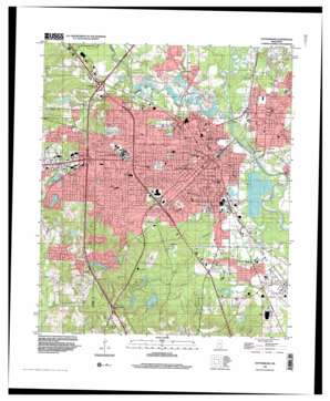
Hattiesburg Topo Map Mississippi
To zoom in, hover over the map of Hattiesburg
USGS Topo Quad 31089c3 - 1:24,000 scale
| Topo Map Name: | Hattiesburg |
| USGS Topo Quad ID: | 31089c3 |
| Print Size: | ca. 21 1/4" wide x 27" high |
| Southeast Coordinates: | 31.25° N latitude / 89.25° W longitude |
| Map Center Coordinates: | 31.3125° N latitude / 89.3125° W longitude |
| U.S. State: | MS |
| Filename: | o31089c3.jpg |
| Download Map JPG Image: | Hattiesburg topo map 1:24,000 scale |
| Map Type: | Topographic |
| Topo Series: | 7.5´ |
| Map Scale: | 1:24,000 |
| Source of Map Images: | United States Geological Survey (USGS) |
| Alternate Map Versions: |
Hattiesburg MS 1964, updated 1965 Download PDF Buy paper map Hattiesburg MS 1964, updated 1976 Download PDF Buy paper map Hattiesburg MS 1964, updated 1983 Download PDF Buy paper map Hattiesburg MS 1964, updated 1983 Download PDF Buy paper map Hattiesburg MS 1996, updated 2000 Download PDF Buy paper map Hattiesburg MS 2012 Download PDF Buy paper map Hattiesburg MS 2015 Download PDF Buy paper map |
1:24,000 Topo Quads surrounding Hattiesburg
> Back to 31089a1 at 1:100,000 scale
> Back to 31088a1 at 1:250,000 scale
> Back to U.S. Topo Maps home
Hattiesburg topo map: Gazetteer
Hattiesburg: Airports
Hattiesburg Municipal Airport elevation 40m 131′Hattiesburg: Crossings
Interchange 60 elevation 109m 357′Interchange 65 elevation 67m 219′
Interchange 67 elevation 56m 183′
McInnis Ferry (historical) elevation 33m 108′
Peoples Ferry (historical) elevation 36m 118′
Rawls Ferry (historical) elevation 36m 118′
Hattiesburg: Dams
H C Hudson Lake Dam elevation 56m 183′Hattiesburg Lagoon Dam elevation 47m 154′
Lake Cole Dam elevation 57m 187′
McArthur Lake Dam elevation 45m 147′
Mrs Margaret Laird Pond Dam elevation 67m 219′
Sumrall Lake Dam elevation 43m 141′
West Lake Dam elevation 79m 259′
Hattiesburg: Parks
Eureka Playground elevation 47m 154′Jaycee Park elevation 52m 170′
Kamper Park elevation 50m 164′
M M Roberts Stadium elevation 61m 200′
Optimist Park elevation 50m 164′
Pineview Park elevation 61m 200′
Hattiesburg: Populated Places
Arnold Line elevation 66m 216′Bedford Woods elevation 72m 236′
Bedford Woods West elevation 89m 291′
Berkshire Hills elevation 70m 229′
Bonhomie elevation 58m 190′
Dixie Pine elevation 45m 147′
Forrest Hills elevation 107m 351′
Forrest Park elevation 63m 206′
Glendale elevation 56m 183′
Harvey elevation 45m 147′
Hattiesburg elevation 52m 170′
Heatherwood Estates elevation 76m 249′
Innswood elevation 97m 318′
Innswood South elevation 93m 305′
Kensington Woods elevation 67m 219′
Kirkwood Park elevation 76m 249′
Lakewood elevation 78m 255′
Lamar Park elevation 72m 236′
Mars Hill elevation 56m 183′
Palmers Crossing elevation 55m 180′
Petal elevation 48m 157′
Regency Estates elevation 72m 236′
Richburg elevation 128m 419′
Richburg Heights elevation 103m 337′
Riverside elevation 52m 170′
Shadow Wood elevation 117m 383′
Sharon Acres elevation 65m 213′
Tall Pines elevation 69m 226′
Varnado elevation 67m 219′
Villa del Rey elevation 91m 298′
West Hills elevation 63m 206′
West Lake Manor elevation 66m 216′
Westgate elevation 93m 305′
Westover elevation 62m 203′
Westover West elevation 60m 196′
Westwood elevation 61m 200′
Woodhaven elevation 113m 370′
Woodlawn Court elevation 54m 177′
Hattiesburg: Post Offices
Hattiesburg Post Office elevation 53m 173′Hattiesburg: Reservoirs
Lairds Lake elevation 68m 223′Hattiesburg: Springs
Mammoth Springs elevation 52m 170′Hattiesburg: Streams
Bay Creek elevation 53m 173′Boggy Branch elevation 44m 144′
Bouie River elevation 36m 118′
Burketts Creek elevation 35m 114′
Camerons Reed Brake elevation 76m 249′
Gordons Creek elevation 38m 124′
Greens Creek elevation 46m 150′
Greens Creek elevation 36m 118′
Mixons Creek elevation 45m 147′
Hattiesburg digital topo map on disk
Buy this Hattiesburg topo map showing relief, roads, GPS coordinates and other geographical features, as a high-resolution digital map file on DVD:
Gulf Coast (LA, MS, AL, FL) & Southwestern Georgia
Buy digital topo maps: Gulf Coast (LA, MS, AL, FL) & Southwestern Georgia


