Oloh Topo Map Mississippi
To zoom in, hover over the map of Oloh
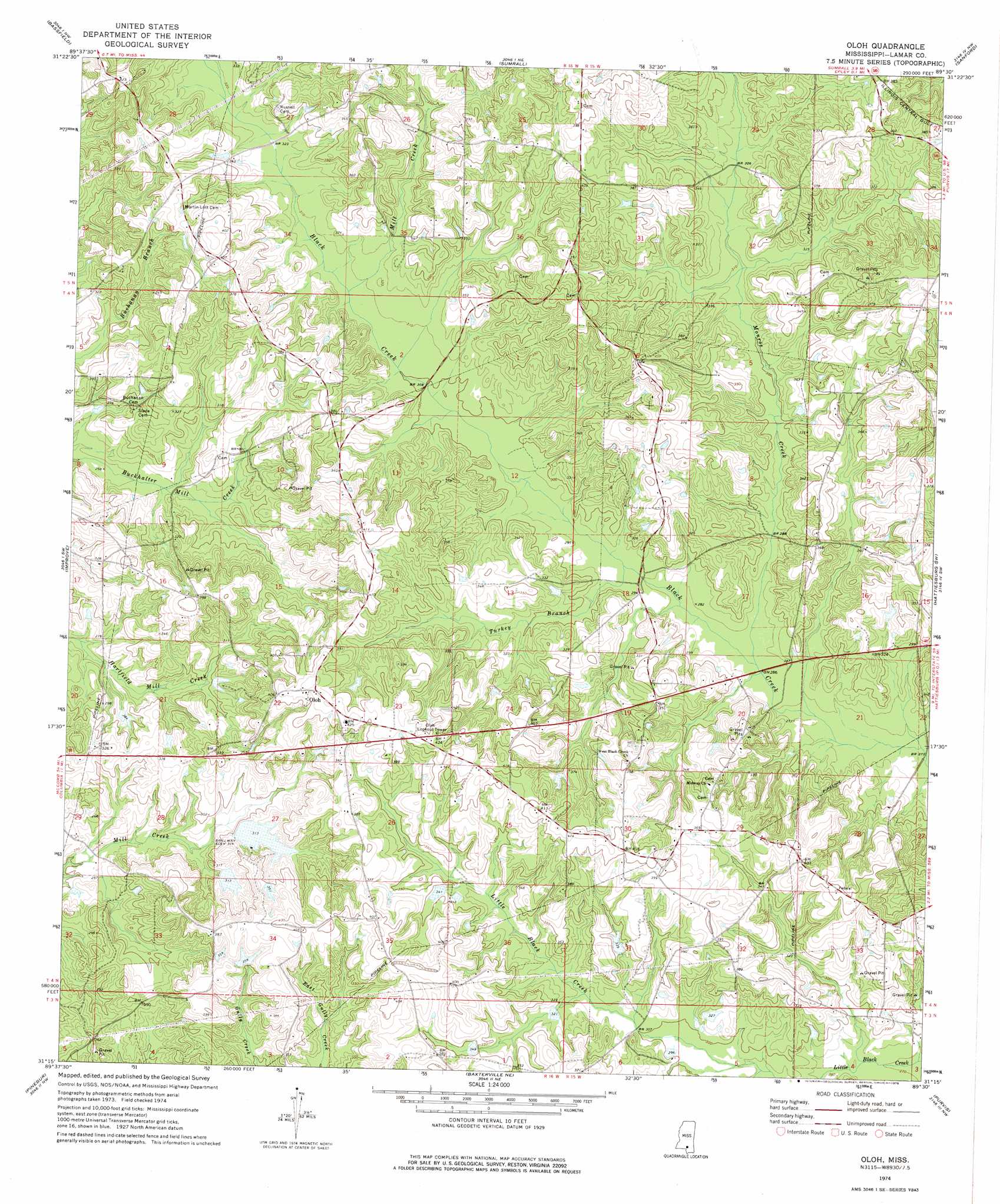
USGS Topo Quad 31089c5 - 1:24,000 scale
| Topo Map Name: | Oloh |
| USGS Topo Quad ID: | 31089c5 |
| Print Size: | ca. 21 1/4" wide x 27" high |
| Southeast Coordinates: | 31.25° N latitude / 89.5° W longitude |
| Map Center Coordinates: | 31.3125° N latitude / 89.5625° W longitude |
| U.S. State: | MS |
| Filename: | o31089c5.jpg |
| Download Map JPG Image: | Oloh topo map 1:24,000 scale |
| Map Type: | Topographic |
| Topo Series: | 7.5´ |
| Map Scale: | 1:24,000 |
| Source of Map Images: | United States Geological Survey (USGS) |
| Alternate Map Versions: |
Oloh MS 1974, updated 1978 Download PDF Buy paper map Oloh MS 2012 Download PDF Buy paper map Oloh MS 2015 Download PDF Buy paper map |
1:24,000 Topo Quads surrounding Oloh
Prentiss East |
Lake Mike Connor |
Williamsburg |
Seminary |
Moselle |
Bunker Hill |
Bassfield |
Sumrall |
Sanford |
Eastabuchie |
Columbia North |
Improve |
Oloh |
Hattiesburg Sw |
Hattiesburg |
Columbia South |
Pinebur |
Baxterville Ne |
Purvis |
Dixie |
Sandy Hook |
Baxterville Sw |
Baxterville |
Lumberton |
Rock Hill |
> Back to 31089a1 at 1:100,000 scale
> Back to 31088a1 at 1:250,000 scale
> Back to U.S. Topo Maps home
Oloh topo map: Gazetteer
Oloh: Bridges
Bob Lott Bridge elevation 77m 252′Oloh: Dams
Doctor Richard Clark Pond Dam elevation 107m 351′Irby-Alexander Pond Dam elevation 109m 357′
J D Broome Pond Dam elevation 93m 305′
J D Broome Pond Dam elevation 93m 305′
Oloh: Populated Places
Oloh elevation 127m 416′Oloh: Streams
Baptist Branch elevation 90m 295′Bear Bay elevation 96m 314′
Mill Creek elevation 95m 311′
Monroe Creek elevation 81m 265′
Turkey Branch elevation 88m 288′
Oloh digital topo map on disk
Buy this Oloh topo map showing relief, roads, GPS coordinates and other geographical features, as a high-resolution digital map file on DVD:
Gulf Coast (LA, MS, AL, FL) & Southwestern Georgia
Buy digital topo maps: Gulf Coast (LA, MS, AL, FL) & Southwestern Georgia
 & Southwestern Georgia map DVD")