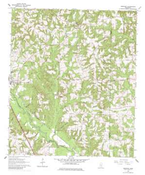
Seminary Topo Map Mississippi
To zoom in, hover over the map of Seminary
USGS Topo Quad 31089e4 - 1:24,000 scale
| Topo Map Name: | Seminary |
| USGS Topo Quad ID: | 31089e4 |
| Print Size: | ca. 21 1/4" wide x 27" high |
| Southeast Coordinates: | 31.5° N latitude / 89.375° W longitude |
| Map Center Coordinates: | 31.5625° N latitude / 89.4375° W longitude |
| U.S. State: | MS |
| Filename: | o31089e4.jpg |
| Download Map JPG Image: | Seminary topo map 1:24,000 scale |
| Map Type: | Topographic |
| Topo Series: | 7.5´ |
| Map Scale: | 1:24,000 |
| Source of Map Images: | United States Geological Survey (USGS) |
| Alternate Map Versions: |
Seminary MS 1964, updated 1965 Download PDF Buy paper map Seminary MS 1964, updated 1978 Download PDF Buy paper map Seminary MS 1964, updated 1982 Download PDF Buy paper map Seminary MS 2012 Download PDF Buy paper map Seminary MS 2015 Download PDF Buy paper map |
1:24,000 Topo Quads surrounding Seminary
> Back to 31089e1 at 1:100,000 scale
> Back to 31088a1 at 1:250,000 scale
> Back to U.S. Topo Maps home
Seminary topo map: Gazetteer
Seminary: Falls
Seminary Falls elevation 68m 223′Seminary: Populated Places
Bethel elevation 135m 442′Eminence elevation 134m 439′
Gandsi elevation 70m 229′
Kelly elevation 119m 390′
Moscos elevation 140m 459′
Oak Bowery elevation 116m 380′
Seminary elevation 77m 252′
Union elevation 92m 301′
Seminary: Post Offices
Katie Post Office (historical) elevation 139m 456′Sitka Post Office (historical) elevation 111m 364′
Seminary: Streams
Birdie Branch elevation 66m 216′Brownie Branch elevation 66m 216′
Curry Creek elevation 65m 213′
Double Branch elevation 67m 219′
Jessie Sanford Branch elevation 85m 278′
Kelly Creek elevation 77m 252′
King Branch elevation 86m 282′
Lower Prong elevation 74m 242′
Manasco Branch elevation 68m 223′
Military Branch elevation 64m 209′
Mooney Branch elevation 64m 209′
Neeley Branch elevation 68m 223′
Padgett Branch elevation 85m 278′
Shop Branch elevation 65m 213′
Taylor Branch elevation 65m 213′
West Fork elevation 78m 255′
Wolfpen Branch elevation 79m 259′
Seminary digital topo map on disk
Buy this Seminary topo map showing relief, roads, GPS coordinates and other geographical features, as a high-resolution digital map file on DVD:
Gulf Coast (LA, MS, AL, FL) & Southwestern Georgia
Buy digital topo maps: Gulf Coast (LA, MS, AL, FL) & Southwestern Georgia


