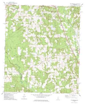
Williamsburg Topo Map Mississippi
To zoom in, hover over the map of Williamsburg
USGS Topo Quad 31089e5 - 1:24,000 scale
| Topo Map Name: | Williamsburg |
| USGS Topo Quad ID: | 31089e5 |
| Print Size: | ca. 21 1/4" wide x 27" high |
| Southeast Coordinates: | 31.5° N latitude / 89.5° W longitude |
| Map Center Coordinates: | 31.5625° N latitude / 89.5625° W longitude |
| U.S. State: | MS |
| Filename: | o31089e5.jpg |
| Download Map JPG Image: | Williamsburg topo map 1:24,000 scale |
| Map Type: | Topographic |
| Topo Series: | 7.5´ |
| Map Scale: | 1:24,000 |
| Source of Map Images: | United States Geological Survey (USGS) |
| Alternate Map Versions: |
Williamsburg MS 1974, updated 1978 Download PDF Buy paper map Williamsburg MS 2012 Download PDF Buy paper map Williamsburg MS 2015 Download PDF Buy paper map |
1:24,000 Topo Quads surrounding Williamsburg
> Back to 31089e1 at 1:100,000 scale
> Back to 31088a1 at 1:250,000 scale
> Back to U.S. Topo Maps home
Williamsburg topo map: Gazetteer
Williamsburg: Dams
W H Hughes Lake Dam elevation 104m 341′Willie Parker Lake Dam elevation 71m 232′
Williamsburg: Populated Places
Cold Springs elevation 100m 328′Liberty elevation 111m 364′
McDonald elevation 113m 370′
Mount Horeb elevation 97m 318′
Williamsburg elevation 104m 341′
Williamsburg: Streams
Big Swamp Creek elevation 67m 219′Caney Head Creek elevation 76m 249′
Dunk Branch elevation 77m 252′
Ezell Creek elevation 73m 239′
Gin Branch elevation 66m 216′
Kelly Creek elevation 71m 232′
Roach Creek elevation 74m 242′
Terrible Creek elevation 77m 252′
Town Creek elevation 81m 265′
West Bowie Creek elevation 75m 246′
Williamsburg: Swamps
Big Swamp elevation 88m 288′Williamsburg digital topo map on disk
Buy this Williamsburg topo map showing relief, roads, GPS coordinates and other geographical features, as a high-resolution digital map file on DVD:
Gulf Coast (LA, MS, AL, FL) & Southwestern Georgia
Buy digital topo maps: Gulf Coast (LA, MS, AL, FL) & Southwestern Georgia


