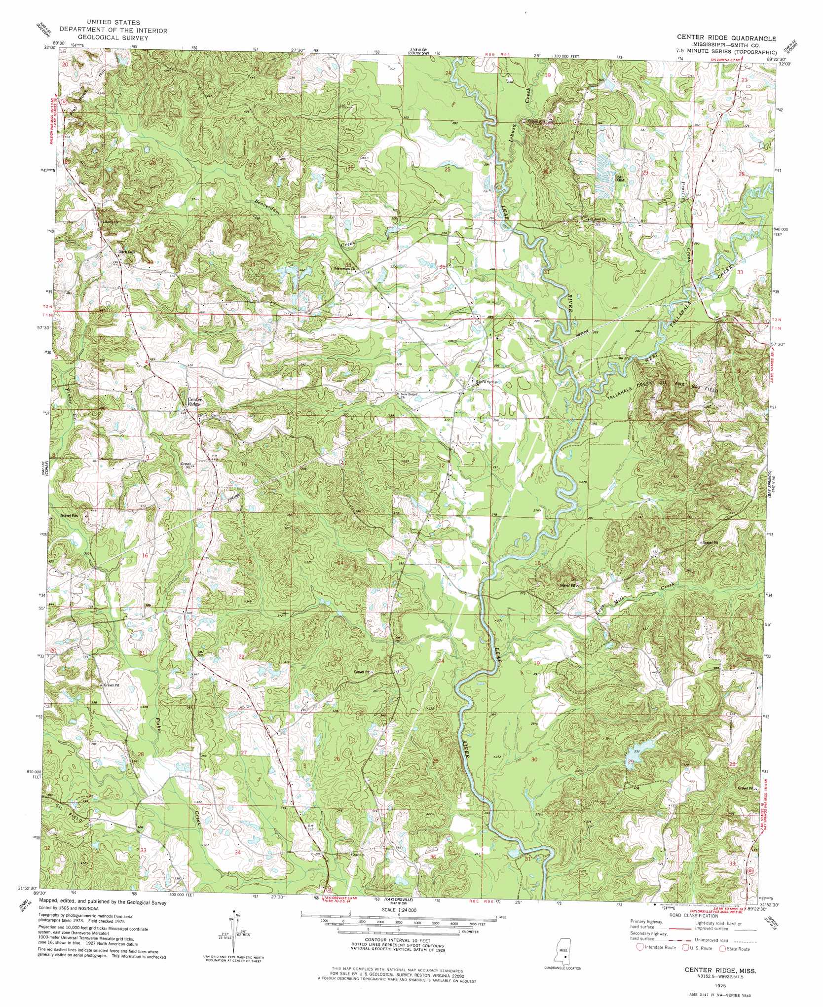
Center Ridge Topo Map Mississippi
To zoom in, hover over the map of Center Ridge
USGS Topo Quad 31089h4 - 1:24,000 scale
| Topo Map Name: | Center Ridge |
| USGS Topo Quad ID: | 31089h4 |
| Print Size: | ca. 21 1/4" wide x 27" high |
| Southeast Coordinates: | 31.875° N latitude / 89.375° W longitude |
| Map Center Coordinates: | 31.9375° N latitude / 89.4375° W longitude |
| U.S. State: | MS |
| Filename: | o31089h4.jpg |
| Download Map JPG Image: | Center Ridge topo map 1:24,000 scale |
| Map Type: | Topographic |
| Topo Series: | 7.5´ |
| Map Scale: | 1:24,000 |
| Source of Map Images: | United States Geological Survey (USGS) |
| Alternate Map Versions: |
Center Ridge MS 1975, updated 1978 Download PDF Buy paper map Center Ridge MS 2012 Download PDF Buy paper map Center Ridge MS 2015 Download PDF Buy paper map |
1:24,000 Topo Quads surrounding Center Ridge
Polkville |
Homewood |
Pineville |
Clear Springs |
Montrose North |
White Oak |
Raleigh |
Louin Sw |
Louin |
Montrose South |
Magee North |
Cohay |
Center Ridge |
Bay Springs |
Lake Como |
Magee South |
Mize |
Taylorsville |
Soso |
Moss |
Lone Star |
Collins |
Hot Coffee |
Hebron |
Laurel West |
> Back to 31089e1 at 1:100,000 scale
> Back to 31088a1 at 1:250,000 scale
> Back to U.S. Topo Maps home
Center Ridge topo map: Gazetteer
Center Ridge: Dams
Blackwell Lake Dam elevation 89m 291′Blackwell Lake Dam elevation 104m 341′
Clarke Lake Dam elevation 102m 334′
Center Ridge: Oilfields
East Tallahalla Creek Oil Field elevation 86m 282′Tallahala Creek Oil and Gas Field elevation 102m 334′
Center Ridge: Populated Places
Bezer elevation 148m 485′Center Ridge elevation 134m 439′
Mineral Springs elevation 95m 311′
Center Ridge: Streams
Beaverdam Creek elevation 88m 288′Ichusa Creek elevation 83m 272′
Keys Mill Creek elevation 76m 249′
Mill Creek elevation 90m 295′
Prairie Creek elevation 82m 269′
Thompson Mill Creek elevation 85m 278′
West Tallahala Creek elevation 86m 282′
Center Ridge digital topo map on disk
Buy this Center Ridge topo map showing relief, roads, GPS coordinates and other geographical features, as a high-resolution digital map file on DVD:
Gulf Coast (LA, MS, AL, FL) & Southwestern Georgia
Buy digital topo maps: Gulf Coast (LA, MS, AL, FL) & Southwestern Georgia
 & Southwestern Georgia map DVD")