Mendenhall East Topo Map Mississippi
To zoom in, hover over the map of Mendenhall East
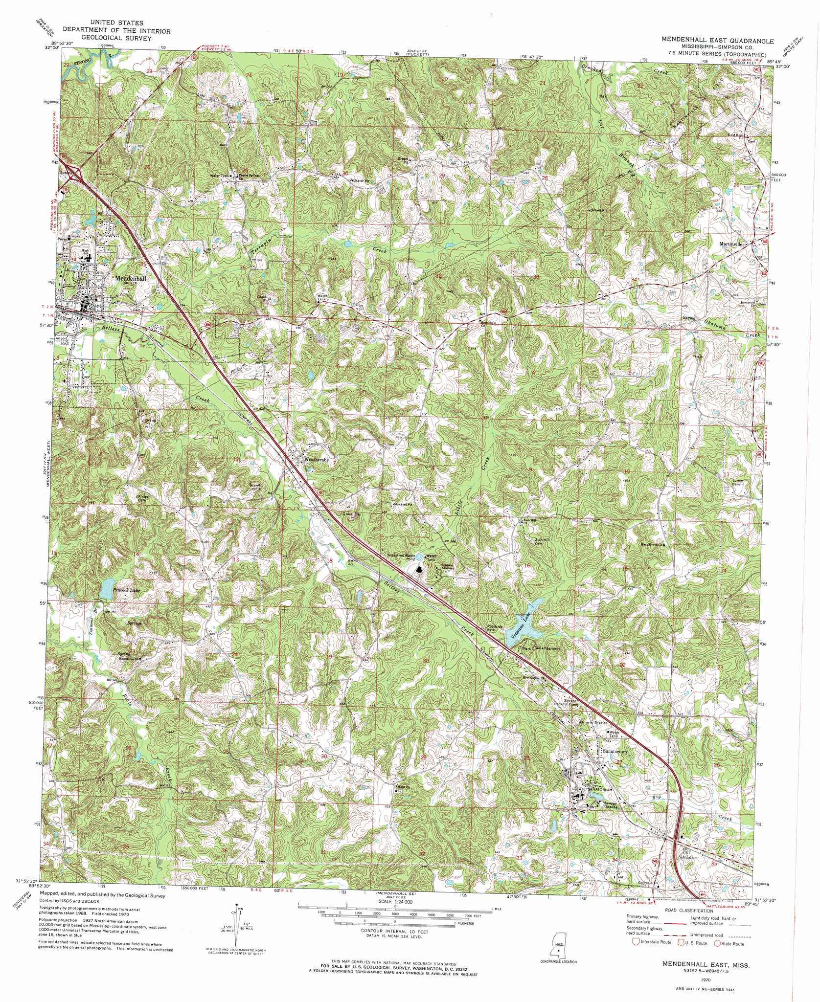
USGS Topo Quad 31089h7 - 1:24,000 scale
| Topo Map Name: | Mendenhall East |
| USGS Topo Quad ID: | 31089h7 |
| Print Size: | ca. 21 1/4" wide x 27" high |
| Southeast Coordinates: | 31.875° N latitude / 89.75° W longitude |
| Map Center Coordinates: | 31.9375° N latitude / 89.8125° W longitude |
| U.S. State: | MS |
| Filename: | o31089h7.jpg |
| Download Map JPG Image: | Mendenhall East topo map 1:24,000 scale |
| Map Type: | Topographic |
| Topo Series: | 7.5´ |
| Map Scale: | 1:24,000 |
| Source of Map Images: | United States Geological Survey (USGS) |
| Alternate Map Versions: |
Mendenhall East MS 1970, updated 1972 Download PDF Buy paper map Mendenhall East MS 2012 Download PDF Buy paper map Mendenhall East MS 2015 Download PDF Buy paper map |
1:24,000 Topo Quads surrounding Mendenhall East
Whitfield |
Puckett Nw |
Johns |
Polkville |
Homewood |
Star |
Braxton |
Puckett |
White Oak |
Raleigh |
Harrisville |
Mendenhall West |
Mendenhall East |
Magee North |
Cohay |
Schley |
Shivers |
Mendenhall Se |
Magee South |
Mize |
Monticello Ne |
New Hebron |
Mount Carmel |
Lone Star |
Collins |
> Back to 31089e1 at 1:100,000 scale
> Back to 31088a1 at 1:250,000 scale
> Back to U.S. Topo Maps home
Mendenhall East topo map: Gazetteer
Mendenhall East: Dams
Peacock Lake Dam elevation 104m 341′Simpson Legion Lake Dam elevation 125m 410′
Mendenhall East: Oilfields
Martinville Oil Field elevation 145m 475′Mendenhall East: Populated Places
Fayettehill elevation 152m 498′Martinville elevation 147m 482′
Mendenhall elevation 102m 334′
Sanatorium elevation 160m 524′
Weathersby elevation 116m 380′
Zion Hill elevation 157m 515′
Mendenhall East: Reservoirs
Peacock Lake elevation 108m 354′Simpson Legion State Fishing Lake elevation 124m 406′
Mendenhall East: Streams
Campbell Creek elevation 85m 278′Cat Branch elevation 105m 344′
Little Creek elevation 113m 370′
Simmons Branch elevation 98m 321′
Terrapin Creek elevation 95m 311′
Mendenhall East digital topo map on disk
Buy this Mendenhall East topo map showing relief, roads, GPS coordinates and other geographical features, as a high-resolution digital map file on DVD:
Gulf Coast (LA, MS, AL, FL) & Southwestern Georgia
Buy digital topo maps: Gulf Coast (LA, MS, AL, FL) & Southwestern Georgia
 & Southwestern Georgia map DVD")