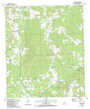
Street Topo Map Mississippi
To zoom in, hover over the map of Street
USGS Topo Quad 31090a7 - 1:24,000 scale
| Topo Map Name: | Street |
| USGS Topo Quad ID: | 31090a7 |
| Print Size: | ca. 21 1/4" wide x 27" high |
| Southeast Coordinates: | 31° N latitude / 90.75° W longitude |
| Map Center Coordinates: | 31.0625° N latitude / 90.8125° W longitude |
| U.S. State: | MS |
| Filename: | o31090a7.jpg |
| Download Map JPG Image: | Street topo map 1:24,000 scale |
| Map Type: | Topographic |
| Topo Series: | 7.5´ |
| Map Scale: | 1:24,000 |
| Source of Map Images: | United States Geological Survey (USGS) |
| Alternate Map Versions: |
Street MS 1988, updated 1988 Download PDF Buy paper map Street MS 2012 Download PDF Buy paper map Street MS 2015 Download PDF Buy paper map |
1:24,000 Topo Quads surrounding Street
> Back to 31090a1 at 1:100,000 scale
> Back to 31090a1 at 1:250,000 scale
> Back to U.S. Topo Maps home
Street topo map: Gazetteer
Street: Bridges
Harold Bridge elevation 62m 203′Lindsey Bridge elevation 62m 203′
Waller Bridge elevation 69m 226′
Street: Crossings
Latimer Ford elevation 61m 200′Street: Dams
F A Anderson Lake Dam elevation 91m 298′F A Anderson Lake Dam elevation 92m 301′
J C Stevens Lake Dam elevation 74m 242′
Street: Oilfields
Liberty Oil Field elevation 89m 291′Street: Populated Places
Beechwood elevation 93m 305′Street: Streams
Cars Creek elevation 69m 226′Causey Creek elevation 74m 242′
Cox Creek elevation 63m 206′
Davis Creek elevation 64m 209′
Felder Creek elevation 76m 249′
Mart Branch elevation 66m 216′
Mill Creek elevation 67m 219′
Powell Creek elevation 61m 200′
Shaw Creek elevation 73m 239′
Waggoner Creek elevation 77m 252′
Wilson Creek elevation 67m 219′
Street digital topo map on disk
Buy this Street topo map showing relief, roads, GPS coordinates and other geographical features, as a high-resolution digital map file on DVD:


