Holmesville Topo Map Mississippi
To zoom in, hover over the map of Holmesville
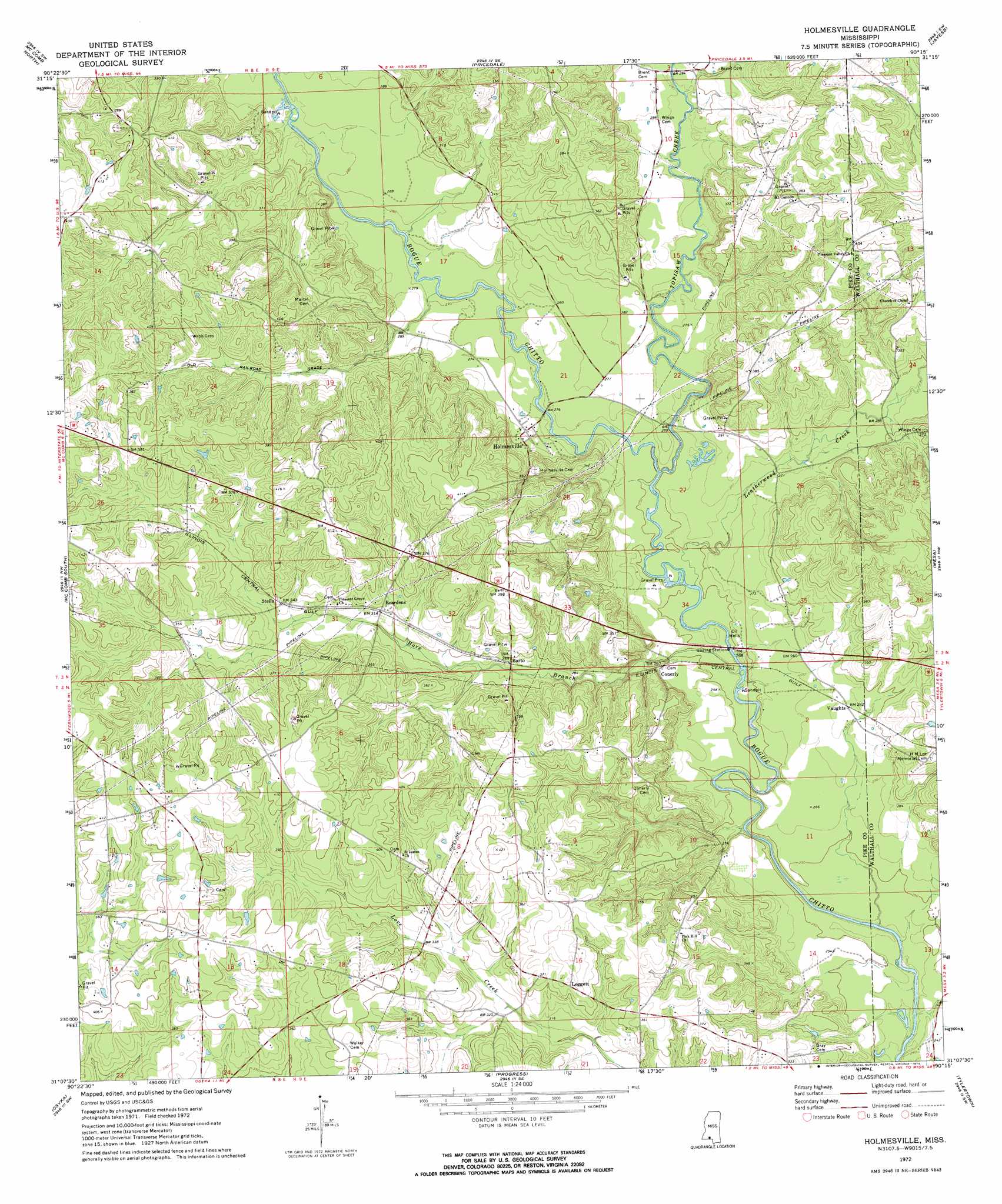
USGS Topo Quad 31090b3 - 1:24,000 scale
| Topo Map Name: | Holmesville |
| USGS Topo Quad ID: | 31090b3 |
| Print Size: | ca. 21 1/4" wide x 27" high |
| Southeast Coordinates: | 31.125° N latitude / 90.25° W longitude |
| Map Center Coordinates: | 31.1875° N latitude / 90.3125° W longitude |
| U.S. State: | MS |
| Filename: | o31090b3.jpg |
| Download Map JPG Image: | Holmesville topo map 1:24,000 scale |
| Map Type: | Topographic |
| Topo Series: | 7.5´ |
| Map Scale: | 1:24,000 |
| Source of Map Images: | United States Geological Survey (USGS) |
| Alternate Map Versions: |
Holmesville MS 1972, updated 1974 Download PDF Buy paper map Holmesville MS 2012 Download PDF Buy paper map Holmesville MS 2015 Download PDF Buy paper map |
1:24,000 Topo Quads surrounding Holmesville
West Lincoln |
Bogue Chitto |
Ruth |
Topeka |
Tilton |
Auburn |
Mccomb North |
Pricedale |
Jayess |
Darbun |
Lake Tangipahoa |
Mccomb South |
Holmesville |
Mesa |
Kokomo |
Terrys Creek |
Osyka |
Progress |
Tylertown |
Tylertown Se |
Kentwood |
Spring Creek |
Sunny Hill |
Clifton |
Pine |
> Back to 31090a1 at 1:100,000 scale
> Back to 31090a1 at 1:250,000 scale
> Back to U.S. Topo Maps home
Holmesville topo map: Gazetteer
Holmesville: Dams
Howell Lake Dam elevation 128m 419′Parker Lake Dam elevation 105m 344′
Holmesville: Populated Places
Barto elevation 87m 285′Beardens elevation 96m 314′
Bridges elevation 112m 367′
Conerly elevation 81m 265′
Holmesville elevation 91m 298′
Leggett elevation 110m 360′
New Holmesville (historical) elevation 84m 275′
Stella elevation 104m 341′
Vaughts elevation 87m 285′
Holmesville: Streams
Bars Branch elevation 73m 239′Leatherwood Creek elevation 73m 239′
Topisaw Creek elevation 75m 246′
Holmesville digital topo map on disk
Buy this Holmesville topo map showing relief, roads, GPS coordinates and other geographical features, as a high-resolution digital map file on DVD: