Auburn Topo Map Mississippi
To zoom in, hover over the map of Auburn
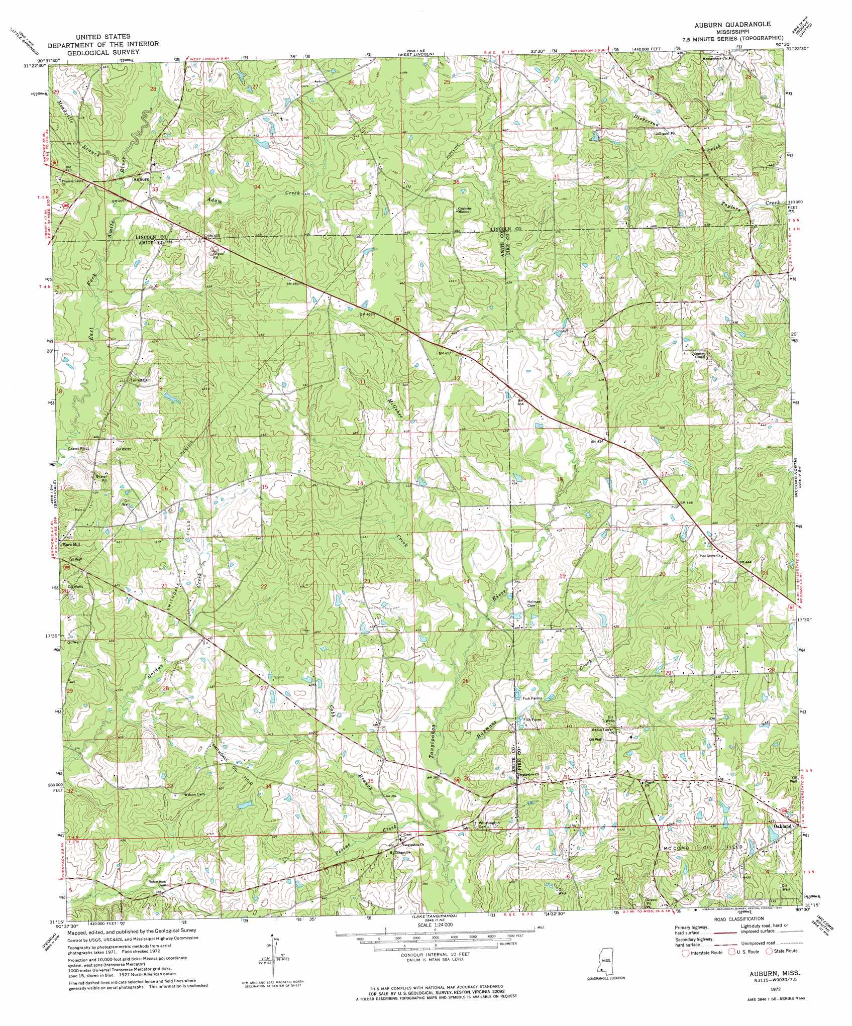
USGS Topo Quad 31090c5 - 1:24,000 scale
| Topo Map Name: | Auburn |
| USGS Topo Quad ID: | 31090c5 |
| Print Size: | ca. 21 1/4" wide x 27" high |
| Southeast Coordinates: | 31.25° N latitude / 90.5° W longitude |
| Map Center Coordinates: | 31.3125° N latitude / 90.5625° W longitude |
| U.S. State: | MS |
| Filename: | o31090c5.jpg |
| Download Map JPG Image: | Auburn topo map 1:24,000 scale |
| Map Type: | Topographic |
| Topo Series: | 7.5´ |
| Map Scale: | 1:24,000 |
| Source of Map Images: | United States Geological Survey (USGS) |
| Alternate Map Versions: |
Auburn MS 1972, updated 1974 Download PDF Buy paper map Auburn MS 2012 Download PDF Buy paper map Auburn MS 2015 Download PDF Buy paper map |
1:24,000 Topo Quads surrounding Auburn
Eddicetown |
Mccall Creek |
Zetus |
Brookhaven |
Fair Oak Springs |
Bude |
Little Springs |
West Lincoln |
Bogue Chitto |
Ruth |
Busy Corner |
Smithdale |
Auburn |
Mccomb North |
Pricedale |
Liberty |
Peoria |
Lake Tangipahoa |
Mccomb South |
Holmesville |
Street |
Gillsburg |
Terrys Creek |
Osyka |
Progress |
> Back to 31090a1 at 1:100,000 scale
> Back to 31090a1 at 1:250,000 scale
> Back to U.S. Topo Maps home
Auburn topo map: Gazetteer
Auburn: Oilfields
Smithdale Oil Field elevation 134m 439′Auburn: Populated Places
Auburn elevation 131m 429′Oakland elevation 139m 456′
Tangipahoa elevation 123m 403′
Auburn: Post Offices
Fairfield Post Office (historical) elevation 131m 429′Auburn: Streams
Adam Creek elevation 119m 390′Cobb Branch elevation 113m 370′
Haymans Creek elevation 112m 367′
McGehee Creek elevation 115m 377′
Meadville Branch elevation 120m 393′
Pevine Creek elevation 113m 370′
Auburn digital topo map on disk
Buy this Auburn topo map showing relief, roads, GPS coordinates and other geographical features, as a high-resolution digital map file on DVD: