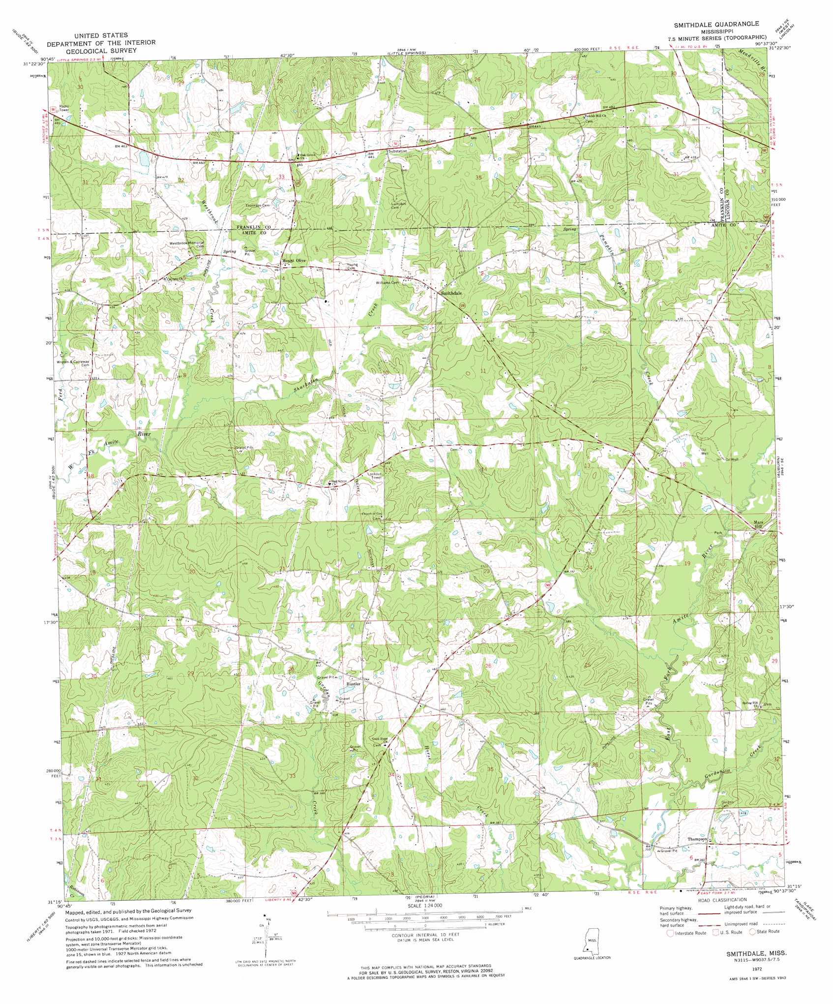
Smithdale Topo Map Mississippi
To zoom in, hover over the map of Smithdale
USGS Topo Quad 31090c6 - 1:24,000 scale
| Topo Map Name: | Smithdale |
| USGS Topo Quad ID: | 31090c6 |
| Print Size: | ca. 21 1/4" wide x 27" high |
| Southeast Coordinates: | 31.25° N latitude / 90.625° W longitude |
| Map Center Coordinates: | 31.3125° N latitude / 90.6875° W longitude |
| U.S. State: | MS |
| Filename: | o31090c6.jpg |
| Download Map JPG Image: | Smithdale topo map 1:24,000 scale |
| Map Type: | Topographic |
| Topo Series: | 7.5´ |
| Map Scale: | 1:24,000 |
| Source of Map Images: | United States Geological Survey (USGS) |
| Alternate Map Versions: |
Smithdale MS 1972, updated 1974 Download PDF Buy paper map Smithdale MS 2012 Download PDF Buy paper map Smithdale MS 2015 Download PDF Buy paper map |
1:24,000 Topo Quads surrounding Smithdale
Kirby |
Eddicetown |
Mccall Creek |
Zetus |
Brookhaven |
Meadville |
Bude |
Little Springs |
West Lincoln |
Bogue Chitto |
Homochitto |
Busy Corner |
Smithdale |
Auburn |
Mccomb North |
Bewelcome |
Liberty |
Peoria |
Lake Tangipahoa |
Mccomb South |
Berwick |
Street |
Gillsburg |
Terrys Creek |
Osyka |
> Back to 31090a1 at 1:100,000 scale
> Back to 31090a1 at 1:250,000 scale
> Back to U.S. Topo Maps home
Smithdale topo map: Gazetteer
Smithdale: Dams
Martin Lake Dam elevation 137m 449′Smithdale: Populated Places
Hustler elevation 135m 442′Mars Hill elevation 123m 403′
Mount Olive elevation 141m 462′
Smithdale elevation 143m 469′
Thompson elevation 118m 387′
Smithdale: Streams
Ferd Creek elevation 113m 370′Gordon Creek elevation 105m 344′
Pumpkin Patch Creek elevation 111m 364′
Shackaloa Creek elevation 116m 380′
Westbrook Creek elevation 116m 380′
Smithdale digital topo map on disk
Buy this Smithdale topo map showing relief, roads, GPS coordinates and other geographical features, as a high-resolution digital map file on DVD: