Busy Corner Topo Map Mississippi
To zoom in, hover over the map of Busy Corner
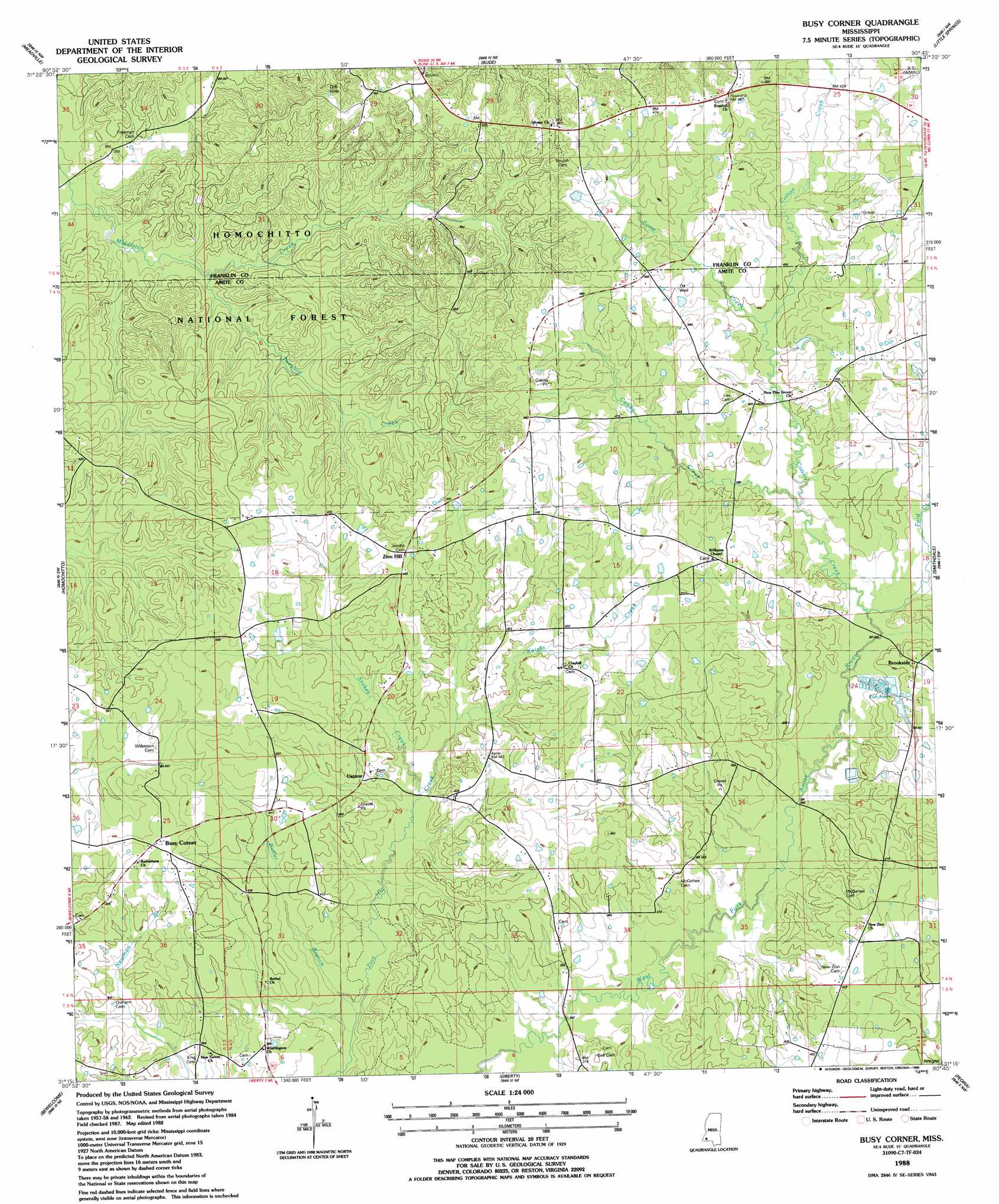
USGS Topo Quad 31090c7 - 1:24,000 scale
| Topo Map Name: | Busy Corner |
| USGS Topo Quad ID: | 31090c7 |
| Print Size: | ca. 21 1/4" wide x 27" high |
| Southeast Coordinates: | 31.25° N latitude / 90.75° W longitude |
| Map Center Coordinates: | 31.3125° N latitude / 90.8125° W longitude |
| U.S. State: | MS |
| Filename: | o31090c7.jpg |
| Download Map JPG Image: | Busy Corner topo map 1:24,000 scale |
| Map Type: | Topographic |
| Topo Series: | 7.5´ |
| Map Scale: | 1:24,000 |
| Source of Map Images: | United States Geological Survey (USGS) |
| Alternate Map Versions: |
Busy Corner MS 1988, updated 1988 Download PDF Buy paper map Busy Corner MS 2012 Download PDF Buy paper map Busy Corner MS 2015 Download PDF Buy paper map |
| FStopo: | US Forest Service topo Busy Corner is available: Download FStopo PDF Download FStopo TIF |
1:24,000 Topo Quads surrounding Busy Corner
Roxie |
Kirby |
Eddicetown |
Mccall Creek |
Zetus |
Knoxville |
Meadville |
Bude |
Little Springs |
West Lincoln |
Crosby |
Homochitto |
Busy Corner |
Smithdale |
Auburn |
Gloster |
Bewelcome |
Liberty |
Peoria |
Lake Tangipahoa |
Centreville |
Berwick |
Street |
Gillsburg |
Terrys Creek |
> Back to 31090a1 at 1:100,000 scale
> Back to 31090a1 at 1:250,000 scale
> Back to U.S. Topo Maps home
Busy Corner topo map: Gazetteer
Busy Corner: Dams
Amite River Industries Pond Dam elevation 119m 390′Amite River Industries Pond Dam elevation 127m 416′
Bowlin Lake Dam elevation 127m 416′
Busy Corner: Populated Places
Brookside elevation 128m 419′Busy Corner elevation 135m 442′
Ustane elevation 122m 400′
Zion Hill elevation 139m 456′
Busy Corner: Streams
Butler Branch elevation 97m 318′Candy Creek elevation 115m 377′
Cotton Creek elevation 110m 360′
Knight Creek elevation 112m 367′
Scott Creek elevation 119m 390′
Stokes Creek elevation 108m 354′
Tanyard Creek elevation 84m 275′
Busy Corner digital topo map on disk
Buy this Busy Corner topo map showing relief, roads, GPS coordinates and other geographical features, as a high-resolution digital map file on DVD: