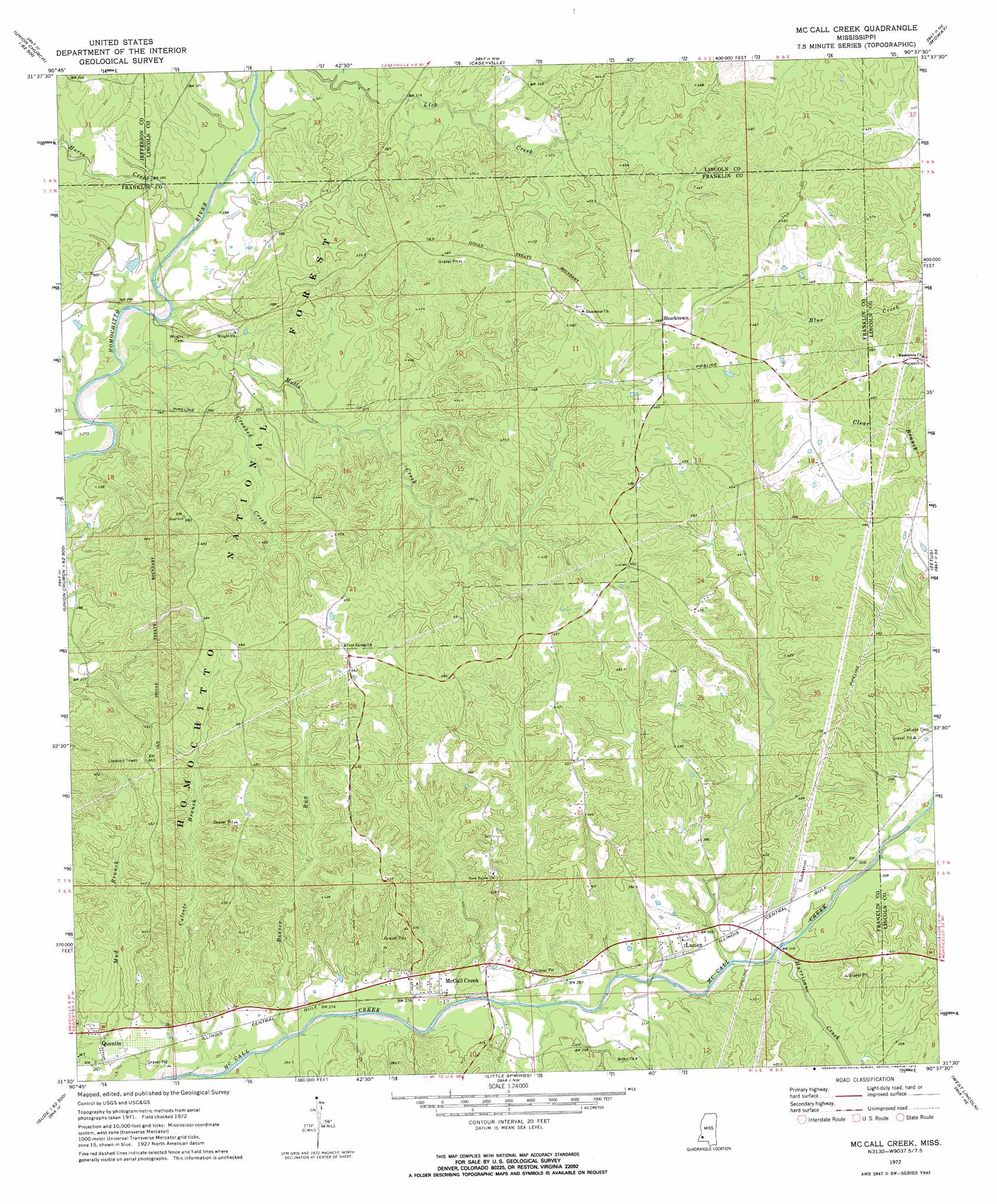
Mccall Creek Topo Map Mississippi
To zoom in, hover over the map of Mccall Creek
USGS Topo Quad 31090e6 - 1:24,000 scale
| Topo Map Name: | Mccall Creek |
| USGS Topo Quad ID: | 31090e6 |
| Print Size: | ca. 21 1/4" wide x 27" high |
| Southeast Coordinates: | 31.5° N latitude / 90.625° W longitude |
| Map Center Coordinates: | 31.5625° N latitude / 90.6875° W longitude |
| U.S. State: | MS |
| Filename: | o31090e6.jpg |
| Download Map JPG Image: | Mccall Creek topo map 1:24,000 scale |
| Map Type: | Topographic |
| Topo Series: | 7.5´ |
| Map Scale: | 1:24,000 |
| Source of Map Images: | United States Geological Survey (USGS) |
| Alternate Map Versions: |
McCall Creek MS 1972, updated 1974 Download PDF Buy paper map McCall Creek MS 2000, updated 2002 Download PDF Buy paper map McCall Creek MS 2012 Download PDF Buy paper map McCall Creek MS 2015 Download PDF Buy paper map |
| FStopo: | US Forest Service topo McCall Creek is available: Download FStopo PDF Download FStopo TIF |
1:24,000 Topo Quads surrounding Mccall Creek
Red Lick |
Mcbride |
Barlow |
Smyrna |
Hazlehurst |
Gin Branch |
Union Church |
Caseyville |
Midway |
Wesson |
Kirby |
Eddicetown |
Mccall Creek |
Zetus |
Brookhaven |
Meadville |
Bude |
Little Springs |
West Lincoln |
Bogue Chitto |
Homochitto |
Busy Corner |
Smithdale |
Auburn |
Mccomb North |
> Back to 31090e1 at 1:100,000 scale
> Back to 31090a1 at 1:250,000 scale
> Back to U.S. Topo Maps home
Mccall Creek topo map: Gazetteer
Mccall Creek: Crossings
Rights Ford elevation 81m 265′Mccall Creek: Dams
Gayle Evans Lake Dam elevation 117m 383′Mccall Creek: Populated Places
Kennolia elevation 148m 485′Lucien elevation 101m 331′
McCall Creek elevation 87m 285′
Quentin elevation 89m 291′
Shucktown elevation 145m 475′
Mccall Creek: Streams
Beaver Run elevation 77m 252′Calcote Branch elevation 73m 239′
Crooked Creek elevation 87m 285′
Horse Creek elevation 84m 275′
Hurricane Creek elevation 86m 282′
Molls Creek elevation 79m 259′
Mccall Creek digital topo map on disk
Buy this Mccall Creek topo map showing relief, roads, GPS coordinates and other geographical features, as a high-resolution digital map file on DVD: