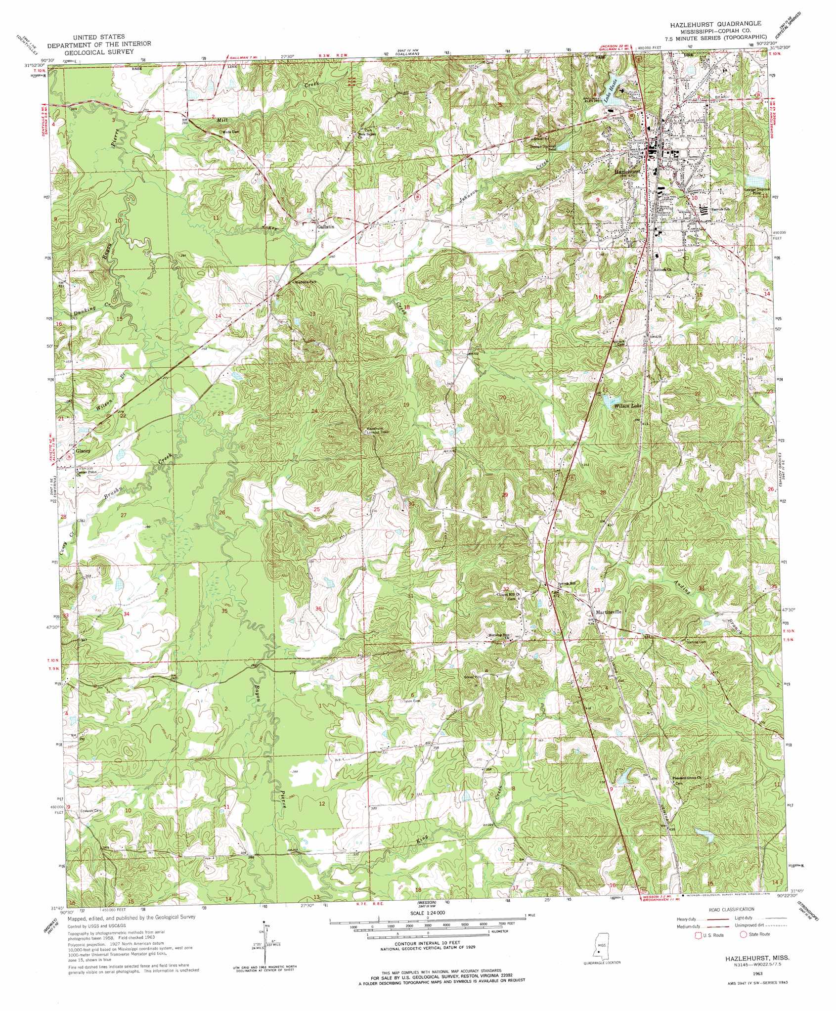
Hazlehurst Topo Map Mississippi
To zoom in, hover over the map of Hazlehurst
USGS Topo Quad 31090g4 - 1:24,000 scale
| Topo Map Name: | Hazlehurst |
| USGS Topo Quad ID: | 31090g4 |
| Print Size: | ca. 21 1/4" wide x 27" high |
| Southeast Coordinates: | 31.75° N latitude / 90.375° W longitude |
| Map Center Coordinates: | 31.8125° N latitude / 90.4375° W longitude |
| U.S. State: | MS |
| Filename: | o31090g4.jpg |
| Download Map JPG Image: | Hazlehurst topo map 1:24,000 scale |
| Map Type: | Topographic |
| Topo Series: | 7.5´ |
| Map Scale: | 1:24,000 |
| Source of Map Images: | United States Geological Survey (USGS) |
| Alternate Map Versions: |
Hazlehurst MS 1963, updated 1964 Download PDF Buy paper map Hazlehurst MS 1963, updated 1978 Download PDF Buy paper map Hazlehurst MS 2012 Download PDF Buy paper map Hazlehurst MS 2015 Download PDF Buy paper map |
1:24,000 Topo Quads surrounding Hazlehurst
Utica West |
Utica East |
Dabney Crossroads |
Terry |
Whites |
Dentville Nw |
Dentville |
Gallman |
Crystal Springs |
Hopewell |
Barlow |
Smyrna |
Hazlehurst |
Shady Grove |
Georgetown |
Caseyville |
Midway |
Wesson |
Stronghope |
Oma |
Mccall Creek |
Zetus |
Brookhaven |
Fair Oak Springs |
Nola |
> Back to 31090e1 at 1:100,000 scale
> Back to 31090a1 at 1:250,000 scale
> Back to U.S. Topo Maps home
Hazlehurst topo map: Gazetteer
Hazlehurst: Crossings
Interchange 56 elevation 135m 442′Interchange 59 elevation 125m 410′
Interchange 61 elevation 141m 462′
Hazlehurst: Dams
Alex Wilson Lake Dam elevation 137m 449′Byron Hutchinson Lake Dam elevation 120m 393′
Circle F Ranch Lake Dam elevation 93m 305′
Lake Hazel Dam elevation 118m 387′
Hazlehurst: Populated Places
Gallatin elevation 91m 298′Glancy elevation 101m 331′
Hazlehurst elevation 144m 472′
Martinsville elevation 135m 442′
Hazlehurst: Reservoirs
Lake Hazle elevation 115m 377′Wilson Lake elevation 116m 380′
Hazlehurst: Streams
Brushy Creek elevation 77m 252′Caney Creek elevation 84m 275′
Dunking Creek elevation 76m 249′
Fullers Creek elevation 79m 259′
Johnson Creek elevation 84m 275′
Jones Creek elevation 73m 239′
King Creek elevation 87m 285′
Mill Creek elevation 73m 239′
Wilson Branch elevation 77m 252′
Hazlehurst digital topo map on disk
Buy this Hazlehurst topo map showing relief, roads, GPS coordinates and other geographical features, as a high-resolution digital map file on DVD: