Dentville Nw Topo Map Mississippi
To zoom in, hover over the map of Dentville Nw
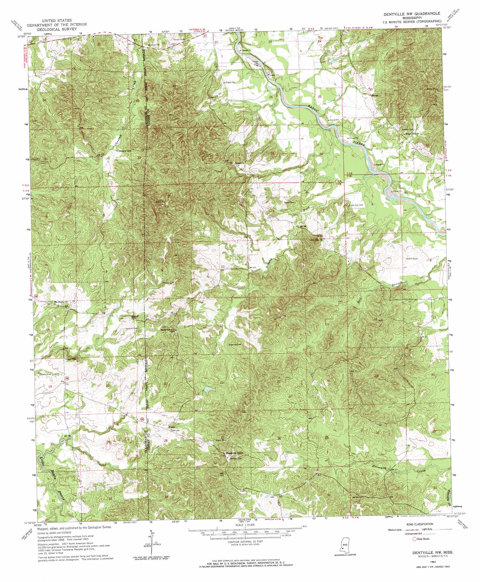
USGS Topo Quad 31090h6 - 1:24,000 scale
| Topo Map Name: | Dentville Nw |
| USGS Topo Quad ID: | 31090h6 |
| Print Size: | ca. 21 1/4" wide x 27" high |
| Southeast Coordinates: | 31.875° N latitude / 90.625° W longitude |
| Map Center Coordinates: | 31.9375° N latitude / 90.6875° W longitude |
| U.S. State: | MS |
| Filename: | o31090h6.jpg |
| Download Map JPG Image: | Dentville Nw topo map 1:24,000 scale |
| Map Type: | Topographic |
| Topo Series: | 7.5´ |
| Map Scale: | 1:24,000 |
| Source of Map Images: | United States Geological Survey (USGS) |
| Alternate Map Versions: |
Dentville NW MS 1963, updated 1964 Download PDF Buy paper map Dentville NW MS 2012 Download PDF Buy paper map Dentville NW MS 2015 Download PDF Buy paper map |
1:24,000 Topo Quads surrounding Dentville Nw
Yokena |
Big Black |
Cayuga |
Learned |
Terry Nw |
Willows |
Carlisle |
Utica West |
Utica East |
Dabney Crossroads |
Port Gibson |
Hermanville |
Dentville Nw |
Dentville |
Gallman |
Red Lick |
Mcbride |
Barlow |
Smyrna |
Hazlehurst |
Gin Branch |
Union Church |
Caseyville |
Midway |
Wesson |
> Back to 31090e1 at 1:100,000 scale
> Back to 31090a1 at 1:250,000 scale
> Back to U.S. Topo Maps home
Dentville Nw topo map: Gazetteer
Dentville Nw: Dams
W C Devinney Lake Dam elevation 78m 255′Dentville Nw: Populated Places
Burtonton (historical) elevation 55m 180′Conn elevation 89m 291′
Linden (historical) elevation 133m 436′
Dentville Nw: Post Offices
Griffins Store Post Office (historical) elevation 67m 219′Dentville Nw: Streams
Brushy Fork elevation 47m 154′Dentville Nw digital topo map on disk
Buy this Dentville Nw topo map showing relief, roads, GPS coordinates and other geographical features, as a high-resolution digital map file on DVD: