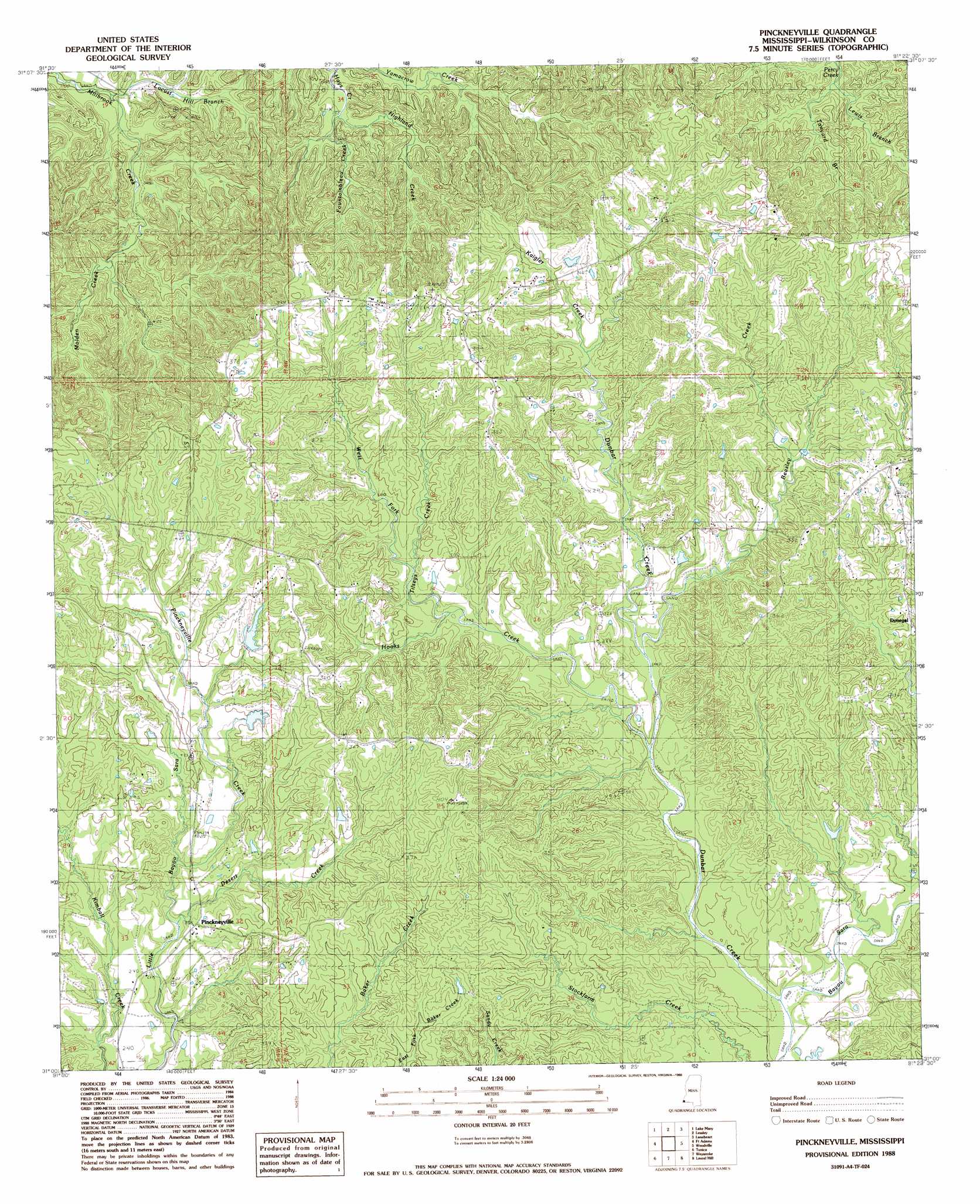
Pinckneyville Topo Map Mississippi
To zoom in, hover over the map of Pinckneyville
USGS Topo Quad 31091a4 - 1:24,000 scale
| Topo Map Name: | Pinckneyville |
| USGS Topo Quad ID: | 31091a4 |
| Print Size: | ca. 21 1/4" wide x 27" high |
| Southeast Coordinates: | 31° N latitude / 91.375° W longitude |
| Map Center Coordinates: | 31.0625° N latitude / 91.4375° W longitude |
| U.S. State: | MS |
| Filename: | o31091a4.jpg |
| Download Map JPG Image: | Pinckneyville topo map 1:24,000 scale |
| Map Type: | Topographic |
| Topo Series: | 7.5´ |
| Map Scale: | 1:24,000 |
| Source of Map Images: | United States Geological Survey (USGS) |
| Alternate Map Versions: |
Pinckneyville MS 1988, updated 1988 Download PDF Buy paper map Pinckneyville MS 2012 Download PDF Buy paper map Pinckneyville MS 2015 Download PDF Buy paper map |
1:24,000 Topo Quads surrounding Pinckneyville
Slocum |
Fairview |
Buck Island |
Doloroso |
Garden City |
Shaw |
Lake Mary |
Lessley |
Laneheart |
Wilkinson |
Turnbull Island |
Fort Adams |
Pinckneyville |
Woodville |
Newtonia |
Innis |
Tunica |
Weyanoke |
Laurel Hill |
Rogillioville |
Batchelor |
Lacour |
Saint Francisville |
Elm Park |
Jackson |
> Back to 31091a1 at 1:100,000 scale
> Back to 31090a1 at 1:250,000 scale
> Back to U.S. Topo Maps home
Pinckneyville topo map: Gazetteer
Pinckneyville: Dams
Woodstock Hunting Club Lake Dam elevation 107m 351′Woodstock Hunting Lake Dam elevation 92m 301′
Pinckneyville: Oilfields
Dunbar Creek Oil Field elevation 92m 301′Pinckneyville: Populated Places
Donegal elevation 94m 308′Pinckneyville elevation 73m 239′
Pinckneyville: Streams
Beasley Creek elevation 62m 203′Bell Creek elevation 65m 213′
Desert Creek elevation 64m 209′
Dunbar Creek elevation 49m 160′
Fountainbleau Creek elevation 49m 160′
Highland Creek elevation 53m 173′
Hooks Creek elevation 58m 190′
Kaigler Creek elevation 83m 272′
Lewis Branch elevation 80m 262′
Locust Hill Branch elevation 30m 98′
Molden Creek elevation 49m 160′
Pinckneyville Creek elevation 69m 226′
Tanyard Branch elevation 76m 249′
Tilseys Creek elevation 73m 239′
West Fork Tilseys Creek elevation 75m 246′
Pinckneyville digital topo map on disk
Buy this Pinckneyville topo map showing relief, roads, GPS coordinates and other geographical features, as a high-resolution digital map file on DVD: