Laneheart Topo Map Mississippi
To zoom in, hover over the map of Laneheart
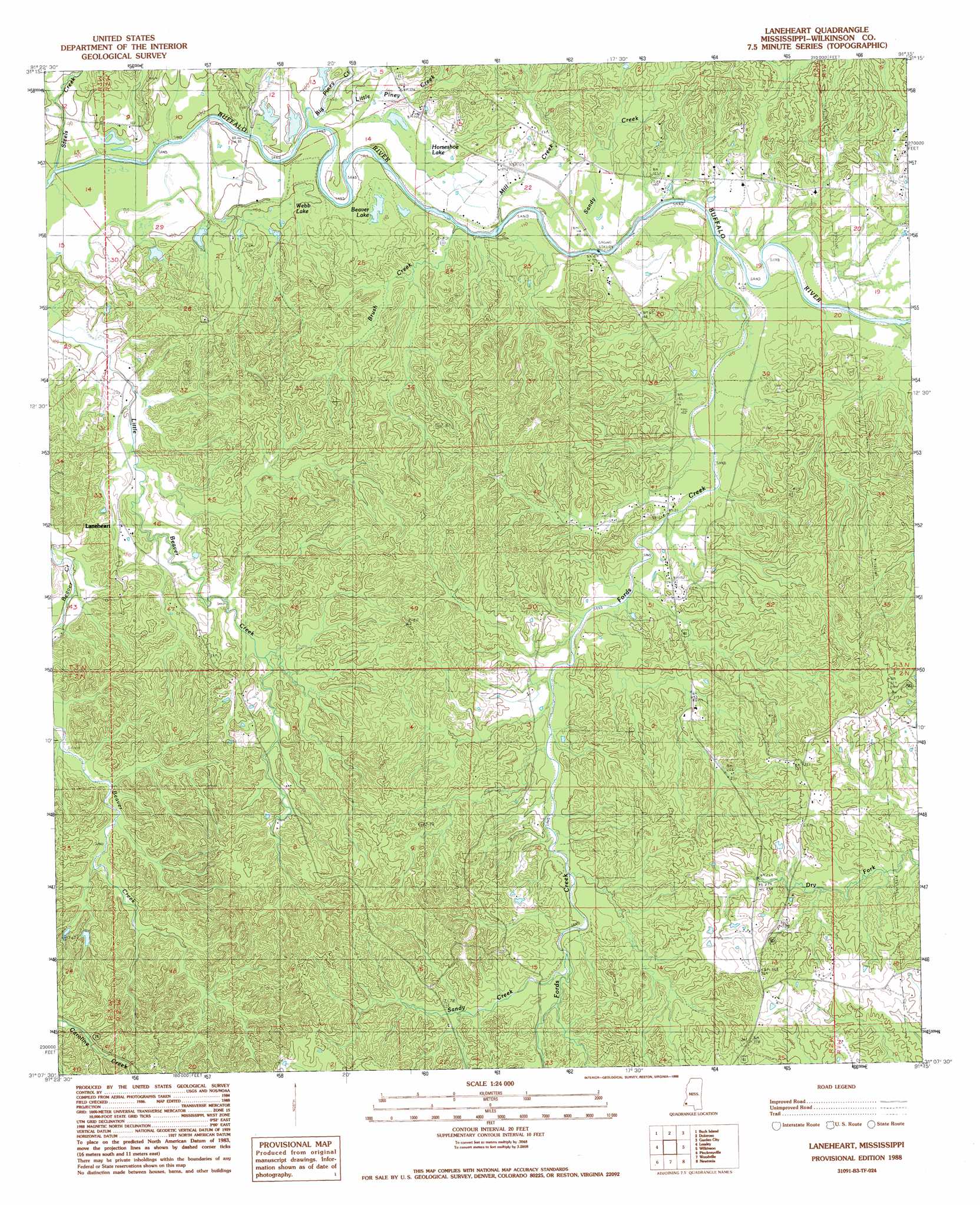
USGS Topo Quad 31091b3 - 1:24,000 scale
| Topo Map Name: | Laneheart |
| USGS Topo Quad ID: | 31091b3 |
| Print Size: | ca. 21 1/4" wide x 27" high |
| Southeast Coordinates: | 31.125° N latitude / 91.25° W longitude |
| Map Center Coordinates: | 31.1875° N latitude / 91.3125° W longitude |
| U.S. State: | MS |
| Filename: | o31091b3.jpg |
| Download Map JPG Image: | Laneheart topo map 1:24,000 scale |
| Map Type: | Topographic |
| Topo Series: | 7.5´ |
| Map Scale: | 1:24,000 |
| Source of Map Images: | United States Geological Survey (USGS) |
| Alternate Map Versions: |
Laneheart MS 1988, updated 1988 Download PDF Buy paper map Laneheart MS 2012 Download PDF Buy paper map Laneheart MS 2015 Download PDF Buy paper map |
1:24,000 Topo Quads surrounding Laneheart
Deer Park |
Sibley |
Kingston |
Jeannette |
Knoxville |
Fairview |
Buck Island |
Doloroso |
Garden City |
Crosby |
Lake Mary |
Lessley |
Laneheart |
Wilkinson |
Gloster |
Fort Adams |
Pinckneyville |
Woodville |
Newtonia |
Centreville |
Tunica |
Weyanoke |
Laurel Hill |
Rogillioville |
Wilson |
> Back to 31091a1 at 1:100,000 scale
> Back to 31090a1 at 1:250,000 scale
> Back to U.S. Topo Maps home
Laneheart topo map: Gazetteer
Laneheart: Dams
J M Sessions Lake Dam elevation 31m 101′Laneheart: Lakes
Beaver Lake elevation 32m 104′Webb Lake elevation 35m 114′
Laneheart: Oilfields
Wilkinson Oil Field elevation 39m 127′Laneheart: Populated Places
Laneheart elevation 54m 177′Laneheart: Streams
Big Piney Creek elevation 29m 95′Brush Creek elevation 32m 104′
Fords Creek elevation 35m 114′
Little Piney Creek elevation 31m 101′
Mill Creek elevation 31m 101′
Sandy Creek elevation 32m 104′
Sandy Creek elevation 64m 209′
Steels Creek elevation 25m 82′
Laneheart: Swamps
Horseshoe Lake elevation 30m 98′Laneheart digital topo map on disk
Buy this Laneheart topo map showing relief, roads, GPS coordinates and other geographical features, as a high-resolution digital map file on DVD: