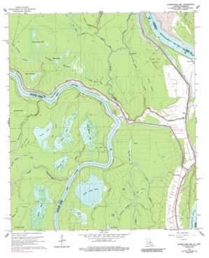
Shaw Topo Map Louisiana
To zoom in, hover over the map of Shaw
USGS Topo Quad 31091b6 - 1:24,000 scale
| Topo Map Name: | Shaw |
| USGS Topo Quad ID: | 31091b6 |
| Print Size: | ca. 21 1/4" wide x 27" high |
| Southeast Coordinates: | 31.125° N latitude / 91.625° W longitude |
| Map Center Coordinates: | 31.1875° N latitude / 91.6875° W longitude |
| U.S. States: | LA, MS |
| Filename: | o31091b6.jpg |
| Download Map JPG Image: | Shaw topo map 1:24,000 scale |
| Map Type: | Topographic |
| Topo Series: | 7.5´ |
| Map Scale: | 1:24,000 |
| Source of Map Images: | United States Geological Survey (USGS) |
| Alternate Map Versions: |
Shaw LA 1965, updated 1966 Download PDF Buy paper map Shaw LA 1965, updated 1977 Download PDF Buy paper map Lower Sunk Lake LA 1965, updated 1989 Download PDF Buy paper map Lower Sunk Lake LA 1996, updated 1999 Download PDF Buy paper map Lower Sunk Lake LA 2012 Download PDF Buy paper map Lower Sunk Lake LA 2015 Download PDF Buy paper map |
1:24,000 Topo Quads surrounding Shaw
> Back to 31091a1 at 1:100,000 scale
> Back to 31090a1 at 1:250,000 scale
> Back to U.S. Topo Maps home
Shaw topo map: Gazetteer
Shaw: Bays
Achiquot Bay elevation 10m 32′Shaw: Dams
Bayou Cocodrie Drainage Structure elevation 17m 55′Shaw: Lakes
Chaney Lakes elevation 10m 32′Cross Lake elevation 11m 36′
Goose Lake elevation 9m 29′
Grand Lake elevation 10m 32′
Grassy Lake elevation 10m 32′
Grassy Lake elevation 11m 36′
Hog Pen Lake elevation 9m 29′
Jeff Lake elevation 10m 32′
Lost Lake elevation 9m 29′
Lower Sunk Lake elevation 11m 36′
Red River Bay elevation 10m 32′
Silver Lakes elevation 10m 32′
Smith Bay elevation 10m 32′
Upper Sunk Lake elevation 10m 32′
Whiskey Bayou Lakes elevation 10m 32′
Shaw: Levees
Bougere Bend Revetment elevation 16m 52′Shaw: Oilfields
Bayou Milligan Oil Field elevation 10m 32′Chaney Lakes Oil Field elevation 10m 32′
Goose Lake Oil Field elevation 17m 55′
Lower Sunk Lake Oil Field elevation 10m 32′
Red River Bay Oil Field elevation 10m 32′
Shaw Oil Field elevation 15m 49′
Union Point Oil Field elevation 12m 39′
Shaw: Populated Places
Black Hawk elevation 16m 52′Shaw elevation 17m 55′
Union Point elevation 15m 49′
Shaw: Streams
Alligator Bayou elevation 9m 29′Bayou Cache - Cache elevation 9m 29′
Bayou Cocodrie elevation 10m 32′
Bayou de la Baie Sec elevation 15m 49′
Bayou des Sots elevation 12m 39′
Bayou Milligan elevation 12m 39′
Bayou Natchitoches elevation 10m 32′
Bee Bayou elevation 9m 29′
Catfish Bayou elevation 11m 36′
Dobbs Bay elevation 9m 29′
Durham Prong elevation 10m 32′
Fools Bay elevation 10m 32′
Grand Cutoff Bayou elevation 9m 29′
Green Bayou elevation 10m 32′
Little Cutoff elevation 10m 32′
Pat Lake Bayou elevation 9m 29′
Red River Bay elevation 9m 29′
Shaw: Swamps
Devils Swamp elevation 11m 36′Dismal Swamp elevation 10m 32′
Dry Cypress Lake elevation 11m 36′
Shaw digital topo map on disk
Buy this Shaw topo map showing relief, roads, GPS coordinates and other geographical features, as a high-resolution digital map file on DVD:


