Kingston Topo Map Mississippi
To zoom in, hover over the map of Kingston
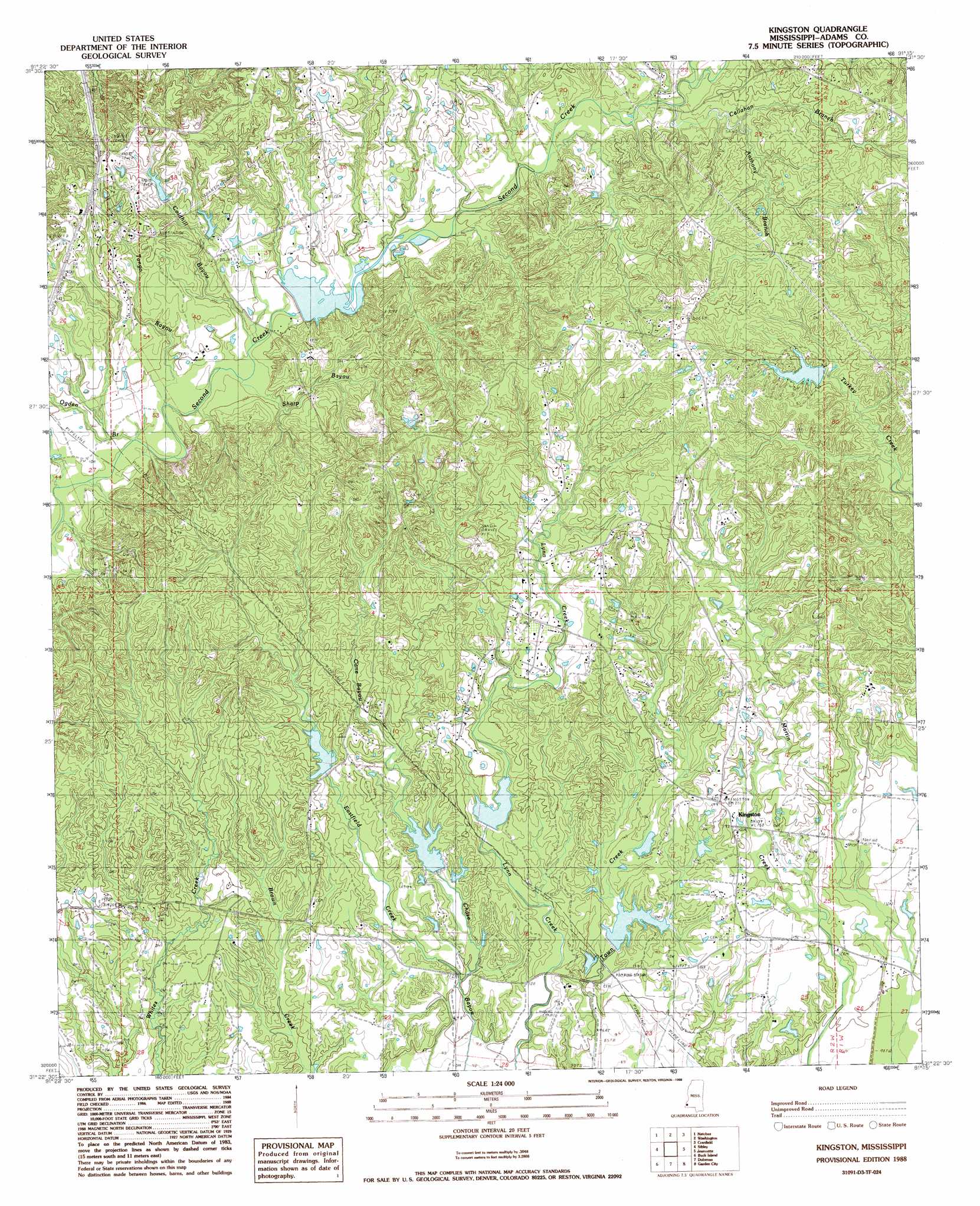
USGS Topo Quad 31091d3 - 1:24,000 scale
| Topo Map Name: | Kingston |
| USGS Topo Quad ID: | 31091d3 |
| Print Size: | ca. 21 1/4" wide x 27" high |
| Southeast Coordinates: | 31.375° N latitude / 91.25° W longitude |
| Map Center Coordinates: | 31.4375° N latitude / 91.3125° W longitude |
| U.S. State: | MS |
| Filename: | o31091d3.jpg |
| Download Map JPG Image: | Kingston topo map 1:24,000 scale |
| Map Type: | Topographic |
| Topo Series: | 7.5´ |
| Map Scale: | 1:24,000 |
| Source of Map Images: | United States Geological Survey (USGS) |
| Alternate Map Versions: |
Kingston MS 1988, updated 1988 Download PDF Buy paper map Kingston MS 2012 Download PDF Buy paper map Kingston MS 2015 Download PDF Buy paper map |
1:24,000 Topo Quads surrounding Kingston
Ferriday North |
Spokane |
Pine Ridge |
Church Hill |
Fayette |
Ferriday South |
Natchez |
Washington |
Cranfield |
Roxie |
Deer Park |
Sibley |
Kingston |
Jeannette |
Knoxville |
Fairview |
Buck Island |
Doloroso |
Garden City |
Crosby |
Lake Mary |
Lessley |
Laneheart |
Wilkinson |
Gloster |
> Back to 31091a1 at 1:100,000 scale
> Back to 31090a1 at 1:250,000 scale
> Back to U.S. Topo Maps home
Kingston topo map: Gazetteer
Kingston: Dams
L J Denny Lake Dam elevation 88m 288′Second Creek Structure 10b Dam elevation 46m 150′
Second Creek Structure 11 Dam elevation 36m 118′
Second Creek Structure 12 Dam elevation 42m 137′
Second Creek Structure 7 Dam elevation 68m 223′
Southwood Lodge Lake Dam elevation 79m 259′
Webb Carter Junior Lake Dam elevation 31m 101′
Kingston: Oilfields
Clifford Oil Field elevation 85m 278′Glendale Oil Field elevation 37m 121′
Jeannette Oil Field elevation 104m 341′
Kingston Oil Field elevation 55m 180′
Magnolia Oil Field elevation 62m 203′
Mantua Oil Field elevation 94m 308′
Moss Hill Oil Field elevation 80m 262′
North Kingston Oil Field elevation 48m 157′
North Overton Oil Field elevation 74m 242′
Overton Oil Field elevation 55m 180′
Poplar Grove Oil Field elevation 94m 308′
South Kingston Oil Field elevation 28m 91′
South Lagrange Oil Field elevation 71m 232′
Southeast Moss Hill Oil Field elevation 84m 275′
Southwood Oil Field elevation 112m 367′
Wayside Oil Field elevation 89m 291′
Kingston: Populated Places
Kingston elevation 55m 180′Kingston: Streams
Anthony Branch elevation 71m 232′Callahan Branch elevation 68m 223′
Cane Bayou elevation 45m 147′
Cave Bayou elevation 44m 144′
Coldhill Bayou elevation 55m 180′
Eastfield Creek elevation 36m 118′
Ogden Branch elevation 49m 160′
Sharp Bayou elevation 49m 160′
Tango Bayou elevation 54m 177′
Kingston digital topo map on disk
Buy this Kingston topo map showing relief, roads, GPS coordinates and other geographical features, as a high-resolution digital map file on DVD: