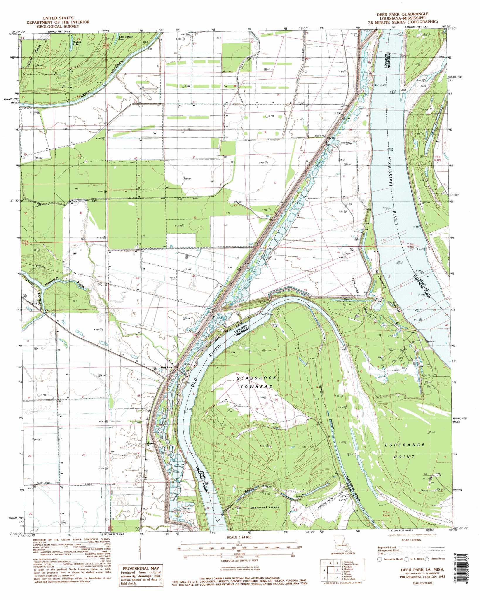
Deer Park Topo Map Louisiana
To zoom in, hover over the map of Deer Park
USGS Topo Quad 31091d5 - 1:24,000 scale
| Topo Map Name: | Deer Park |
| USGS Topo Quad ID: | 31091d5 |
| Print Size: | ca. 21 1/4" wide x 27" high |
| Southeast Coordinates: | 31.375° N latitude / 91.5° W longitude |
| Map Center Coordinates: | 31.4375° N latitude / 91.5625° W longitude |
| U.S. States: | LA, MS |
| Filename: | o31091d5.jpg |
| Download Map JPG Image: | Deer Park topo map 1:24,000 scale |
| Map Type: | Topographic |
| Topo Series: | 7.5´ |
| Map Scale: | 1:24,000 |
| Source of Map Images: | United States Geological Survey (USGS) |
| Alternate Map Versions: |
Deer Park LA 1983, updated 1984 Download PDF Buy paper map Deer Park LA 1983, updated 1984 Download PDF Buy paper map Deer Park LA 2012 Download PDF Buy paper map Deer Park LA 2015 Download PDF Buy paper map |
1:24,000 Topo Quads surrounding Deer Park
Jonesville North |
Dunbarton |
Ferriday North |
Spokane |
Pine Ridge |
Jonesville South |
Frogmore |
Ferriday South |
Natchez |
Washington |
Mayna |
Monterey |
Deer Park |
Sibley |
Kingston |
Acme |
Slocum |
Fairview |
Buck Island |
Doloroso |
Ile Natchitoches |
Shaw |
Lake Mary |
Lessley |
Laneheart |
> Back to 31091a1 at 1:100,000 scale
> Back to 31090a1 at 1:250,000 scale
> Back to U.S. Topo Maps home
Deer Park topo map: Gazetteer
Deer Park: Bends
Deer Park Bend elevation 8m 26′Deer Park: Capes
Esperance Point elevation 16m 52′Deer Park: Guts
Briars Chute elevation 15m 49′Deer Park: Islands
Glasscock Towhead elevation 17m 55′Saint Catherine Towhead elevation 16m 52′
Deer Park: Lakes
Old River elevation 6m 19′Wallace Lake elevation 15m 49′
Deer Park: Levees
Catherine Bend Revetment elevation 7m 22′Morville Revetment elevation 9m 29′
Deer Park: Oilfields
Deer Park Oil Field elevation 15m 49′Esperance Point Oil Field elevation 17m 55′
Glasscock Towhead Oil Field elevation 15m 49′
North Esperance Oil Field elevation 17m 55′
Southwest Deer Park Oil Field elevation 13m 42′
Warnicott Oil Field elevation 14m 45′
Deer Park: Populated Places
Deer Park elevation 16m 52′Warnicott (historical) elevation 18m 59′
Deer Park: Streams
Briars Chute elevation 7m 22′Mississippi Bayou elevation 11m 36′
Deer Park digital topo map on disk
Buy this Deer Park topo map showing relief, roads, GPS coordinates and other geographical features, as a high-resolution digital map file on DVD: