Fayette Topo Map Mississippi
To zoom in, hover over the map of Fayette
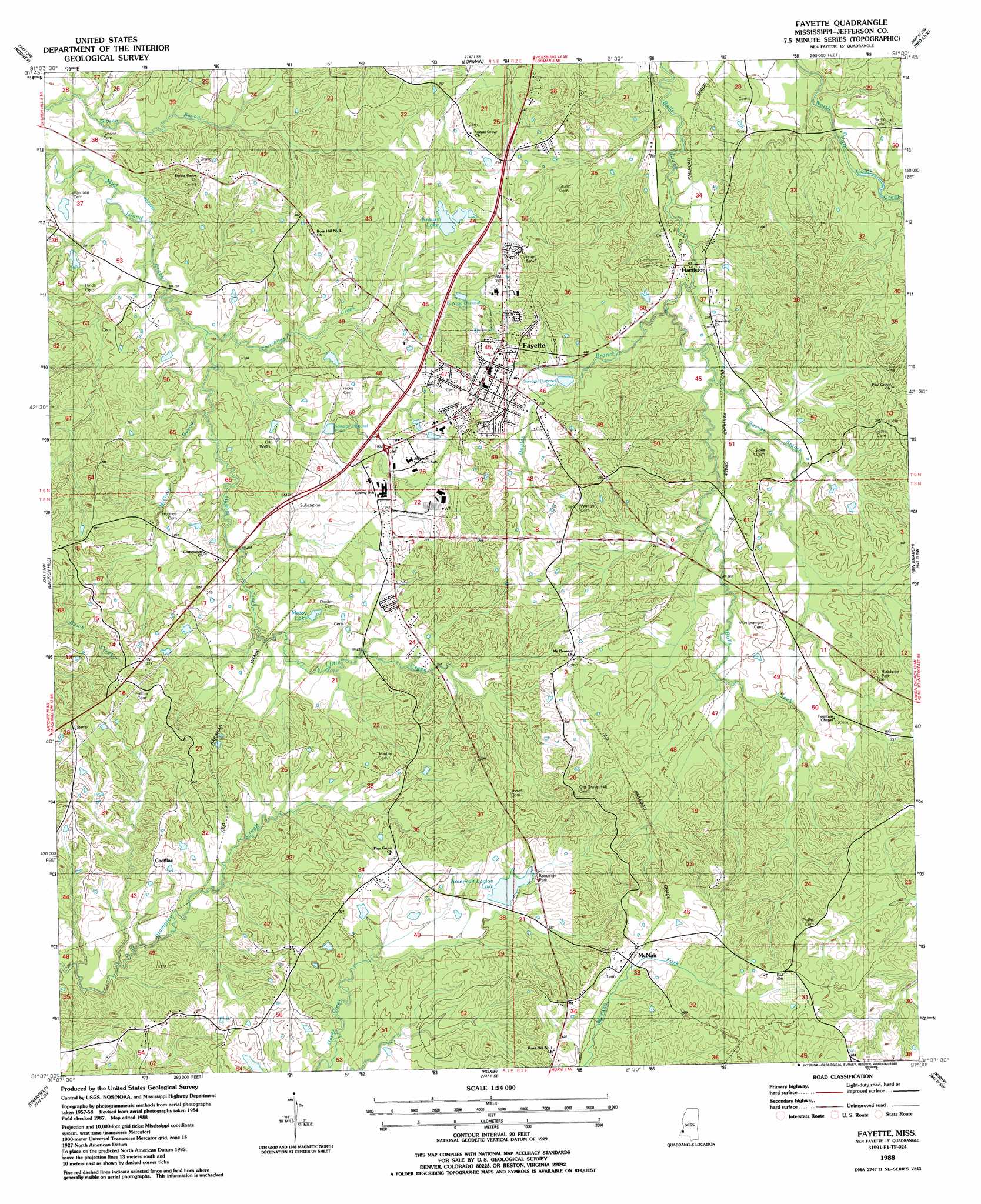
USGS Topo Quad 31091f1 - 1:24,000 scale
| Topo Map Name: | Fayette |
| USGS Topo Quad ID: | 31091f1 |
| Print Size: | ca. 21 1/4" wide x 27" high |
| Southeast Coordinates: | 31.625° N latitude / 91° W longitude |
| Map Center Coordinates: | 31.6875° N latitude / 91.0625° W longitude |
| U.S. State: | MS |
| Filename: | o31091f1.jpg |
| Download Map JPG Image: | Fayette topo map 1:24,000 scale |
| Map Type: | Topographic |
| Topo Series: | 7.5´ |
| Map Scale: | 1:24,000 |
| Source of Map Images: | United States Geological Survey (USGS) |
| Alternate Map Versions: |
Fayette MS 1988, updated 1988 Download PDF Buy paper map Fayette MS 2012 Download PDF Buy paper map Fayette MS 2015 Download PDF Buy paper map |
1:24,000 Topo Quads surrounding Fayette
Lake Bruin |
Saint Joseph |
Widows Creek |
Port Gibson |
Hermanville |
Chamblee |
Rodney |
Lorman |
Red Lick |
Mcbride |
Pine Ridge |
Church Hill |
Fayette |
Gin Branch |
Union Church |
Washington |
Cranfield |
Roxie |
Kirby |
Eddicetown |
Kingston |
Jeannette |
Knoxville |
Meadville |
Bude |
> Back to 31091e1 at 1:100,000 scale
> Back to 31090a1 at 1:250,000 scale
> Back to U.S. Topo Maps home
Fayette topo map: Gazetteer
Fayette: Dams
American Legion Lake Dam elevation 98m 321′Grover Brown Lake Dam elevation 38m 124′
John Berry Lake Dam elevation 53m 173′
Krauss Lake Dam elevation 86m 282′
Krauss Lake Dam elevation 73m 239′
Krauss Lake Dam elevation 73m 239′
Trullys Lake Dam elevation 79m 259′
Fayette: Oilfields
Cadillac Oil Field elevation 108m 354′South Fayette Oil Field elevation 67m 219′
Fayette: Populated Places
Cadillac elevation 88m 288′Deane (historical) elevation 68m 223′
Fayette elevation 86m 282′
Harriston elevation 64m 209′
McNair elevation 128m 419′
Phoenix (historical) elevation 84m 275′
Fayette: Reservoirs
American Legion Lake elevation 98m 321′Krauss Lake elevation 73m 239′
Mossy Lake elevation 73m 239′
Fayette: Streams
Beaver Branch elevation 68m 223′Doyles Branch elevation 61m 200′
Fairchilds Creek elevation 48m 157′
Hughes Creek elevation 48m 157′
Little Creek elevation 62m 203′
McGinty Bayou elevation 54m 177′
Fayette digital topo map on disk
Buy this Fayette topo map showing relief, roads, GPS coordinates and other geographical features, as a high-resolution digital map file on DVD: