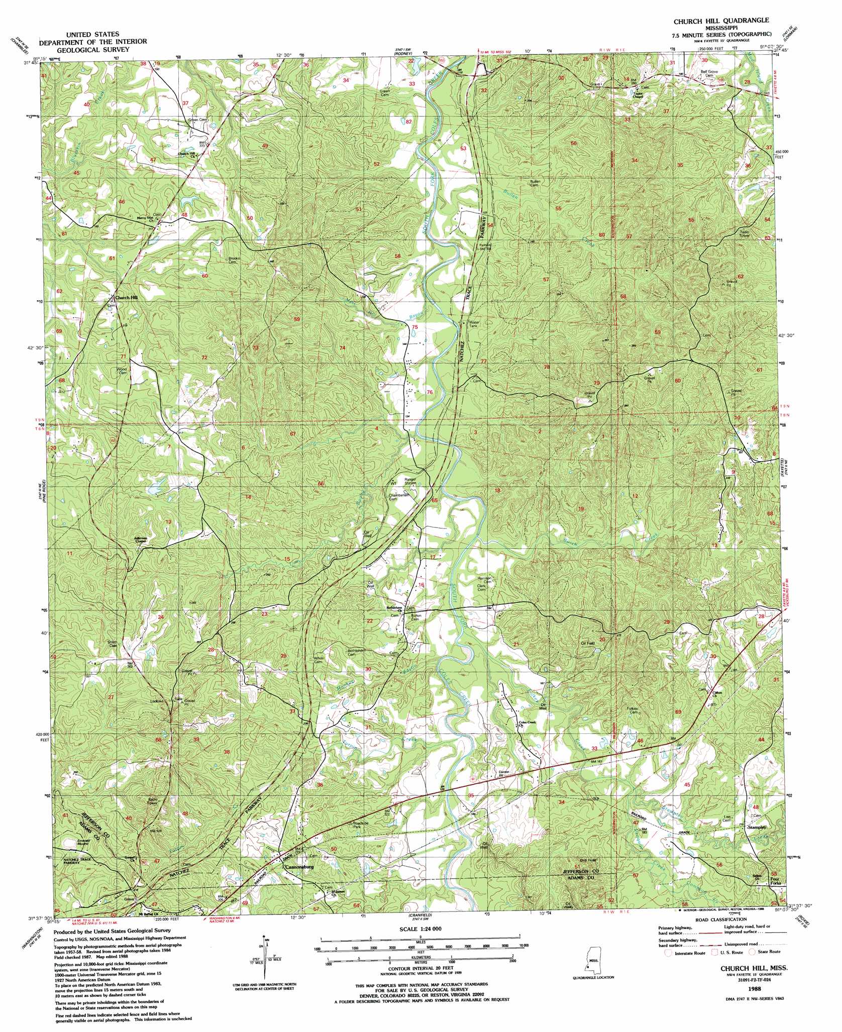
Church Hill Topo Map Mississippi
To zoom in, hover over the map of Church Hill
USGS Topo Quad 31091f2 - 1:24,000 scale
| Topo Map Name: | Church Hill |
| USGS Topo Quad ID: | 31091f2 |
| Print Size: | ca. 21 1/4" wide x 27" high |
| Southeast Coordinates: | 31.625° N latitude / 91.125° W longitude |
| Map Center Coordinates: | 31.6875° N latitude / 91.1875° W longitude |
| U.S. State: | MS |
| Filename: | o31091f2.jpg |
| Download Map JPG Image: | Church Hill topo map 1:24,000 scale |
| Map Type: | Topographic |
| Topo Series: | 7.5´ |
| Map Scale: | 1:24,000 |
| Source of Map Images: | United States Geological Survey (USGS) |
| Alternate Map Versions: |
Church Hill MS 1988, updated 1988 Download PDF Buy paper map Church Hill MS 2012 Download PDF Buy paper map Church Hill MS 2015 Download PDF Buy paper map |
1:24,000 Topo Quads surrounding Church Hill
Gretna Green |
Lake Bruin |
Saint Joseph |
Widows Creek |
Port Gibson |
Waterproof |
Chamblee |
Rodney |
Lorman |
Red Lick |
Spokane |
Pine Ridge |
Church Hill |
Fayette |
Gin Branch |
Natchez |
Washington |
Cranfield |
Roxie |
Kirby |
Sibley |
Kingston |
Jeannette |
Knoxville |
Meadville |
> Back to 31091e1 at 1:100,000 scale
> Back to 31090a1 at 1:250,000 scale
> Back to U.S. Topo Maps home
Church Hill topo map: Gazetteer
Church Hill: Oilfields
Cannonsburg Oil Field elevation 58m 190′Coles Creek Oil Field elevation 78m 255′
North Sunnyside Oil Field elevation 43m 141′
Stampley Oil Field elevation 58m 190′
Sunnyside Oil Field elevation 50m 164′
Church Hill: Populated Places
Cannonsburg elevation 84m 275′Four Forks elevation 82m 269′
Springfield (historical) elevation 47m 154′
Stampley elevation 66m 216′
Church Hill: Post Offices
Church Hill Post Office elevation 66m 216′Church Hill: Streams
Bullen Creek elevation 30m 98′Burch Creek elevation 36m 118′
Compton Creek elevation 51m 167′
Folkes Creek elevation 42m 137′
Gibson Bayou elevation 37m 121′
Lum Bayou elevation 38m 124′
Monkey Bayou elevation 41m 134′
Moss Hill Bayou elevation 30m 98′
Penquite Creek elevation 56m 183′
Stampley Creek elevation 50m 164′
Turpin Creek elevation 50m 164′
Church Hill: Summits
Emerald Mound elevation 120m 393′Church Hill digital topo map on disk
Buy this Church Hill topo map showing relief, roads, GPS coordinates and other geographical features, as a high-resolution digital map file on DVD: