Manifest Topo Map Louisiana
To zoom in, hover over the map of Manifest
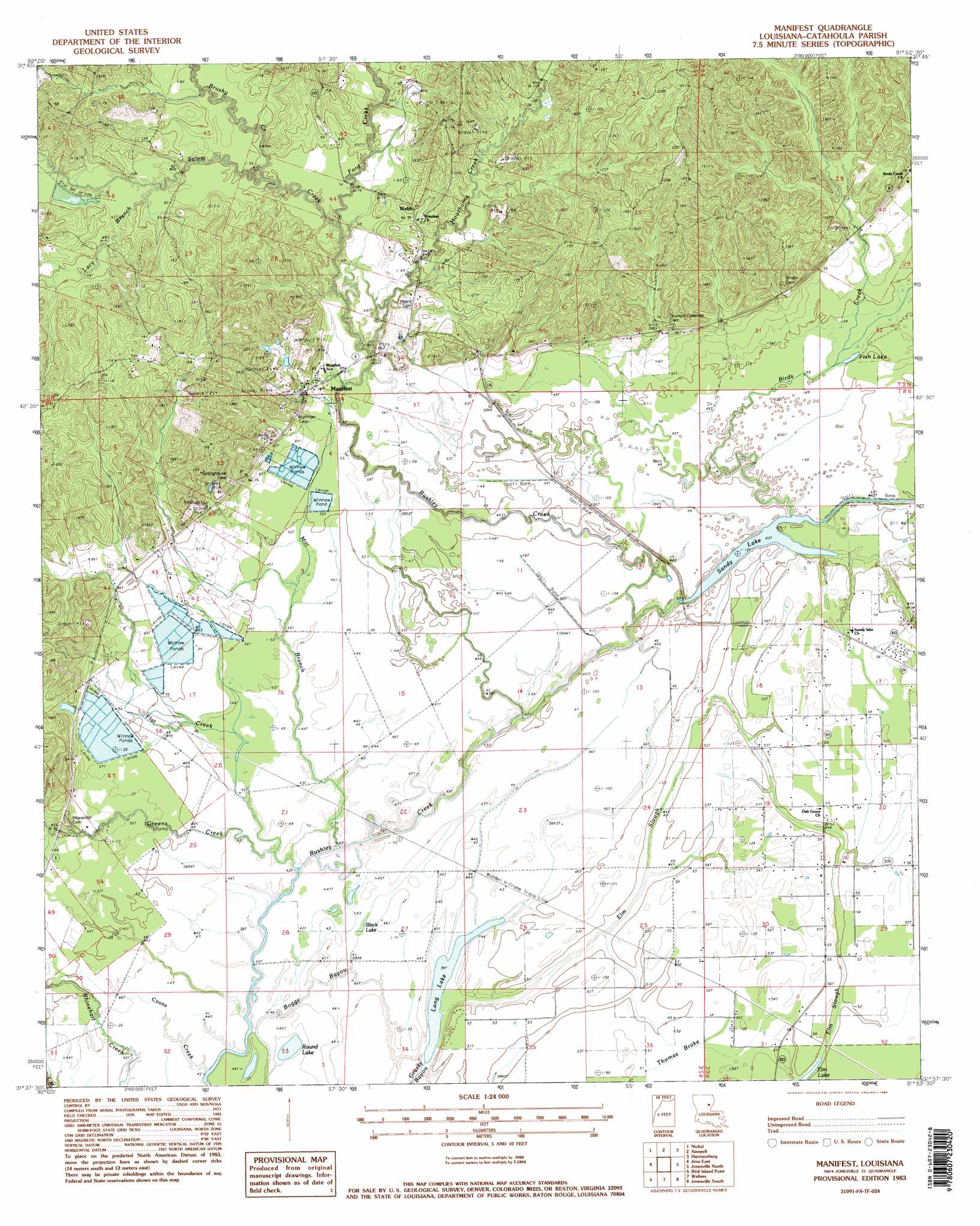
USGS Topo Quad 31091f8 - 1:24,000 scale
| Topo Map Name: | Manifest |
| USGS Topo Quad ID: | 31091f8 |
| Print Size: | ca. 21 1/4" wide x 27" high |
| Southeast Coordinates: | 31.625° N latitude / 91.875° W longitude |
| Map Center Coordinates: | 31.6875° N latitude / 91.9375° W longitude |
| U.S. State: | LA |
| Filename: | o31091f8.jpg |
| Download Map JPG Image: | Manifest topo map 1:24,000 scale |
| Map Type: | Topographic |
| Topo Series: | 7.5´ |
| Map Scale: | 1:24,000 |
| Source of Map Images: | United States Geological Survey (USGS) |
| Alternate Map Versions: |
Manifest LA 1983, updated 1984 Download PDF Buy paper map Manifest LA 1983, updated 1984 Download PDF Buy paper map Manifest LA 2012 Download PDF Buy paper map Manifest LA 2015 Download PDF Buy paper map |
1:24,000 Topo Quads surrounding Manifest
Olla East |
Holum |
Enterprise |
Extension |
Wisner |
Summerville |
Nickel |
Aimwell |
Harrisonburg |
Sicily Island |
Jena West |
Jena East |
Manifest |
Jonesville North |
Dunbarton |
Nebo |
Bird Island Point |
Walters |
Jonesville South |
Frogmore |
Holloway |
Buckeye Ne |
Larto Lake North |
Mayna |
Monterey |
> Back to 31091e1 at 1:100,000 scale
> Back to 31090a1 at 1:250,000 scale
> Back to U.S. Topo Maps home
Manifest topo map: Gazetteer
Manifest: Guts
Boggy Bayou elevation 12m 39′Elm Slough elevation 14m 45′
Manifest: Lakes
Black Lake elevation 13m 42′Dysons Lake (historical) elevation 12m 39′
Fish Lake elevation 15m 49′
Long Lake elevation 12m 39′
Round Lake elevation 11m 36′
Sandy Lake elevation 13m 42′
Manifest: Oilfields
Birds Creek Oil Field elevation 14m 45′Craig Bayou Oil Field elevation 41m 134′
Manifest Oil Field elevation 32m 104′
Sandy Lake Oil Field elevation 17m 55′
Manifest: Populated Places
Manifest elevation 23m 75′Webb elevation 30m 98′
Manifest: Streams
Birds Creek elevation 13m 42′Brushy Creek elevation 20m 65′
Clear Run elevation 31m 101′
Coons Creek elevation 12m 39′
Flat Creek elevation 12m 39′
Ford Creek elevation 17m 55′
Greens Creek elevation 12m 39′
Hawthorne Creek elevation 20m 65′
Lacy Branch elevation 22m 72′
Mill Branch elevation 12m 39′
Salem Creek elevation 17m 55′
Manifest: Swamps
Thomas Brake elevation 16m 52′Manifest digital topo map on disk
Buy this Manifest topo map showing relief, roads, GPS coordinates and other geographical features, as a high-resolution digital map file on DVD: