Harrisonburg Topo Map Louisiana
To zoom in, hover over the map of Harrisonburg
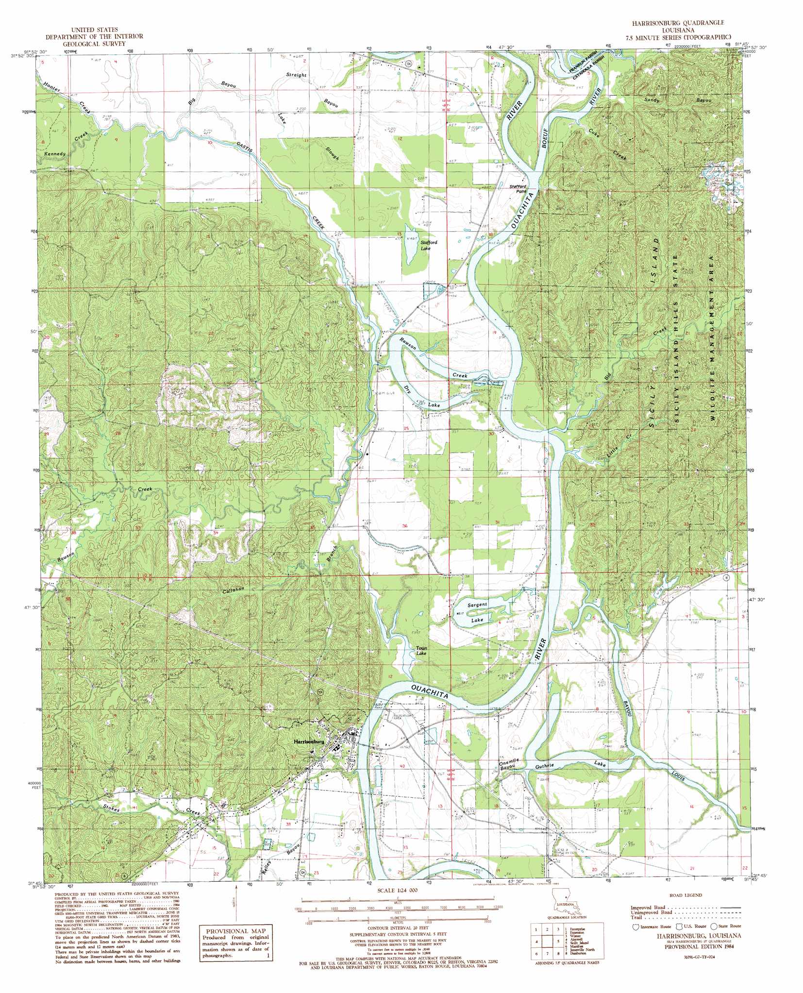
USGS Topo Quad 31091g7 - 1:24,000 scale
| Topo Map Name: | Harrisonburg |
| USGS Topo Quad ID: | 31091g7 |
| Print Size: | ca. 21 1/4" wide x 27" high |
| Southeast Coordinates: | 31.75° N latitude / 91.75° W longitude |
| Map Center Coordinates: | 31.8125° N latitude / 91.8125° W longitude |
| U.S. State: | LA |
| Filename: | o31091g7.jpg |
| Download Map JPG Image: | Harrisonburg topo map 1:24,000 scale |
| Map Type: | Topographic |
| Topo Series: | 7.5´ |
| Map Scale: | 1:24,000 |
| Source of Map Images: | United States Geological Survey (USGS) |
| Alternate Map Versions: |
Harrisonburg LA 1984, updated 1985 Download PDF Buy paper map Harrisonburg LA 2012 Download PDF Buy paper map Harrisonburg LA 2015 Download PDF Buy paper map |
1:24,000 Topo Quads surrounding Harrisonburg
Columbia |
Mason |
Fort Necessity |
Gilbert |
Como |
Holum |
Enterprise |
Extension |
Wisner |
Oakley |
Nickel |
Aimwell |
Harrisonburg |
Sicily Island |
Foules |
Jena East |
Manifest |
Jonesville North |
Dunbarton |
Ferriday North |
Bird Island Point |
Walters |
Jonesville South |
Frogmore |
Ferriday South |
> Back to 31091e1 at 1:100,000 scale
> Back to 31090a1 at 1:250,000 scale
> Back to U.S. Topo Maps home
Harrisonburg topo map: Gazetteer
Harrisonburg: Areas
Sicily Island elevation 34m 111′Harrisonburg: Capes
Stafford Point elevation 14m 45′Harrisonburg: Dams
Lock and Dam Number Two elevation 10m 32′Harrisonburg: Guts
Big Bayou elevation 12m 39′Lake Slough elevation 13m 42′
Onemile Bayou elevation 12m 39′
Sandy Bayou elevation 23m 75′
Harrisonburg: Lakes
Dry Lake elevation 10m 32′Guthrie Lake elevation 11m 36′
Sargent Lake elevation 16m 52′
Stafford Lake elevation 14m 45′
Town Lake elevation 12m 39′
Harrisonburg: Oilfields
Harrisonburg Oil Field elevation 16m 52′Prichard Oil Field elevation 16m 52′
Rawson Creek Oil Field elevation 18m 59′
South Prichard Oil Field elevation 61m 200′
Stokes Creek Oil Field elevation 30m 98′
Harrisonburg: Parks
Sicily Island Hills State Wildlife Management Area elevation 21m 68′Harrisonburg: Populated Places
Harrisonburg elevation 24m 78′Harrisonburg: Streams
Bayou Louis elevation 12m 39′Big Creek elevation 12m 39′
Boeuf River elevation 10m 32′
Brushy Creek elevation 24m 78′
Callahan Branch elevation 10m 32′
Coke Creek elevation 10m 32′
Deer Creek elevation 11m 36′
Gastis Creek elevation 10m 32′
Hooter Creek elevation 12m 39′
Kennedy Creek elevation 12m 39′
Little Creek elevation 11m 36′
Rawson Creek elevation 10m 32′
Straight Bayou elevation 12m 39′
Harrisonburg digital topo map on disk
Buy this Harrisonburg topo map showing relief, roads, GPS coordinates and other geographical features, as a high-resolution digital map file on DVD: