Melder Topo Map Louisiana
To zoom in, hover over the map of Melder
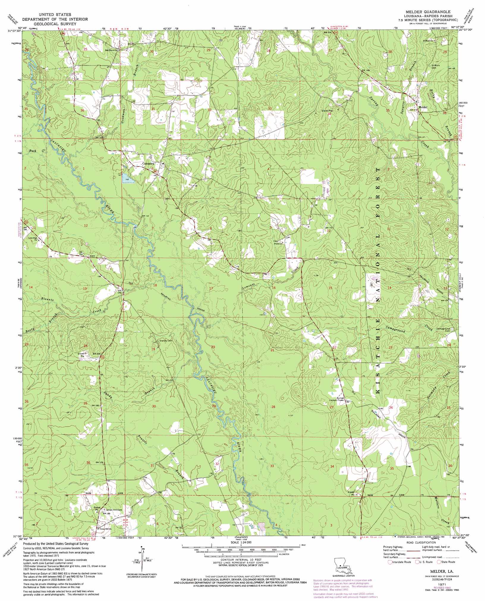
USGS Topo Quad 31092a6 - 1:24,000 scale
| Topo Map Name: | Melder |
| USGS Topo Quad ID: | 31092a6 |
| Print Size: | ca. 21 1/4" wide x 27" high |
| Southeast Coordinates: | 31° N latitude / 92.625° W longitude |
| Map Center Coordinates: | 31.0625° N latitude / 92.6875° W longitude |
| U.S. State: | LA |
| Filename: | o31092a6.jpg |
| Download Map JPG Image: | Melder topo map 1:24,000 scale |
| Map Type: | Topographic |
| Topo Series: | 7.5´ |
| Map Scale: | 1:24,000 |
| Source of Map Images: | United States Geological Survey (USGS) |
| Alternate Map Versions: |
Melder LA 1971, updated 1973 Download PDF Buy paper map Melder LA 1971, updated 1993 Download PDF Buy paper map Melder LA 2003, updated 2005 Download PDF Buy paper map Melder LA 2012 Download PDF Buy paper map Melder LA 2015 Download PDF Buy paper map |
| FStopo: | US Forest Service topo Melder is available: Download FStopo PDF Download FStopo TIF |
1:24,000 Topo Quads surrounding Melder
Temple |
Jericho |
Gardner |
Rapides |
Alexandria |
Lacamp |
Sieper |
Elmer |
Woodworth West |
Woodworth East |
Fullerton Lake |
Afeman |
Melder |
Forest Hill |
Lecompte |
Pitkin |
Steep Gully |
Pawnee |
Glenmora |
Cocodrie Lake |
Grant |
Elizabeth |
Oakdale |
Beaver |
Pine Prairie |
> Back to 31092a1 at 1:100,000 scale
> Back to 31092a1 at 1:250,000 scale
> Back to U.S. Topo Maps home
Melder topo map: Gazetteer
Melder: Parks
Palustris Experimental Forest Longleaf Tract elevation 45m 147′Melder: Populated Places
Calcasieu elevation 51m 167′Elmelhine elevation 67m 219′
Melder elevation 53m 173′
Melder: Post Offices
Melder Post Office elevation 55m 180′Melder: Streams
Bill Creek elevation 46m 150′Blounts Creek elevation 41m 134′
Buck Creek elevation 44m 144′
Goodman Branch elevation 44m 144′
Lemeuse Creek elevation 41m 134′
Padget Branch elevation 45m 147′
Rocky Branch elevation 38m 124′
Rooty Branch elevation 46m 150′
Sandy Branch elevation 40m 131′
Squyres Branch elevation 42m 137′
Melder digital topo map on disk
Buy this Melder topo map showing relief, roads, GPS coordinates and other geographical features, as a high-resolution digital map file on DVD: