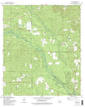
Sieper Topo Map Louisiana
To zoom in, hover over the map of Sieper
USGS Topo Quad 31092b7 - 1:24,000 scale
| Topo Map Name: | Sieper |
| USGS Topo Quad ID: | 31092b7 |
| Print Size: | ca. 21 1/4" wide x 27" high |
| Southeast Coordinates: | 31.125° N latitude / 92.75° W longitude |
| Map Center Coordinates: | 31.1875° N latitude / 92.8125° W longitude |
| U.S. State: | LA |
| Filename: | o31092b7.jpg |
| Download Map JPG Image: | Sieper topo map 1:24,000 scale |
| Map Type: | Topographic |
| Topo Series: | 7.5´ |
| Map Scale: | 1:24,000 |
| Source of Map Images: | United States Geological Survey (USGS) |
| Alternate Map Versions: |
Sieper LA 1954, updated 1959 Download PDF Buy paper map Sieper LA 1978, updated 1979 Download PDF Buy paper map Sieper LA 2003, updated 2005 Download PDF Buy paper map Sieper LA 2012 Download PDF Buy paper map Sieper LA 2015 Download PDF Buy paper map |
| FStopo: | US Forest Service topo Sieper is available: Download FStopo PDF Download FStopo TIF |
1:24,000 Topo Quads surrounding Sieper
> Back to 31092a1 at 1:100,000 scale
> Back to 31092a1 at 1:250,000 scale
> Back to U.S. Topo Maps home
Sieper topo map: Gazetteer
Sieper: Airports
Nichols Landing Strip elevation 68m 223′Sieper: Populated Places
Clifton Crossing elevation 54m 177′Hemphill elevation 53m 173′
Hineston elevation 61m 200′
Leander elevation 72m 236′
Muse (historical) elevation 58m 190′
Price Crossing elevation 50m 164′
Sieper elevation 55m 180′
Stille elevation 58m 190′
Walding elevation 59m 193′
Sieper: Post Offices
Hineston Post Office elevation 64m 209′Leander Post Office elevation 60m 196′
Sieper Post Office elevation 54m 177′
Sieper: Streams
Big Creek elevation 48m 157′Comrade Creek elevation 54m 177′
Cypress Bayou elevation 47m 154′
Dan Branch elevation 54m 177′
Gum Branch elevation 51m 167′
Hineston Branch elevation 46m 150′
Houge Branch elevation 51m 167′
Howell Branch elevation 55m 180′
Little Dry Creek elevation 65m 213′
Majors Branch elevation 52m 170′
Merchant Branch elevation 47m 154′
Mill Creek elevation 52m 170′
Mineral Branch elevation 51m 167′
Sieper Creek elevation 54m 177′
Sieper digital topo map on disk
Buy this Sieper topo map showing relief, roads, GPS coordinates and other geographical features, as a high-resolution digital map file on DVD:


