Green Gables Topo Map Louisiana
To zoom in, hover over the map of Green Gables
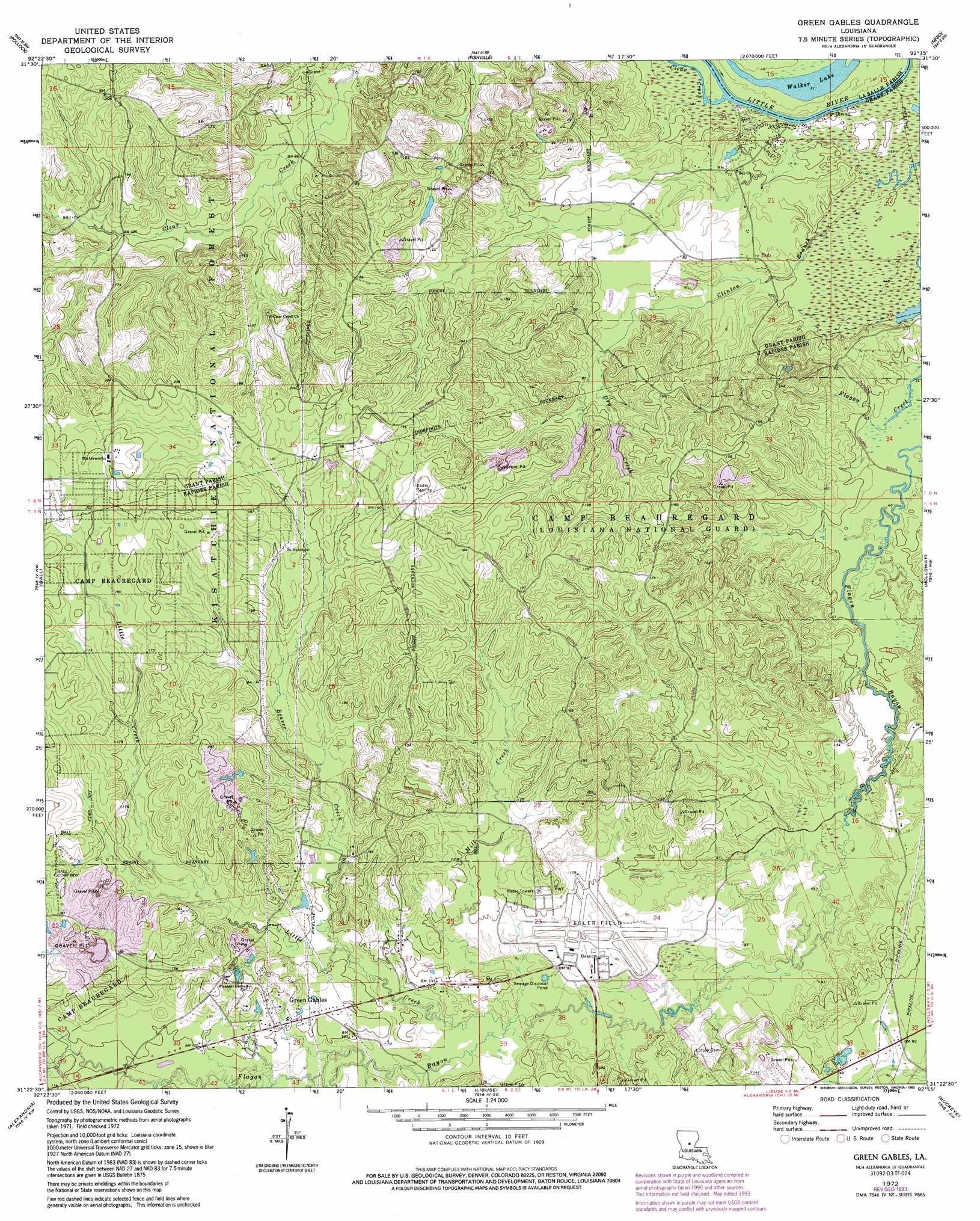
USGS Topo Quad 31092d3 - 1:24,000 scale
| Topo Map Name: | Green Gables |
| USGS Topo Quad ID: | 31092d3 |
| Print Size: | ca. 21 1/4" wide x 27" high |
| Southeast Coordinates: | 31.375° N latitude / 92.25° W longitude |
| Map Center Coordinates: | 31.4375° N latitude / 92.3125° W longitude |
| U.S. State: | LA |
| Filename: | o31092d3.jpg |
| Download Map JPG Image: | Green Gables topo map 1:24,000 scale |
| Map Type: | Topographic |
| Topo Series: | 7.5´ |
| Map Scale: | 1:24,000 |
| Source of Map Images: | United States Geological Survey (USGS) |
| Alternate Map Versions: |
Green Gables LA 1972, updated 1974 Download PDF Buy paper map Green Gables LA 1972, updated 1993 Download PDF Buy paper map Green Gables LA 2003, updated 2005 Download PDF Buy paper map Green Gables LA 2003, updated 2005 Download PDF Buy paper map Green Gables LA 2012 Download PDF Buy paper map Green Gables LA 2015 Download PDF Buy paper map |
| FStopo: | US Forest Service topo Green Gables is available: Download FStopo PDF Download FStopo TIF |
1:24,000 Topo Quads surrounding Green Gables
Williana |
Mudville |
Little Creek |
Jena West |
Jena East |
Dry Prong |
Pollock |
Fishville |
Nebo |
Bird Island Point |
Rock Hill |
Ball |
Green Gables |
Holloway |
Buckeye Ne |
Rapides |
Alexandria |
Libuse |
Buckeye |
Powell Point |
Woodworth West |
Woodworth East |
Latanier |
Effie |
Marksville North |
> Back to 31092a1 at 1:100,000 scale
> Back to 31092a1 at 1:250,000 scale
> Back to U.S. Topo Maps home
Green Gables topo map: Gazetteer
Green Gables: Airports
Alexandria Esler Regional Airport elevation 27m 88′Green Gables: Lakes
Walker Lake elevation 12m 39′Green Gables: Oilfields
Virgin Bend Oil Field elevation 12m 39′Green Gables: Populated Places
Bob elevation 22m 72′Green Gables elevation 32m 104′
Thomas (historical) elevation 52m 170′
Green Gables: Streams
Beaver Creek elevation 26m 85′Clear Creek elevation 12m 39′
Clinton Branch elevation 12m 39′
Dry Creek elevation 24m 78′
Little Creek elevation 22m 72′
Mill Creek elevation 23m 75′
Green Gables digital topo map on disk
Buy this Green Gables topo map showing relief, roads, GPS coordinates and other geographical features, as a high-resolution digital map file on DVD: