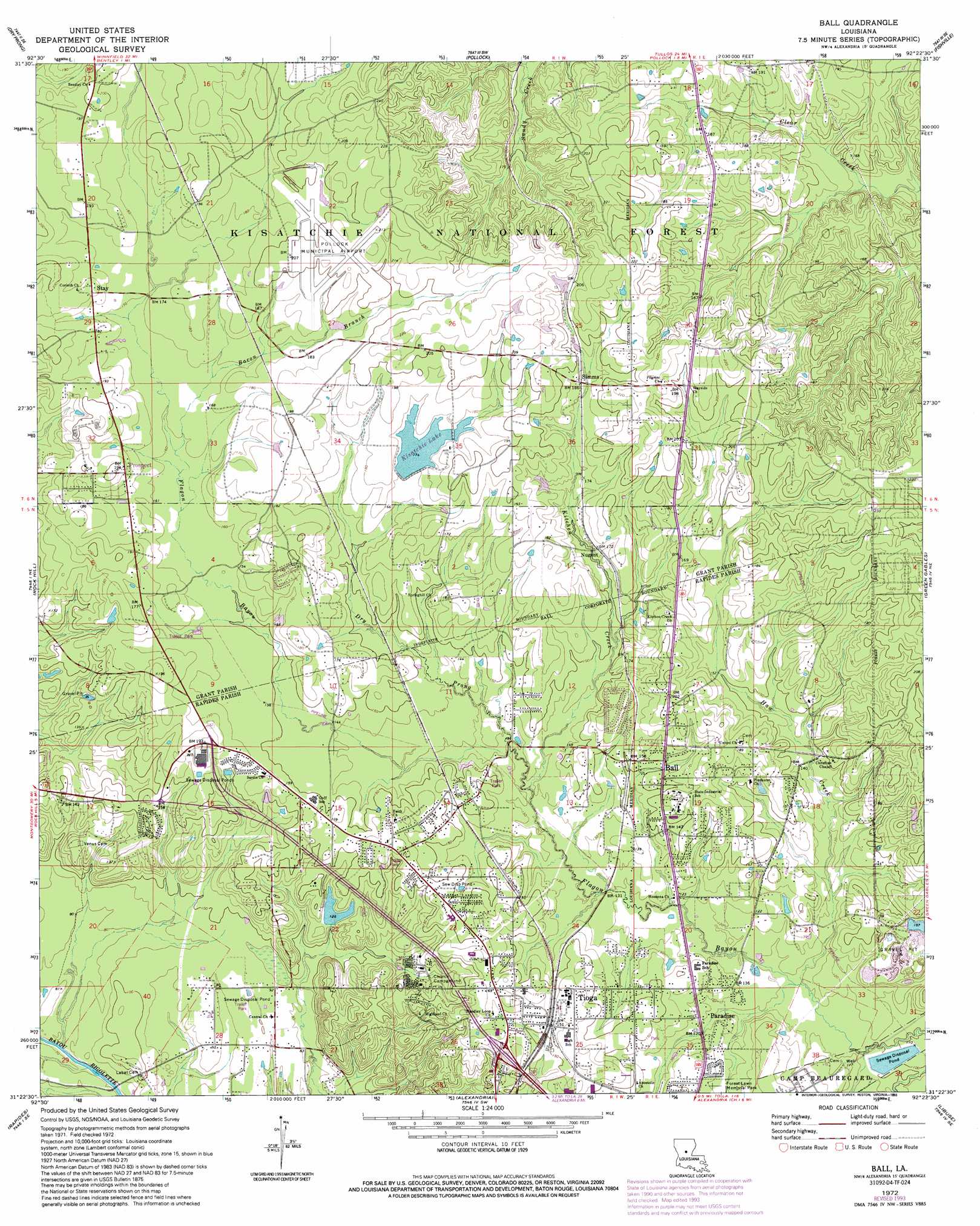
Ball Topo Map Louisiana
To zoom in, hover over the map of Ball
USGS Topo Quad 31092d4 - 1:24,000 scale
| Topo Map Name: | Ball |
| USGS Topo Quad ID: | 31092d4 |
| Print Size: | ca. 21 1/4" wide x 27" high |
| Southeast Coordinates: | 31.375° N latitude / 92.375° W longitude |
| Map Center Coordinates: | 31.4375° N latitude / 92.4375° W longitude |
| U.S. State: | LA |
| Filename: | o31092d4.jpg |
| Download Map JPG Image: | Ball topo map 1:24,000 scale |
| Map Type: | Topographic |
| Topo Series: | 7.5´ |
| Map Scale: | 1:24,000 |
| Source of Map Images: | United States Geological Survey (USGS) |
| Alternate Map Versions: |
Ball LA 1972, updated 1974 Download PDF Buy paper map Ball LA 1972, updated 1993 Download PDF Buy paper map Ball LA 2003, updated 2005 Download PDF Buy paper map Ball LA 2012 Download PDF Buy paper map Ball LA 2015 Download PDF Buy paper map |
| FStopo: | US Forest Service topo Ball is available: Download FStopo PDF Download FStopo TIF |
1:24,000 Topo Quads surrounding Ball
Savage Creek |
Williana |
Mudville |
Little Creek |
Jena West |
Colfax |
Dry Prong |
Pollock |
Fishville |
Nebo |
Boyce |
Rock Hill |
Ball |
Green Gables |
Holloway |
Gardner |
Rapides |
Alexandria |
Libuse |
Buckeye |
Elmer |
Woodworth West |
Woodworth East |
Latanier |
Effie |
> Back to 31092a1 at 1:100,000 scale
> Back to 31092a1 at 1:250,000 scale
> Back to U.S. Topo Maps home
Ball topo map: Gazetteer
Ball: Airports
Pollock Municipal Airport elevation 63m 206′Ball: Dams
Kisatchie Lake Dam elevation 54m 177′Louisiana Noname Number 53 Dam elevation 57m 187′
Ball: Populated Places
Ball elevation 49m 160′Garnett (historical) elevation 57m 187′
Nugent elevation 50m 164′
Paradise elevation 38m 124′
Prospect elevation 56m 183′
Simms elevation 57m 187′
Stay elevation 58m 190′
Timber Trails elevation 41m 134′
Tioga elevation 52m 170′
Ball: Reservoirs
Kisatchie Lake elevation 54m 177′Ball: Streams
Bacon Branch elevation 49m 160′Dry Prong elevation 39m 127′
Haw Creek elevation 33m 108′
Kitchen Creek elevation 37m 121′
Ball digital topo map on disk
Buy this Ball topo map showing relief, roads, GPS coordinates and other geographical features, as a high-resolution digital map file on DVD: