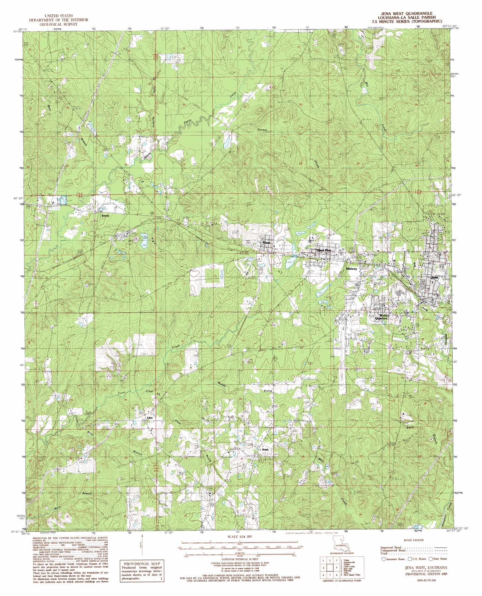
Jena West Topo Map Louisiana
To zoom in, hover over the map of Jena West
USGS Topo Quad 31092f2 - 1:24,000 scale
| Topo Map Name: | Jena West |
| USGS Topo Quad ID: | 31092f2 |
| Print Size: | ca. 21 1/4" wide x 27" high |
| Southeast Coordinates: | 31.625° N latitude / 92.125° W longitude |
| Map Center Coordinates: | 31.6875° N latitude / 92.1875° W longitude |
| U.S. State: | LA |
| Filename: | o31092f2.jpg |
| Download Map JPG Image: | Jena West topo map 1:24,000 scale |
| Map Type: | Topographic |
| Topo Series: | 7.5´ |
| Map Scale: | 1:24,000 |
| Source of Map Images: | United States Geological Survey (USGS) |
| Alternate Map Versions: |
Jena West LA 1985, updated 1985 Download PDF Buy paper map Jena West LA 2012 Download PDF Buy paper map Jena West LA 2015 Download PDF Buy paper map |
1:24,000 Topo Quads surrounding Jena West
Flat Creek |
Fords Creek |
Olla East |
Holum |
Enterprise |
Georgetown |
Tullas |
Summerville |
Nickel |
Aimwell |
Mudville |
Little Creek |
Jena West |
Jena East |
Manifest |
Pollock |
Fishville |
Nebo |
Bird Island Point |
Walters |
Ball |
Green Gables |
Holloway |
Buckeye Ne |
Larto Lake North |
> Back to 31092e1 at 1:100,000 scale
> Back to 31092a1 at 1:250,000 scale
> Back to U.S. Topo Maps home
Jena West topo map: Gazetteer
Jena West: Airports
Jena Airport elevation 64m 209′Jena West: Dams
Searcy Lake Dam elevation 43m 141′Jena West: Oilfields
Jena Airport Oil Field elevation 52m 170′Searcy Oil Field elevation 29m 95′
Summerville Oil Field elevation 38m 124′
Trout Creek Oil Field elevation 54m 177′
Jena West: Populated Places
Belah elevation 67m 219′Eden elevation 50m 164′
Fellowship elevation 60m 196′
Good Pine elevation 64m 209′
Jena elevation 51m 167′
Midway elevation 62m 203′
Searcy elevation 31m 101′
Trout elevation 62m 203′
Webb Quarters elevation 66m 216′
Jena West: Post Offices
Trout Post Office elevation 61m 200′Jena West: Streams
Bear Branch elevation 28m 91′Clear Fork elevation 34m 111′
Clear Prong elevation 37m 121′
Jumping Gully Creek elevation 29m 95′
Muddy Prong elevation 36m 118′
Riley Branch elevation 31m 101′
West Prong Hemphill Creek elevation 40m 131′
Zimmer Creek elevation 31m 101′
Jena West digital topo map on disk
Buy this Jena West topo map showing relief, roads, GPS coordinates and other geographical features, as a high-resolution digital map file on DVD: