Calvin Topo Map Louisiana
To zoom in, hover over the map of Calvin
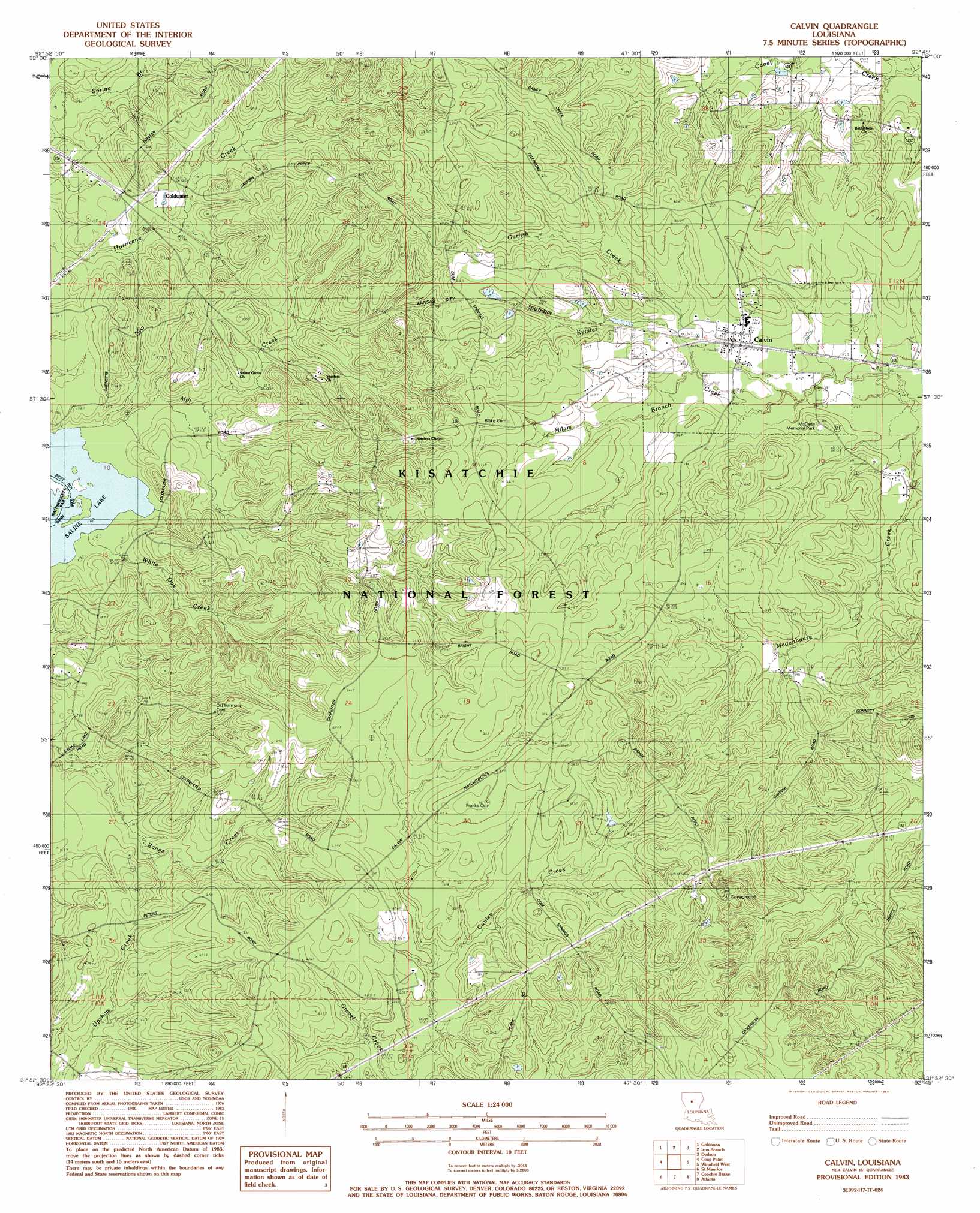
USGS Topo Quad 31092h7 - 1:24,000 scale
| Topo Map Name: | Calvin |
| USGS Topo Quad ID: | 31092h7 |
| Print Size: | ca. 21 1/4" wide x 27" high |
| Southeast Coordinates: | 31.875° N latitude / 92.75° W longitude |
| Map Center Coordinates: | 31.9375° N latitude / 92.8125° W longitude |
| U.S. State: | LA |
| Filename: | o31092h7.jpg |
| Download Map JPG Image: | Calvin topo map 1:24,000 scale |
| Map Type: | Topographic |
| Topo Series: | 7.5´ |
| Map Scale: | 1:24,000 |
| Source of Map Images: | United States Geological Survey (USGS) |
| Alternate Map Versions: |
Calvin LA 1983, updated 1984 Download PDF Buy paper map Calvin LA 2003, updated 2005 Download PDF Buy paper map Calvin LA 2012 Download PDF Buy paper map Calvin LA 2015 Download PDF Buy paper map |
| FStopo: | US Forest Service topo Calvin is available: Download FStopo PDF Download FStopo TIF |
1:24,000 Topo Quads surrounding Calvin
Ashland |
Saline |
Danville |
Jonesboro South |
Weston |
Chestnut |
Goldonna |
Iron Branch |
Dodson |
Hudson |
Campti |
Coup Point |
Calvin |
Winnfield West |
Winnfield East |
Natchitoches North |
Saint Maurice |
Coochie Brake |
Atlanta |
Packton |
Flora |
Montgomery |
Verda |
Savage Creek |
Williana |
> Back to 31092e1 at 1:100,000 scale
> Back to 31092a1 at 1:250,000 scale
> Back to U.S. Topo Maps home
Calvin topo map: Gazetteer
Calvin: Parks
McDade Memorial Park elevation 58m 190′Calvin: Populated Places
Calvin elevation 52m 170′Coldwater elevation 44m 144′
Calvin: Streams
Garfish Creek elevation 52m 170′Milam Branch elevation 48m 157′
Mill Creek elevation 31m 101′
White Oak Creek elevation 31m 101′
Calvin digital topo map on disk
Buy this Calvin topo map showing relief, roads, GPS coordinates and other geographical features, as a high-resolution digital map file on DVD: