Burr Ferry Topo Map Louisiana
To zoom in, hover over the map of Burr Ferry
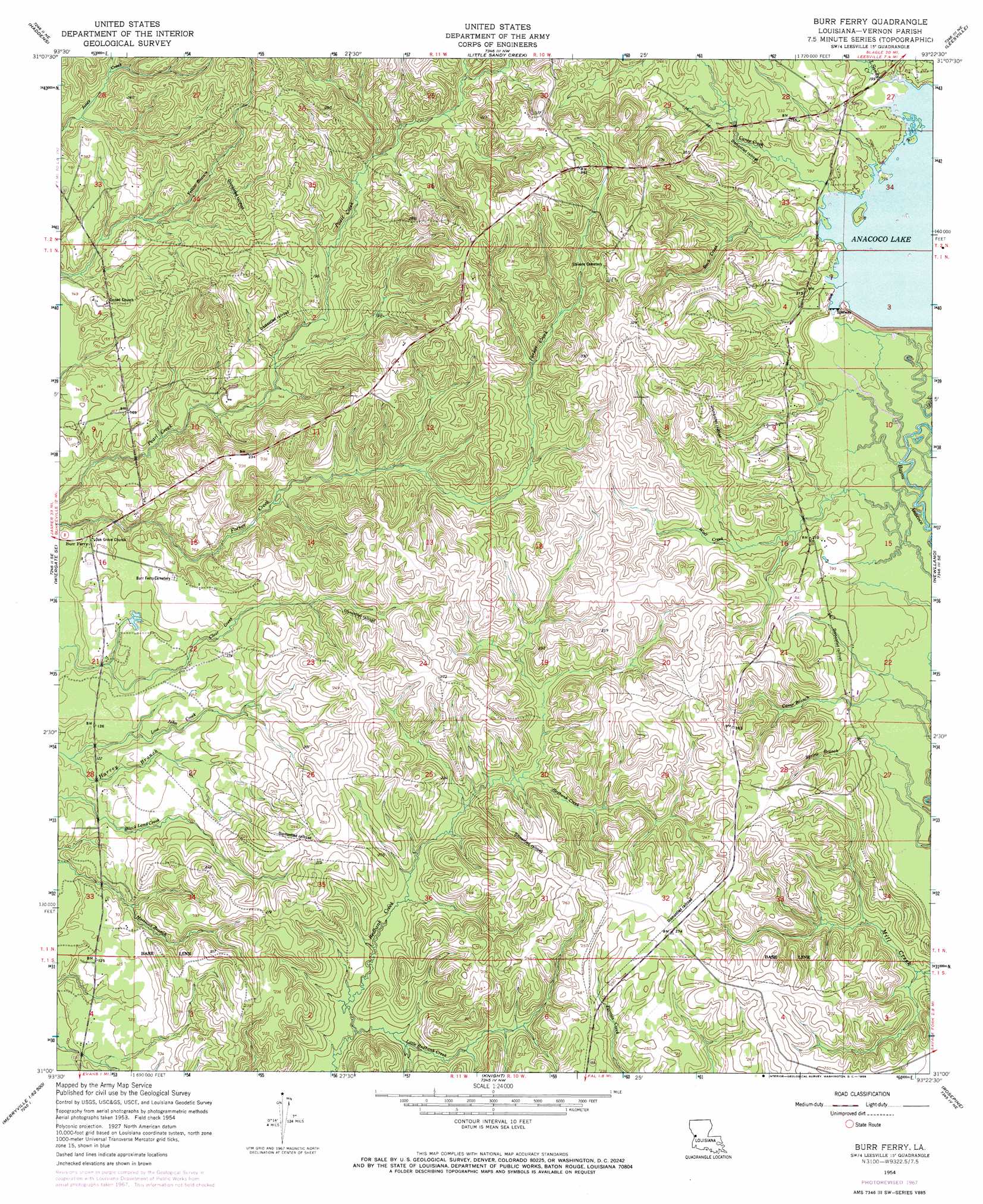
USGS Topo Quad 31093a4 - 1:24,000 scale
| Topo Map Name: | Burr Ferry |
| USGS Topo Quad ID: | 31093a4 |
| Print Size: | ca. 21 1/4" wide x 27" high |
| Southeast Coordinates: | 31° N latitude / 93.375° W longitude |
| Map Center Coordinates: | 31.0625° N latitude / 93.4375° W longitude |
| U.S. State: | LA |
| Filename: | o31093a4.jpg |
| Download Map JPG Image: | Burr Ferry topo map 1:24,000 scale |
| Map Type: | Topographic |
| Topo Series: | 7.5´ |
| Map Scale: | 1:24,000 |
| Source of Map Images: | United States Geological Survey (USGS) |
| Alternate Map Versions: |
Burr Ferry LA 1954, updated 1958 Download PDF Buy paper map Burr Ferry LA 1954, updated 1968 Download PDF Buy paper map Burr Ferry LA 2012 Download PDF Buy paper map Burr Ferry LA 2015 Download PDF Buy paper map |
1:24,000 Topo Quads surrounding Burr Ferry
Negreet Sw |
Toro |
Hornbeck |
Dowden Creek |
Kurthwood |
Fairmount |
Haddens |
Little Sandy Creek |
Leesville |
Slagle |
Wiergate |
Wiergate Se |
Burr Ferry |
Newllano |
Fort Polk |
Shankleville |
Evans |
Knight |
Rose Pine |
Hurricane Branch |
Newton East |
Merryville North |
Neale |
De Ridder |
Boneset Creek |
> Back to 31093a1 at 1:100,000 scale
> Back to 31092a1 at 1:250,000 scale
> Back to U.S. Topo Maps home
Burr Ferry topo map: Gazetteer
Burr Ferry: Islands
Rabbit Island elevation 63m 206′Burr Ferry: Parks
Boise-Vernon Wildlife Management Area elevation 71m 232′Burr Ferry: Populated Places
Burr Ferry elevation 39m 127′Caney elevation 65m 213′
Burr Ferry: Reservoirs
Anacoco Lake elevation 63m 206′Burr Ferry: Streams
Buck Creek elevation 59m 193′Camp Branch elevation 49m 160′
Caney Creek elevation 59m 193′
Little Redbank Creek elevation 44m 144′
Little Sandy Creek elevation 59m 193′
Low John Creek elevation 30m 98′
Wolf Creek elevation 51m 167′
Burr Ferry digital topo map on disk
Buy this Burr Ferry topo map showing relief, roads, GPS coordinates and other geographical features, as a high-resolution digital map file on DVD: