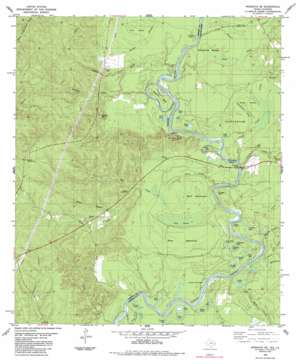
Wiergate Se Topo Map Texas
To zoom in, hover over the map of Wiergate Se
USGS Topo Quad 31093a5 - 1:24,000 scale
| Topo Map Name: | Wiergate Se |
| USGS Topo Quad ID: | 31093a5 |
| Print Size: | ca. 21 1/4" wide x 27" high |
| Southeast Coordinates: | 31° N latitude / 93.5° W longitude |
| Map Center Coordinates: | 31.0625° N latitude / 93.5625° W longitude |
| U.S. States: | TX, LA |
| Filename: | o31093a5.jpg |
| Download Map JPG Image: | Wiergate Se topo map 1:24,000 scale |
| Map Type: | Topographic |
| Topo Series: | 7.5´ |
| Map Scale: | 1:24,000 |
| Source of Map Images: | United States Geological Survey (USGS) |
| Alternate Map Versions: |
Wiergate SE TX 1954, updated 1958 Download PDF Buy paper map Wiergate SE TX 1954, updated 1970 Download PDF Buy paper map Wiergate SE TX 1954, updated 1976 Download PDF Buy paper map Wiergate SE TX 1985, updated 1985 Download PDF Buy paper map Wiergate SE TX 1985, updated 1985 Download PDF Buy paper map Wiergate SE TX 2010 Download PDF Buy paper map Wiergate SE TX 2012 Download PDF Buy paper map Wiergate SE TX 2016 Download PDF Buy paper map |
1:24,000 Topo Quads surrounding Wiergate Se
> Back to 31093a1 at 1:100,000 scale
> Back to 31092a1 at 1:250,000 scale
> Back to U.S. Topo Maps home
Wiergate Se topo map: Gazetteer
Wiergate Se: Bends
Russell Bend elevation 24m 78′Scoggins Bend elevation 29m 95′
Wiergate Se: Bridges
Burr Ferry Bridge elevation 23m 75′Burrs Ferry Bridge elevation 23m 75′
Wiergate Se: Crossings
Burr Ferry (historical) elevation 23m 75′Wiergate Se: Flats
Palmettos Brake elevation 32m 104′Wiergate Se: Guts
Huckleberry River elevation 29m 95′Jim River elevation 25m 82′
Old Wing Slough elevation 29m 95′
Swain River elevation 26m 85′
Wiergate Se: Islands
Dark Hammock elevation 29m 95′Gray Hammock elevation 33m 108′
Pine Island elevation 35m 114′
Wiergate Se: Lakes
Bird Lake elevation 28m 91′Bird Lake elevation 27m 88′
Brooks Eddy elevation 23m 75′
Brushy Lake elevation 27m 88′
Catfish Lake elevation 26m 85′
Copeland Lakes elevation 32m 104′
Daycrain Lake elevation 26m 85′
Duck Lake elevation 27m 88′
Eddie Lake elevation 27m 88′
Evans Brake elevation 29m 95′
Gar Lake elevation 30m 98′
Gum Lake elevation 27m 88′
Horseshoe Lake elevation 29m 95′
Jarrels Ferry Lake elevation 24m 78′
Joe Lake elevation 24m 78′
Jones Lake elevation 26m 85′
Labar Lake elevation 24m 78′
Pine Bluff Lake elevation 26m 85′
Round Lake elevation 24m 78′
Round Lake elevation 26m 85′
Smith Lake elevation 24m 78′
Wood Lake elevation 24m 78′
Yellow Lake elevation 32m 104′
Yokum Lake elevation 26m 85′
Wiergate Se: Ranges
Runyon Hills elevation 73m 239′Wiergate Se: Streams
Black Branch elevation 40m 131′Black Creek elevation 23m 75′
Black Land Creek elevation 28m 91′
Brack Creek elevation 36m 118′
Clear Creek elevation 26m 85′
Corey Branch elevation 23m 75′
Detty Creek elevation 23m 75′
Flat Creek elevation 23m 75′
Forker Creek elevation 30m 98′
Harvey Branch elevation 23m 75′
Hickman Creek elevation 27m 88′
Hurger Branch elevation 30m 98′
Hurricane Branch elevation 28m 91′
Indian Creek elevation 23m 75′
Jones Creek elevation 23m 75′
Melton Creek elevation 31m 101′
Mill Creek elevation 28m 91′
Pearl Creek elevation 23m 75′
Red Bank Creek elevation 22m 72′
Yellow Branch elevation 29m 95′
Wiergate Se: Summits
Gunter Hill elevation 86m 282′Wiergate Se: Swamps
Sibo Brake elevation 29m 95′Wiergate Se digital topo map on disk
Buy this Wiergate Se topo map showing relief, roads, GPS coordinates and other geographical features, as a high-resolution digital map file on DVD:


