Hurricane Creek Topo Map Texas
To zoom in, hover over the map of Hurricane Creek
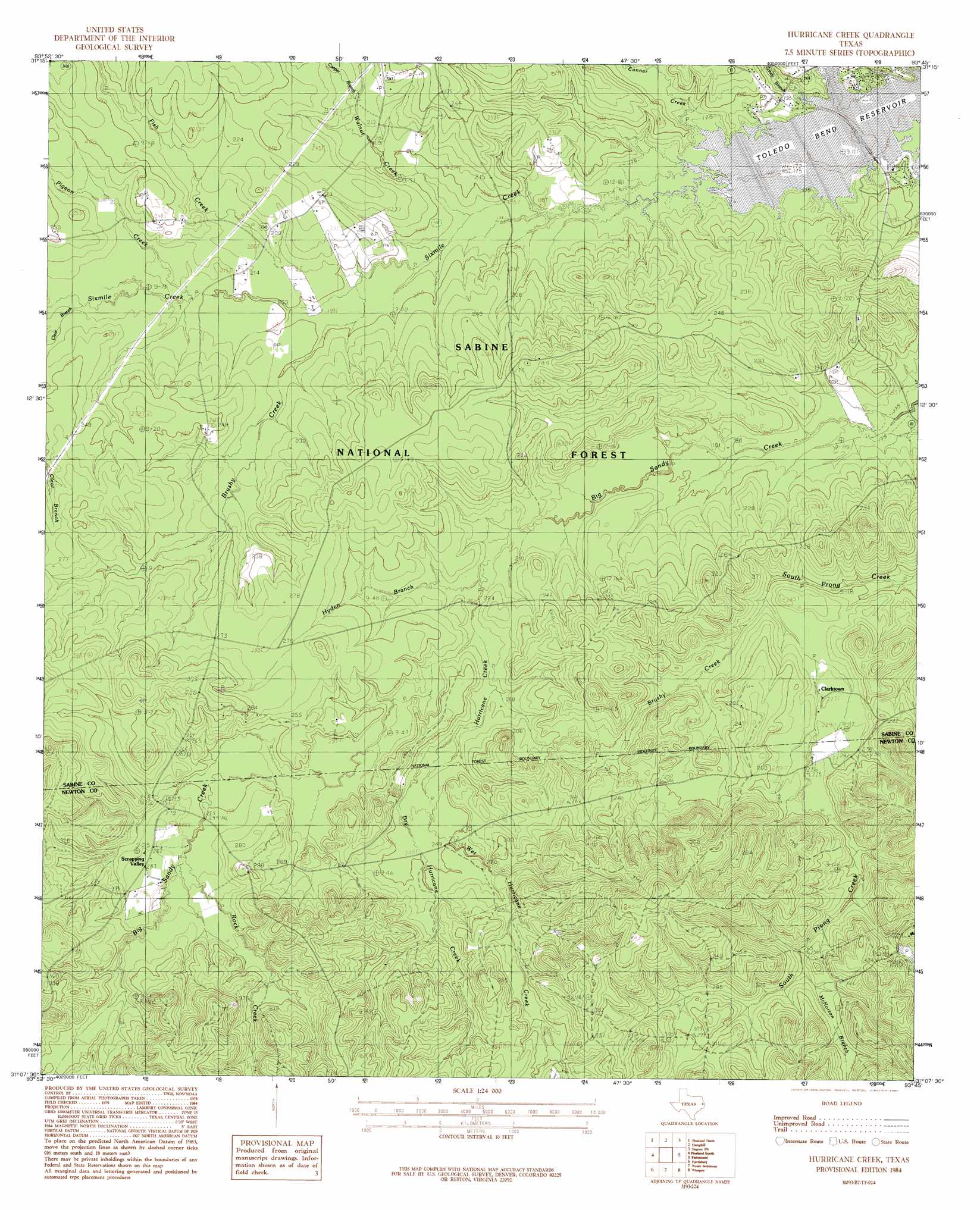
USGS Topo Quad 31093b7 - 1:24,000 scale
| Topo Map Name: | Hurricane Creek |
| USGS Topo Quad ID: | 31093b7 |
| Print Size: | ca. 21 1/4" wide x 27" high |
| Southeast Coordinates: | 31.125° N latitude / 93.75° W longitude |
| Map Center Coordinates: | 31.1875° N latitude / 93.8125° W longitude |
| U.S. State: | TX |
| Filename: | o31093b7.jpg |
| Download Map JPG Image: | Hurricane Creek topo map 1:24,000 scale |
| Map Type: | Topographic |
| Topo Series: | 7.5´ |
| Map Scale: | 1:24,000 |
| Source of Map Images: | United States Geological Survey (USGS) |
| Alternate Map Versions: |
Hurricane Creek TX 1984, updated 1984 Download PDF Buy paper map Hurricane Creek TX 2003, updated 2004 Download PDF Buy paper map Hurricane Creek TX 2010 Download PDF Buy paper map Hurricane Creek TX 2012 Download PDF Buy paper map Hurricane Creek TX 2016 Download PDF Buy paper map |
| FStopo: | US Forest Service topo Hurricane Creek is available: Download FStopo PDF Download FStopo TIF |
1:24,000 Topo Quads surrounding Hurricane Creek
Chinquapin |
Geneva |
Milam |
Salter Creek |
Negreet |
Bronson |
Pineland North |
Hemphill |
Negreet Sw |
Toro |
Buck Bay |
Pineland South |
Hurricane Creek |
Fairmount |
Haddens |
Mcgee Bend |
Harrisburg |
Weeks Settlement |
Wiergate |
Wiergate Se |
Jasper West |
Jasper East |
Jamestown |
Shankleville |
Evans |
> Back to 31093a1 at 1:100,000 scale
> Back to 31092a1 at 1:250,000 scale
> Back to U.S. Topo Maps home
Hurricane Creek topo map: Gazetteer
Hurricane Creek: Dams
Scrappin Valley Lake Dam elevation 91m 298′Hurricane Creek: Populated Places
Clarktown elevation 69m 226′Mason elevation 59m 193′
Scrapping Valley elevation 84m 275′
Hurricane Creek: Reservoirs
Scrappin Valley Lake elevation 91m 298′Hurricane Creek: Streams
Brushy Creek elevation 61m 200′Brushy Creek elevation 69m 226′
Conner Creek elevation 52m 170′
Cooper Branch elevation 64m 209′
Dry Hurricane Creek elevation 77m 252′
Fish Creek elevation 58m 190′
Hurricane Creek elevation 64m 209′
Hyden Branch elevation 65m 213′
Lick Branch elevation 56m 183′
McNorton Branch elevation 80m 262′
Pigeon Creek elevation 62m 203′
Rice Creek elevation 52m 170′
Rock Creek elevation 77m 252′
Sandy Branch elevation 53m 173′
Sixmile Creek elevation 52m 170′
Walnut Creek elevation 55m 180′
Wet Hurricane Creek elevation 77m 252′
Hurricane Creek digital topo map on disk
Buy this Hurricane Creek topo map showing relief, roads, GPS coordinates and other geographical features, as a high-resolution digital map file on DVD: