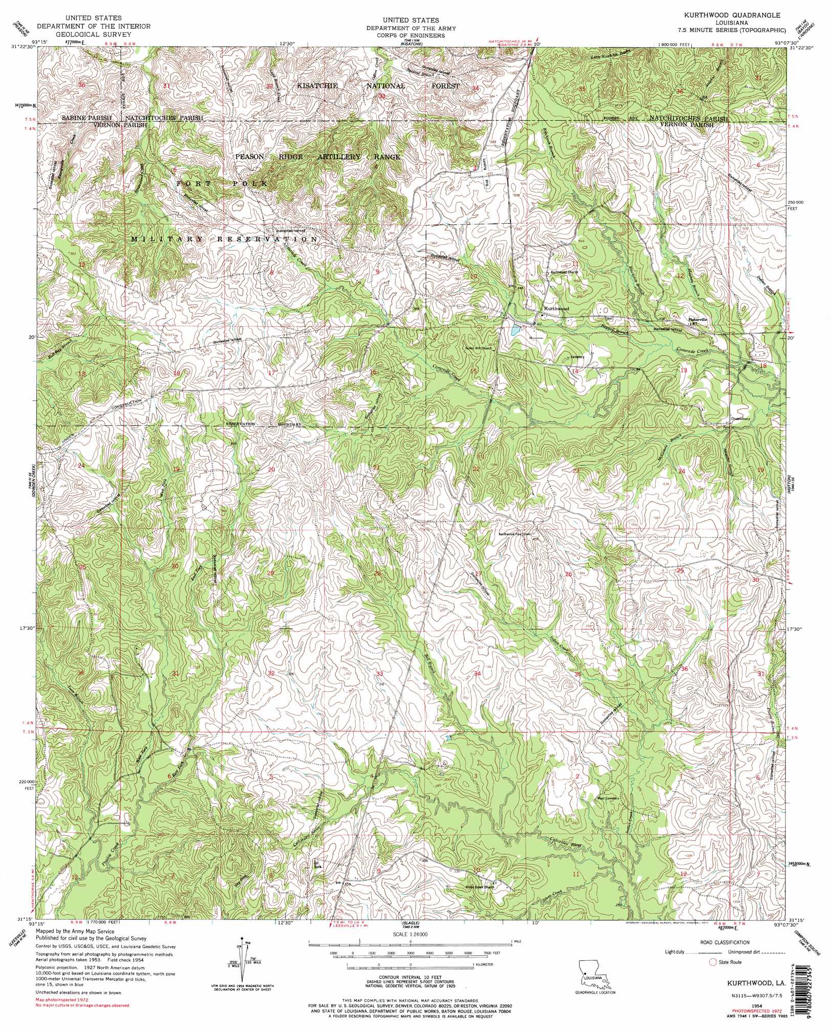
Kurthwood Topo Map Louisiana
To zoom in, hover over the map of Kurthwood
USGS Topo Quad 31093c2 - 1:24,000 scale
| Topo Map Name: | Kurthwood |
| USGS Topo Quad ID: | 31093c2 |
| Print Size: | ca. 21 1/4" wide x 27" high |
| Southeast Coordinates: | 31.25° N latitude / 93.125° W longitude |
| Map Center Coordinates: | 31.3125° N latitude / 93.1875° W longitude |
| U.S. State: | LA |
| Filename: | o31093c2.jpg |
| Download Map JPG Image: | Kurthwood topo map 1:24,000 scale |
| Map Type: | Topographic |
| Topo Series: | 7.5´ |
| Map Scale: | 1:24,000 |
| Source of Map Images: | United States Geological Survey (USGS) |
| Alternate Map Versions: |
Kurthwood LA 1954, updated 1958 Download PDF Buy paper map Kurthwood LA 1954, updated 1977 Download PDF Buy paper map Kurthwood LA 1954, updated 1977 Download PDF Buy paper map Kurthwood LA 2003, updated 2005 Download PDF Buy paper map Kurthwood LA 2012 Download PDF Buy paper map Kurthwood LA 2015 Download PDF Buy paper map |
| FStopo: | US Forest Service topo Kurthwood is available: Download FStopo PDF Download FStopo TIF |
1:24,000 Topo Quads surrounding Kurthwood
Many |
Vowells Mill |
Bellwood |
Natchitoches South |
Cloutierville |
Florien |
Peason |
Kisatchie |
Bayou Livrogne |
Gorum |
Hornbeck |
Dowden Creek |
Kurthwood |
Simpson North |
Temple |
Little Sandy Creek |
Leesville |
Slagle |
Simpson South |
Lacamp |
Burr Ferry |
Newllano |
Fort Polk |
Birds Creek |
Fullerton Lake |
> Back to 31093a1 at 1:100,000 scale
> Back to 31092a1 at 1:250,000 scale
> Back to U.S. Topo Maps home
Kurthwood topo map: Gazetteer
Kurthwood: Dams
Jack Anderson Pond Dam elevation 102m 334′Kurthwood: Populated Places
Alco elevation 95m 311′Dusenbury elevation 92m 301′
Fisherville elevation 102m 334′
Kurthwood elevation 101m 331′
Kurthwood: Post Offices
Kurthwood Post Office elevation 97m 318′Kurthwood: Streams
Alligator Branch elevation 90m 295′Baygall Branch elevation 90m 295′
Bell Branch elevation 85m 278′
Blackjack Branch elevation 91m 298′
East Fork Prairie Creek elevation 90m 295′
Indian Creek elevation 81m 265′
Mayhaw Branch elevation 89m 291′
McGifford Branch elevation 88m 288′
Silver Creek elevation 80m 262′
Squirrel Branch elevation 83m 272′
Stagestand Creek elevation 85m 278′
Twin Branch elevation 85m 278′
West Fork Prairie Creek elevation 89m 291′
Kurthwood digital topo map on disk
Buy this Kurthwood topo map showing relief, roads, GPS coordinates and other geographical features, as a high-resolution digital map file on DVD: