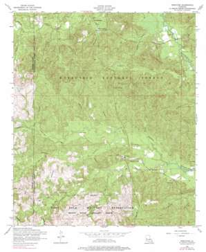
Kisatchie Topo Map Louisiana
To zoom in, hover over the map of Kisatchie
USGS Topo Quad 31093d2 - 1:24,000 scale
| Topo Map Name: | Kisatchie |
| USGS Topo Quad ID: | 31093d2 |
| Print Size: | ca. 21 1/4" wide x 27" high |
| Southeast Coordinates: | 31.375° N latitude / 93.125° W longitude |
| Map Center Coordinates: | 31.4375° N latitude / 93.1875° W longitude |
| U.S. State: | LA |
| Filename: | o31093d2.jpg |
| Download Map JPG Image: | Kisatchie topo map 1:24,000 scale |
| Map Type: | Topographic |
| Topo Series: | 7.5´ |
| Map Scale: | 1:24,000 |
| Source of Map Images: | United States Geological Survey (USGS) |
| Alternate Map Versions: |
Kisatchie LA 1954, updated 1958 Download PDF Buy paper map Kisatchie LA 1954, updated 1976 Download PDF Buy paper map Kisatchie LA 1954, updated 1976 Download PDF Buy paper map Kisatchie LA 2003, updated 2005 Download PDF Buy paper map Kisatchie LA 2012 Download PDF Buy paper map Kisatchie LA 2015 Download PDF Buy paper map |
| FStopo: | US Forest Service topo Kisatchie is available: Download FStopo PDF Download FStopo TIF |
1:24,000 Topo Quads surrounding Kisatchie
> Back to 31093a1 at 1:100,000 scale
> Back to 31092a1 at 1:250,000 scale
> Back to U.S. Topo Maps home
Kisatchie topo map: Gazetteer
Kisatchie: Falls
Kisatchie Fall elevation 56m 183′Odum Falls elevation 75m 246′
Kisatchie: Populated Places
Kile elevation 64m 209′Kisatchie elevation 87m 285′
Lotus elevation 66m 216′
Kisatchie: Post Offices
Kisatchie Post Office elevation 87m 285′Kisatchie: Springs
Hannah Spring elevation 43m 141′Kisatchie: Streams
Caney Branch elevation 63m 206′Double Branch elevation 40m 131′
Dry Creek elevation 76m 249′
Hyatt Branch elevation 66m 216′
Key Branch elevation 63m 206′
Little Sandy Creek elevation 61m 200′
Long Branch elevation 76m 249′
Lyles Creek elevation 72m 236′
Mike Branch elevation 64m 209′
Mill Creek elevation 49m 160′
Odom Creek elevation 65m 213′
Pate Creek elevation 79m 259′
Reaugaulle Creek elevation 76m 249′
Saddle Branch elevation 67m 219′
School House Creek elevation 45m 147′
Sheard Branch elevation 42m 137′
Simmons Creek elevation 47m 154′
Sulphur Branch elevation 76m 249′
Tiger Branch elevation 78m 255′
Tiger Creek elevation 72m 236′
Wilson Branch elevation 49m 160′
Kisatchie digital topo map on disk
Buy this Kisatchie topo map showing relief, roads, GPS coordinates and other geographical features, as a high-resolution digital map file on DVD:


