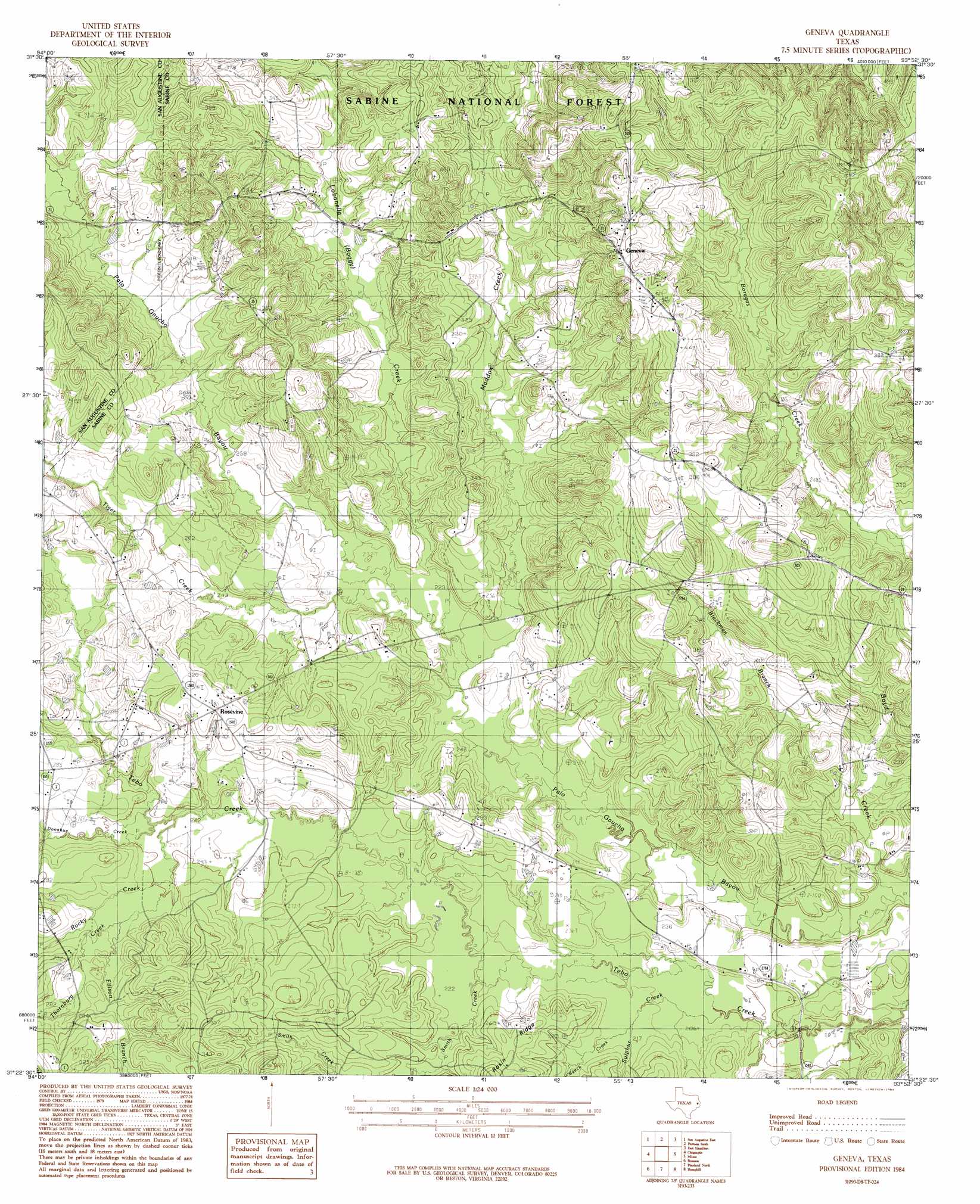
Geneva Topo Map Texas
To zoom in, hover over the map of Geneva
USGS Topo Quad 31093d8 - 1:24,000 scale
| Topo Map Name: | Geneva |
| USGS Topo Quad ID: | 31093d8 |
| Print Size: | ca. 21 1/4" wide x 27" high |
| Southeast Coordinates: | 31.375° N latitude / 93.875° W longitude |
| Map Center Coordinates: | 31.4375° N latitude / 93.9375° W longitude |
| U.S. State: | TX |
| Filename: | o31093d8.jpg |
| Download Map JPG Image: | Geneva topo map 1:24,000 scale |
| Map Type: | Topographic |
| Topo Series: | 7.5´ |
| Map Scale: | 1:24,000 |
| Source of Map Images: | United States Geological Survey (USGS) |
| Alternate Map Versions: |
Geneva TX 1984, updated 1984 Download PDF Buy paper map Geneva TX 2010 Download PDF Buy paper map Geneva TX 2012 Download PDF Buy paper map Geneva TX 2016 Download PDF Buy paper map |
| FStopo: | US Forest Service topo Geneva is available: Download FStopo PDF Download FStopo TIF |
1:24,000 Topo Quads surrounding Geneva
Neuville |
Hurstown |
Patroon North |
Brushy Creek |
Zwolle |
San Augustine West |
San Augustine East |
Patroon South |
East Hamilton |
Beech Bayou |
Norwood |
Chinquapin |
Geneva |
Milam |
Salter Creek |
Harvey Creek |
Bronson |
Pineland North |
Hemphill |
Negreet Sw |
Veach |
Buck Bay |
Pineland South |
Hurricane Creek |
Fairmount |
> Back to 31093a1 at 1:100,000 scale
> Back to 31092a1 at 1:250,000 scale
> Back to U.S. Topo Maps home
Geneva topo map: Gazetteer
Geneva: Populated Places
Geneva elevation 140m 459′Rosevine elevation 94m 308′
Geneva: Ridges
Rosin Ridge elevation 85m 278′Geneva: Springs
Myrtle Spring elevation 131m 429′Sulphur Springs elevation 110m 360′
Geneva: Streams
Beech Creek elevation 66m 216′Blackman Branch elevation 63m 206′
Boyd Creek elevation 59m 193′
Donahue Creek elevation 73m 239′
El Lobanillo Creek elevation 67m 219′
Ellison Branch elevation 78m 255′
Maddox Creek elevation 66m 216′
Rocky Creek elevation 74m 242′
Smith Creek elevation 65m 213′
Sulphur Creek elevation 62m 203′
Thornburg Creek elevation 75m 246′
Tiger Creek elevation 67m 219′
Geneva digital topo map on disk
Buy this Geneva topo map showing relief, roads, GPS coordinates and other geographical features, as a high-resolution digital map file on DVD: