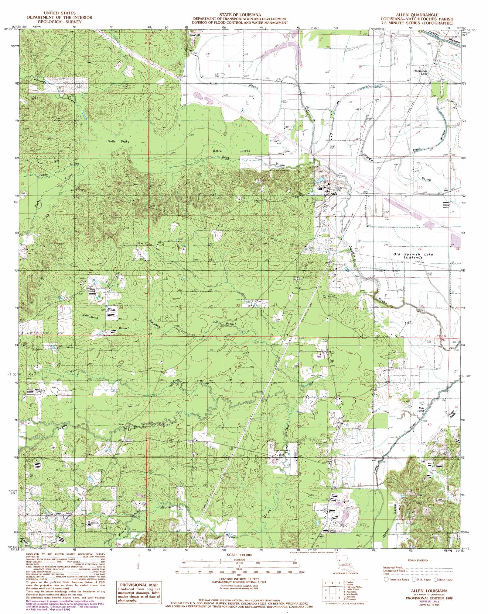
Allen Topo Map Louisiana
To zoom in, hover over the map of Allen
USGS Topo Quad 31093g3 - 1:24,000 scale
| Topo Map Name: | Allen |
| USGS Topo Quad ID: | 31093g3 |
| Print Size: | ca. 21 1/4" wide x 27" high |
| Southeast Coordinates: | 31.75° N latitude / 93.25° W longitude |
| Map Center Coordinates: | 31.8125° N latitude / 93.3125° W longitude |
| U.S. State: | LA |
| Filename: | o31093g3.jpg |
| Download Map JPG Image: | Allen topo map 1:24,000 scale |
| Map Type: | Topographic |
| Topo Series: | 7.5´ |
| Map Scale: | 1:24,000 |
| Source of Map Images: | United States Geological Survey (USGS) |
| Alternate Map Versions: |
Allen LA 1989, updated 1989 Download PDF Buy paper map Allen LA 1989, updated 1992 Download PDF Buy paper map Allen LA 2012 Download PDF Buy paper map Allen LA 2015 Download PDF Buy paper map |
1:24,000 Topo Quads surrounding Allen
Bayou Pierre Lake |
Harmon |
Coushatta |
Martin |
Chestnut |
Pelican |
Evelyn |
Hanna |
Messick |
Campti |
Pleasant Hill |
Hollis Creek |
Allen |
Powhatan |
Natchitoches North |
Belmont |
Marthaville |
Robeline |
Provencal |
Flora |
Loring |
Many |
Vowells Mill |
Bellwood |
Natchitoches South |
> Back to 31093e1 at 1:100,000 scale
> Back to 31092a1 at 1:250,000 scale
> Back to U.S. Topo Maps home
Allen topo map: Gazetteer
Allen: Guts
Cow Bayou elevation 38m 124′Rocks Bayou elevation 37m 121′
Tapalcat Bayou elevation 37m 121′
Allen: Lakes
Fish Pond elevation 33m 108′Allen: Oilfields
Kings Hill Gas Field elevation 38m 124′Allen: Populated Places
Allen elevation 51m 167′Allen: Streams
Bayou Terre Blanc elevation 36m 118′Brushy Bayou elevation 36m 118′
Gum Bayou elevation 43m 141′
Magason Branch elevation 40m 131′
Mallard Bayou elevation 34m 111′
Mayous Bayou elevation 38m 124′
Rawhide Creek elevation 36m 118′
Rocks Creek elevation 36m 118′
Watson Bayou elevation 42m 137′
Williamson Branch elevation 48m 157′
Allen: Summits
King Hill elevation 51m 167′Allen: Swamps
Berry Brake elevation 35m 114′Halls Brake elevation 36m 118′
Horseshoe Lake elevation 34m 111′
Allen digital topo map on disk
Buy this Allen topo map showing relief, roads, GPS coordinates and other geographical features, as a high-resolution digital map file on DVD: