Union Springs Topo Map Louisiana
To zoom in, hover over the map of Union Springs
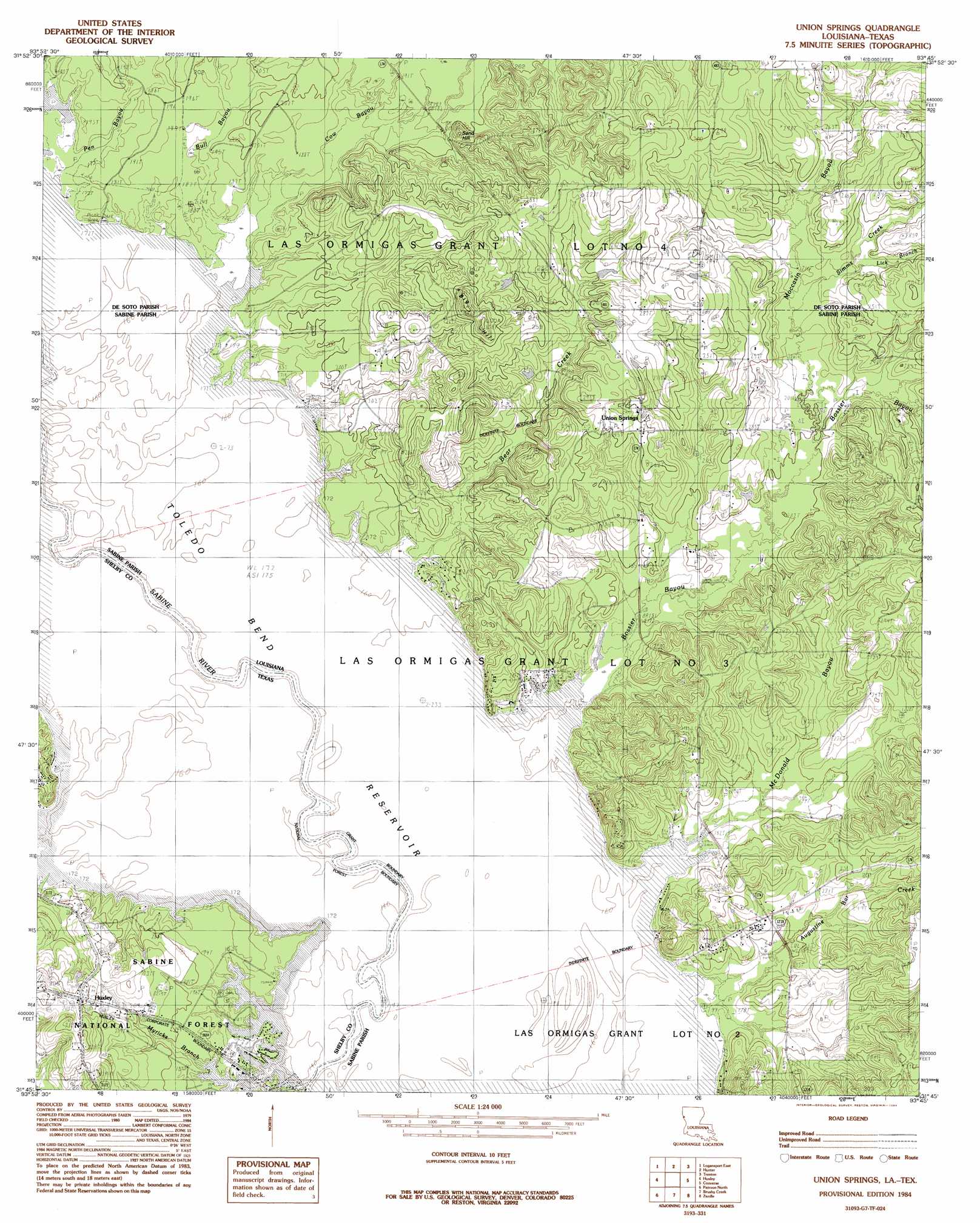
USGS Topo Quad 31093g7 - 1:24,000 scale
| Topo Map Name: | Union Springs |
| USGS Topo Quad ID: | 31093g7 |
| Print Size: | ca. 21 1/4" wide x 27" high |
| Southeast Coordinates: | 31.75° N latitude / 93.75° W longitude |
| Map Center Coordinates: | 31.8125° N latitude / 93.8125° W longitude |
| U.S. States: | LA, TX |
| Filename: | o31093g7.jpg |
| Download Map JPG Image: | Union Springs topo map 1:24,000 scale |
| Map Type: | Topographic |
| Topo Series: | 7.5´ |
| Map Scale: | 1:24,000 |
| Source of Map Images: | United States Geological Survey (USGS) |
| Alternate Map Versions: |
Union Springs LA 1984, updated 1984 Download PDF Buy paper map Union Springs LA 2003, updated 2004 Download PDF Buy paper map Union Springs LA 2010 Download PDF Buy paper map Union Springs LA 2015 Download PDF Buy paper map |
| FStopo: | US Forest Service topo Union Springs is available: Download FStopo PDF Download FStopo TIF |
1:24,000 Topo Quads surrounding Union Springs
Galloway |
Longstreet |
Grand Cane |
Mansfield |
Bayou Pierre Lake |
Logansport West |
Logansport East |
Hunter |
Trenton |
Pelican |
Shelbyville |
Huxley |
Union Springs |
Converse |
Pleasant Hill |
Hurstown |
Patroon North |
Brushy Creek |
Zwolle |
Belmont |
San Augustine East |
Patroon South |
East Hamilton |
Beech Bayou |
Loring |
> Back to 31093e1 at 1:100,000 scale
> Back to 31092a1 at 1:250,000 scale
> Back to U.S. Topo Maps home
Union Springs topo map: Gazetteer
Union Springs: Flats
Gravel Prairie elevation 52m 170′Racetrack Prairie elevation 52m 170′
Union Springs: Lakes
Boggy Lake elevation 52m 170′Union Springs: Populated Places
Union Springs elevation 80m 262′Union Springs: Streams
Augustine Bar Creek elevation 54m 177′Bear Creek elevation 52m 170′
Bossier Bayou elevation 52m 170′
Bull Bayou elevation 53m 173′
Cow Bayou elevation 52m 170′
Grannies Creek elevation 52m 170′
Lick Branch elevation 69m 226′
McDonald Bayou elevation 52m 170′
Moccasin Bayou elevation 66m 216′
Myricks Branch elevation 52m 170′
Pen Bayou elevation 54m 177′
Prairie Creek elevation 57m 187′
Simms Creek elevation 67m 219′
Union Springs: Summits
Big Hill elevation 108m 354′Sand Hill elevation 76m 249′
Union Springs digital topo map on disk
Buy this Union Springs topo map showing relief, roads, GPS coordinates and other geographical features, as a high-resolution digital map file on DVD: