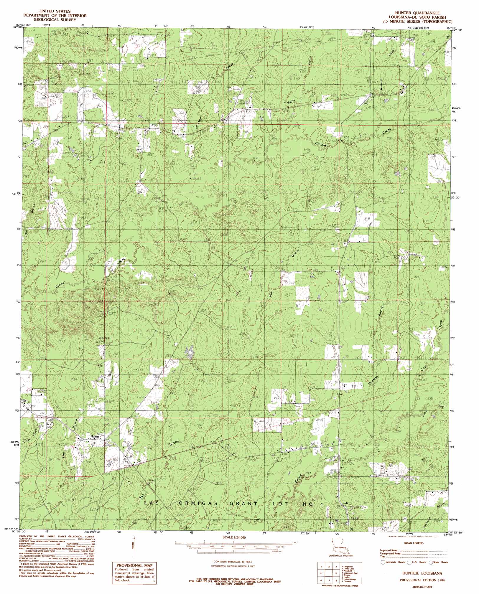
Hunter Topo Map Louisiana
To zoom in, hover over the map of Hunter
USGS Topo Quad 31093h7 - 1:24,000 scale
| Topo Map Name: | Hunter |
| USGS Topo Quad ID: | 31093h7 |
| Print Size: | ca. 21 1/4" wide x 27" high |
| Southeast Coordinates: | 31.875° N latitude / 93.75° W longitude |
| Map Center Coordinates: | 31.9375° N latitude / 93.8125° W longitude |
| U.S. State: | LA |
| Filename: | o31093h7.jpg |
| Download Map JPG Image: | Hunter topo map 1:24,000 scale |
| Map Type: | Topographic |
| Topo Series: | 7.5´ |
| Map Scale: | 1:24,000 |
| Source of Map Images: | United States Geological Survey (USGS) |
| Alternate Map Versions: |
Hunter LA 1984, updated 1984 Download PDF Buy paper map Hunter LA 2012 Download PDF Buy paper map Hunter LA 2015 Download PDF Buy paper map |
1:24,000 Topo Quads surrounding Hunter
Old Panola |
Keatchie |
Gloster |
Holly |
Clear Lake |
Galloway |
Longstreet |
Grand Cane |
Mansfield |
Bayou Pierre Lake |
Logansport West |
Logansport East |
Hunter |
Trenton |
Pelican |
Shelbyville |
Huxley |
Union Springs |
Converse |
Pleasant Hill |
Hurstown |
Patroon North |
Brushy Creek |
Zwolle |
Belmont |
> Back to 31093e1 at 1:100,000 scale
> Back to 31092a1 at 1:250,000 scale
> Back to U.S. Topo Maps home
Hunter topo map: Gazetteer
Hunter: Oilfields
Catuna Gas Field elevation 85m 278′Lula Gas Field elevation 93m 305′
Spider Gas Field elevation 81m 265′
Hunter: Populated Places
Cook (historical) elevation 87m 285′Hunter elevation 80m 262′
Lenoir (historical) elevation 76m 249′
Lula elevation 69m 226′
Spider (historical) elevation 98m 321′
Hunter: Streams
Baget Creek elevation 70m 229′Cypress Bayou elevation 64m 209′
Duke Bayou elevation 70m 229′
Jackson Creek elevation 64m 209′
Williams Creek elevation 79m 259′
Hunter digital topo map on disk
Buy this Hunter topo map showing relief, roads, GPS coordinates and other geographical features, as a high-resolution digital map file on DVD: