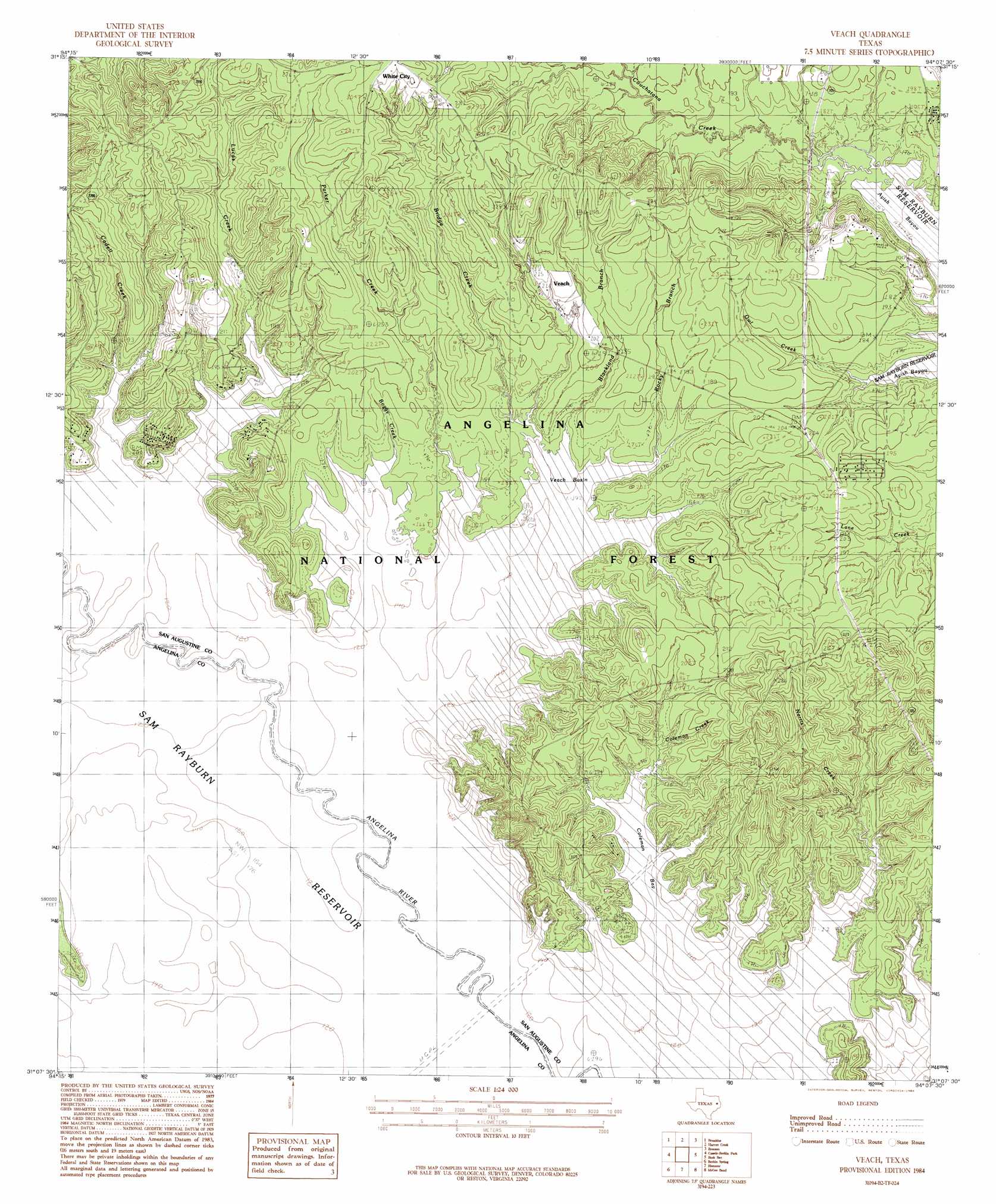
Veach Topo Map Texas
To zoom in, hover over the map of Veach
USGS Topo Quad 31094b2 - 1:24,000 scale
| Topo Map Name: | Veach |
| USGS Topo Quad ID: | 31094b2 |
| Print Size: | ca. 21 1/4" wide x 27" high |
| Southeast Coordinates: | 31.125° N latitude / 94.125° W longitude |
| Map Center Coordinates: | 31.1875° N latitude / 94.1875° W longitude |
| U.S. State: | TX |
| Filename: | o31094b2.jpg |
| Download Map JPG Image: | Veach topo map 1:24,000 scale |
| Map Type: | Topographic |
| Topo Series: | 7.5´ |
| Map Scale: | 1:24,000 |
| Source of Map Images: | United States Geological Survey (USGS) |
| Alternate Map Versions: |
Veach TX 1984, updated 1984 Download PDF Buy paper map Veach TX 2003, updated 2004 Download PDF Buy paper map Veach TX 2011 Download PDF Buy paper map Veach TX 2013 Download PDF Buy paper map Veach TX 2016 Download PDF Buy paper map |
| FStopo: | US Forest Service topo Veach is available: Download FStopo PDF Download FStopo TIF |
1:24,000 Topo Quads surrounding Veach
Etoile North |
Chireno South |
Norwood |
Chinquapin |
Geneva |
Etoile South |
Broaddus |
Harvey Creek |
Bronson |
Pineland North |
Zavalla |
Cassells-Boykin Park |
Veach |
Buck Bay |
Pineland South |
Rockland |
Boykin Spring |
Ebenezer |
Mcgee Bend |
Harrisburg |
Colmesneil |
Boggy Lake |
Pace Hill |
Jasper West |
Jasper East |
> Back to 31094a1 at 1:100,000 scale
> Back to 31094a1 at 1:250,000 scale
> Back to U.S. Topo Maps home
Veach topo map: Gazetteer
Veach: Basins
Veach Basin elevation 50m 164′Veach: Bays
Coleman Bay elevation 50m 164′Five Fingers elevation 50m 164′
Veach: Lakes
McGilberry Lake elevation 50m 164′Veach: Populated Places
Veach elevation 68m 223′Veach: Streams
Blackland Branch elevation 50m 164′Boggy Creek elevation 50m 164′
Bridge Creek elevation 50m 164′
Cadell Creek elevation 50m 164′
Campbell Branch elevation 50m 164′
Caney Creek elevation 50m 164′
Coleman Creek elevation 50m 164′
Hornsby Creek elevation 50m 164′
Little Caney Creek elevation 50m 164′
Lucas Creek elevation 53m 173′
Parker Creek elevation 50m 164′
Rocky Branch elevation 50m 164′
Rocky Creek elevation 50m 164′
Veach digital topo map on disk
Buy this Veach topo map showing relief, roads, GPS coordinates and other geographical features, as a high-resolution digital map file on DVD: