Apple Springs Topo Map Texas
To zoom in, hover over the map of Apple Springs
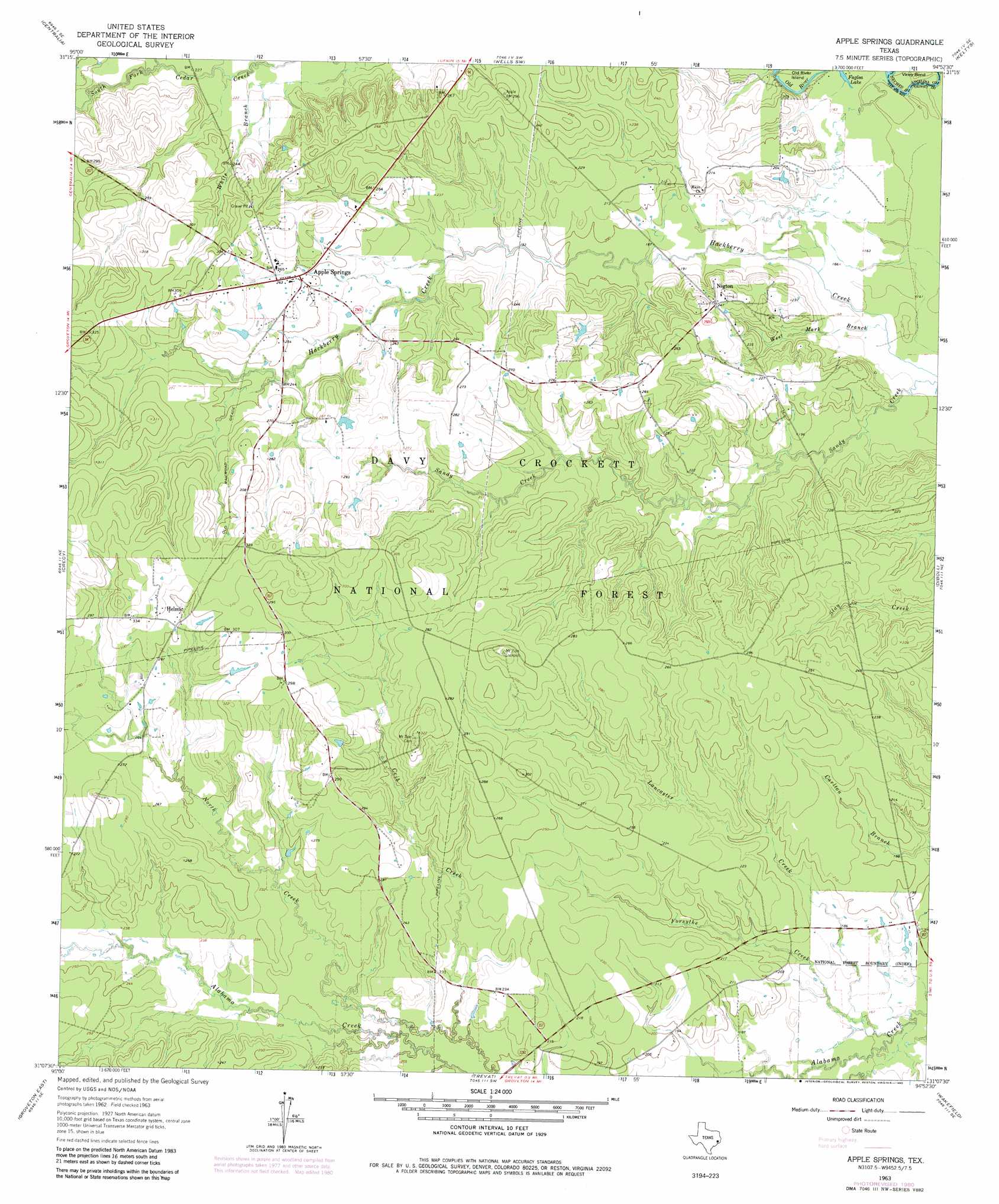
USGS Topo Quad 31094b8 - 1:24,000 scale
| Topo Map Name: | Apple Springs |
| USGS Topo Quad ID: | 31094b8 |
| Print Size: | ca. 21 1/4" wide x 27" high |
| Southeast Coordinates: | 31.125° N latitude / 94.875° W longitude |
| Map Center Coordinates: | 31.1875° N latitude / 94.9375° W longitude |
| U.S. State: | TX |
| Filename: | o31094b8.jpg |
| Download Map JPG Image: | Apple Springs topo map 1:24,000 scale |
| Map Type: | Topographic |
| Topo Series: | 7.5´ |
| Map Scale: | 1:24,000 |
| Source of Map Images: | United States Geological Survey (USGS) |
| Alternate Map Versions: |
Apple Springs TX 1963, updated 1966 Download PDF Buy paper map Apple Springs TX 1963, updated 1980 Download PDF Buy paper map Apple Springs TX 2010 Download PDF Buy paper map Apple Springs TX 2013 Download PDF Buy paper map Apple Springs TX 2016 Download PDF Buy paper map |
| FStopo: | US Forest Service topo Apple Springs is available: Download FStopo PDF Download FStopo TIF |
1:24,000 Topo Quads surrounding Apple Springs
Ratcliff |
Kennard Ne |
Wells |
Clawson |
Redland |
Kennard |
Centralia |
Wells Sw |
Keltys |
Lufkin |
Pennington |
Crecy |
Apple Springs |
Diboll |
Bald Hill |
Groveton West |
Groveton East |
Trevat |
Wakefield |
Pluck |
Chita |
Colita |
Carmona |
Corrigan |
Camden |
> Back to 31094a1 at 1:100,000 scale
> Back to 31094a1 at 1:250,000 scale
> Back to U.S. Topo Maps home
Apple Springs topo map: Gazetteer
Apple Springs: Bends
Viney Bend elevation 49m 160′Apple Springs: Islands
Old River Island elevation 49m 160′Apple Springs: Parks
Alabama Creek WMA elevation 54m 177′Apple Springs: Populated Places
Apple Springs elevation 77m 252′Helmic elevation 94m 308′
Nigton elevation 73m 239′
Apple Springs: Springs
Apple Springs elevation 87m 285′Apple Springs: Streams
Black Lake Creek elevation 67m 219′Crib Creek elevation 61m 200′
Forsythe Creek elevation 48m 157′
Lancaster Creek elevation 49m 160′
West Mark Branch elevation 48m 157′
Apple Springs digital topo map on disk
Buy this Apple Springs topo map showing relief, roads, GPS coordinates and other geographical features, as a high-resolution digital map file on DVD: