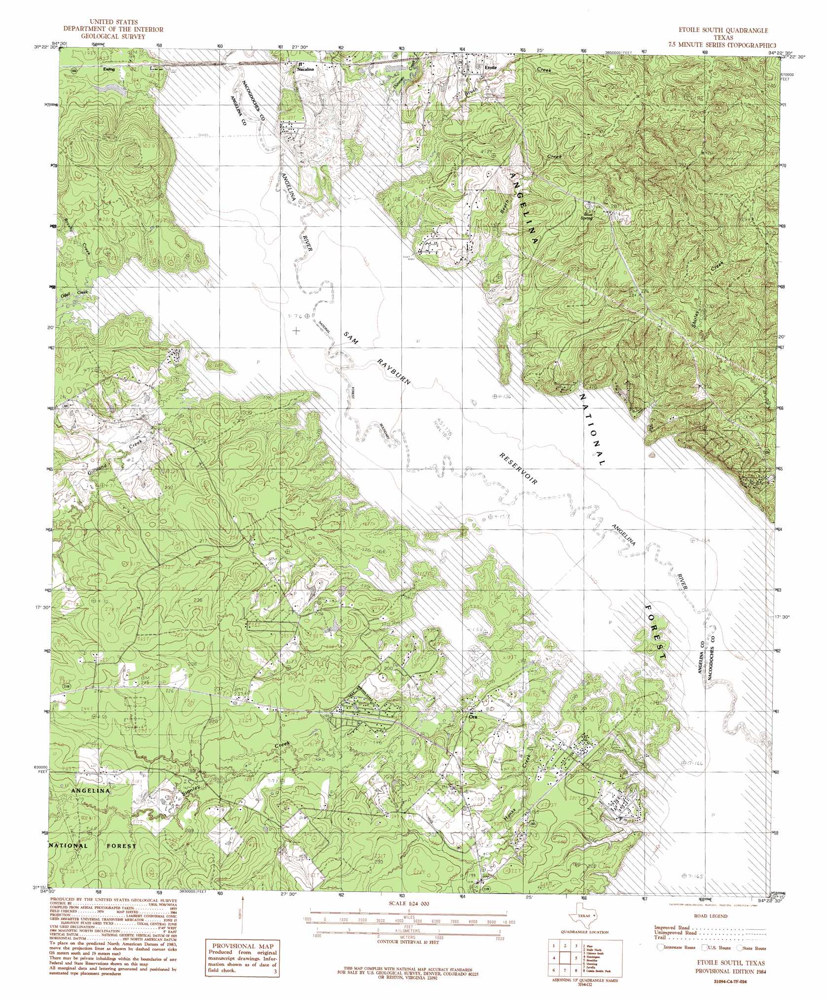
Etoile South Topo Map Texas
To zoom in, hover over the map of Etoile South
USGS Topo Quad 31094c4 - 1:24,000 scale
| Topo Map Name: | Etoile South |
| USGS Topo Quad ID: | 31094c4 |
| Print Size: | ca. 21 1/4" wide x 27" high |
| Southeast Coordinates: | 31.25° N latitude / 94.375° W longitude |
| Map Center Coordinates: | 31.3125° N latitude / 94.4375° W longitude |
| U.S. State: | TX |
| Filename: | o31094c4.jpg |
| Download Map JPG Image: | Etoile South topo map 1:24,000 scale |
| Map Type: | Topographic |
| Topo Series: | 7.5´ |
| Map Scale: | 1:24,000 |
| Source of Map Images: | United States Geological Survey (USGS) |
| Alternate Map Versions: |
Etoile South TX 1984, updated 1984 Download PDF Buy paper map Etoile South TX 2003, updated 2004 Download PDF Buy paper map Etoile South TX 2010 Download PDF Buy paper map Etoile South TX 2013 Download PDF Buy paper map Etoile South TX 2016 Download PDF Buy paper map |
| FStopo: | US Forest Service topo Etoile South is available: Download FStopo PDF Download FStopo TIF |
1:24,000 Topo Quads surrounding Etoile South
Nacogdoches South |
Woden |
Melrose |
Chireno North |
San Augustine West |
Redland |
Platt |
Etoile North |
Chireno South |
Norwood |
Lufkin |
Huntington |
Etoile South |
Broaddus |
Harvey Creek |
Bald Hill |
Manning |
Zavalla |
Cassells-Boykin Park |
Veach |
Pluck |
Wolf Hill |
Rockland |
Boykin Spring |
Ebenezer |
> Back to 31094a1 at 1:100,000 scale
> Back to 31094a1 at 1:250,000 scale
> Back to U.S. Topo Maps home
Etoile South topo map: Gazetteer
Etoile South: Guts
Big Slough elevation 50m 164′Etoile South: Populated Places
Ewing elevation 57m 187′Ora elevation 61m 200′
Shirley Creek elevation 80m 262′
Etoile South: Springs
Blue Spring elevation 84m 275′Etoile South: Streams
Beech Creek elevation 50m 164′Brush Creek elevation 50m 164′
Brushy Creek elevation 50m 164′
Duranzo Creek elevation 50m 164′
Gilliland Creek elevation 50m 164′
Hanks Creek elevation 50m 164′
Odell Creek elevation 50m 164′
Shirley Creek elevation 50m 164′
Stanley Creek elevation 50m 164′
Etoile South digital topo map on disk
Buy this Etoile South topo map showing relief, roads, GPS coordinates and other geographical features, as a high-resolution digital map file on DVD: