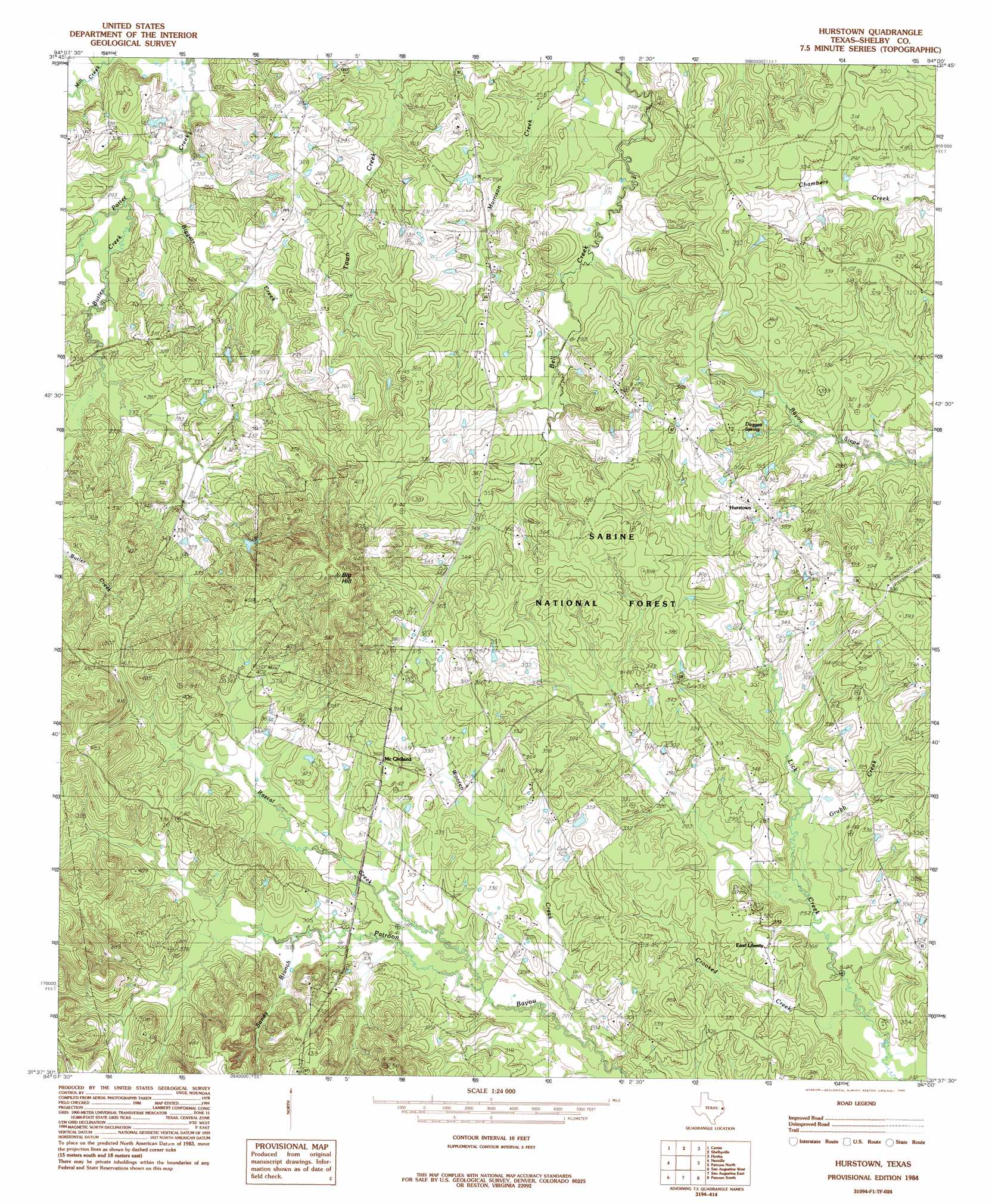
Hurstown Topo Map Texas
To zoom in, hover over the map of Hurstown
USGS Topo Quad 31094f1 - 1:24,000 scale
| Topo Map Name: | Hurstown |
| USGS Topo Quad ID: | 31094f1 |
| Print Size: | ca. 21 1/4" wide x 27" high |
| Southeast Coordinates: | 31.625° N latitude / 94° W longitude |
| Map Center Coordinates: | 31.6875° N latitude / 94.0625° W longitude |
| U.S. State: | TX |
| Filename: | o31094f1.jpg |
| Download Map JPG Image: | Hurstown topo map 1:24,000 scale |
| Map Type: | Topographic |
| Topo Series: | 7.5´ |
| Map Scale: | 1:24,000 |
| Source of Map Images: | United States Geological Survey (USGS) |
| Alternate Map Versions: |
Hurstown TX 1984, updated 1985 Download PDF Buy paper map Hurstown TX 2003, updated 2004 Download PDF Buy paper map Hurstown TX 2010 Download PDF Buy paper map Hurstown TX 2013 Download PDF Buy paper map Hurstown TX 2016 Download PDF Buy paper map |
| FStopo: | US Forest Service topo Hurstown is available: Download FStopo PDF Download FStopo TIF |
1:24,000 Topo Quads surrounding Hurstown
Tenaha West |
Tenaha East |
Logansport West |
Logansport East |
Hunter |
Arcadia |
Center |
Shelbyville |
Huxley |
Union Springs |
Mount Herman |
Neuville |
Hurstown |
Patroon North |
Brushy Creek |
Chireno North |
San Augustine West |
San Augustine East |
Patroon South |
East Hamilton |
Chireno South |
Norwood |
Chinquapin |
Geneva |
Milam |
> Back to 31094e1 at 1:100,000 scale
> Back to 31094a1 at 1:250,000 scale
> Back to U.S. Topo Maps home
Hurstown topo map: Gazetteer
Hurstown: Populated Places
East Liberty elevation 91m 298′East Liberty elevation 99m 324′
Hurstown elevation 114m 374′
McClelland elevation 110m 360′
Hurstown: Springs
Doggett Spring elevation 105m 344′Hurstown: Streams
Biggers Creek elevation 68m 223′Butler Creek elevation 86m 282′
Crooked Creek elevation 75m 246′
Grubb Creek elevation 80m 262′
Rascal Creek elevation 83m 272′
Sandy Branch elevation 88m 288′
Wooten Creek elevation 81m 265′
Hurstown: Summits
Big Hill elevation 164m 538′Hurstown digital topo map on disk
Buy this Hurstown topo map showing relief, roads, GPS coordinates and other geographical features, as a high-resolution digital map file on DVD: