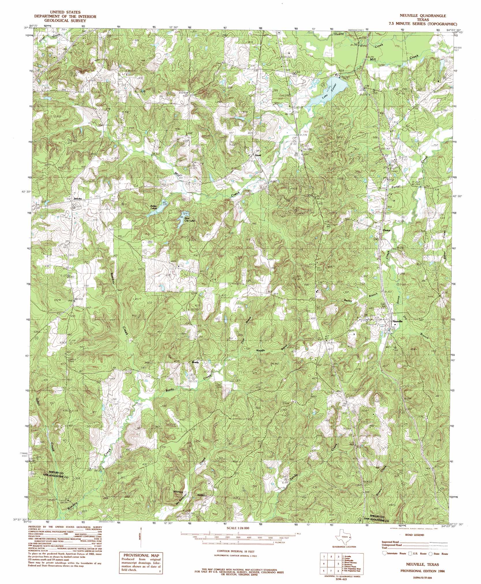
Neuville Topo Map Texas
To zoom in, hover over the map of Neuville
USGS Topo Quad 31094f2 - 1:24,000 scale
| Topo Map Name: | Neuville |
| USGS Topo Quad ID: | 31094f2 |
| Print Size: | ca. 21 1/4" wide x 27" high |
| Southeast Coordinates: | 31.625° N latitude / 94.125° W longitude |
| Map Center Coordinates: | 31.6875° N latitude / 94.1875° W longitude |
| U.S. State: | TX |
| Filename: | o31094f2.jpg |
| Download Map JPG Image: | Neuville topo map 1:24,000 scale |
| Map Type: | Topographic |
| Topo Series: | 7.5´ |
| Map Scale: | 1:24,000 |
| Source of Map Images: | United States Geological Survey (USGS) |
| Alternate Map Versions: |
Neuville TX 1984, updated 1985 Download PDF Buy paper map Neuville TX 2010 Download PDF Buy paper map Neuville TX 2013 Download PDF Buy paper map Neuville TX 2016 Download PDF Buy paper map |
1:24,000 Topo Quads surrounding Neuville
Timpson |
Tenaha West |
Tenaha East |
Logansport West |
Logansport East |
Garrison East |
Arcadia |
Center |
Shelbyville |
Huxley |
Martinsville |
Mount Herman |
Neuville |
Hurstown |
Patroon North |
Melrose |
Chireno North |
San Augustine West |
San Augustine East |
Patroon South |
Etoile North |
Chireno South |
Norwood |
Chinquapin |
Geneva |
> Back to 31094e1 at 1:100,000 scale
> Back to 31094a1 at 1:250,000 scale
> Back to U.S. Topo Maps home
Neuville topo map: Gazetteer
Neuville: Dams
Lake Center Dam elevation 78m 255′Slayden Lake Number 1 Dam elevation 110m 360′
Slayden Lake Number 2 Dam elevation 100m 328′
Neuville: Populated Places
Brady elevation 121m 396′Choice elevation 92m 301′
Duff elevation 149m 488′
Jericho elevation 132m 433′
Neuville elevation 98m 321′
Short elevation 98m 321′
Neuville: Reservoirs
Bailey Lakes elevation 102m 334′Lake Center elevation 78m 255′
New City Lake elevation 100m 328′
Slayden Lake Number 1 elevation 110m 360′
Slayden Lake Number 2 elevation 100m 328′
Neuville: Springs
Hughes Springs elevation 94m 308′Neuville: Streams
Bailey Branch elevation 91m 298′Brady Creek elevation 87m 285′
Cave Branch elevation 98m 321′
Dry Branch elevation 95m 311′
Kimbro Creek elevation 76m 249′
Stonedive Creek elevation 73m 239′
Straw Creek elevation 80m 262′
Woodfin Branch elevation 98m 321′
Neuville digital topo map on disk
Buy this Neuville topo map showing relief, roads, GPS coordinates and other geographical features, as a high-resolution digital map file on DVD: