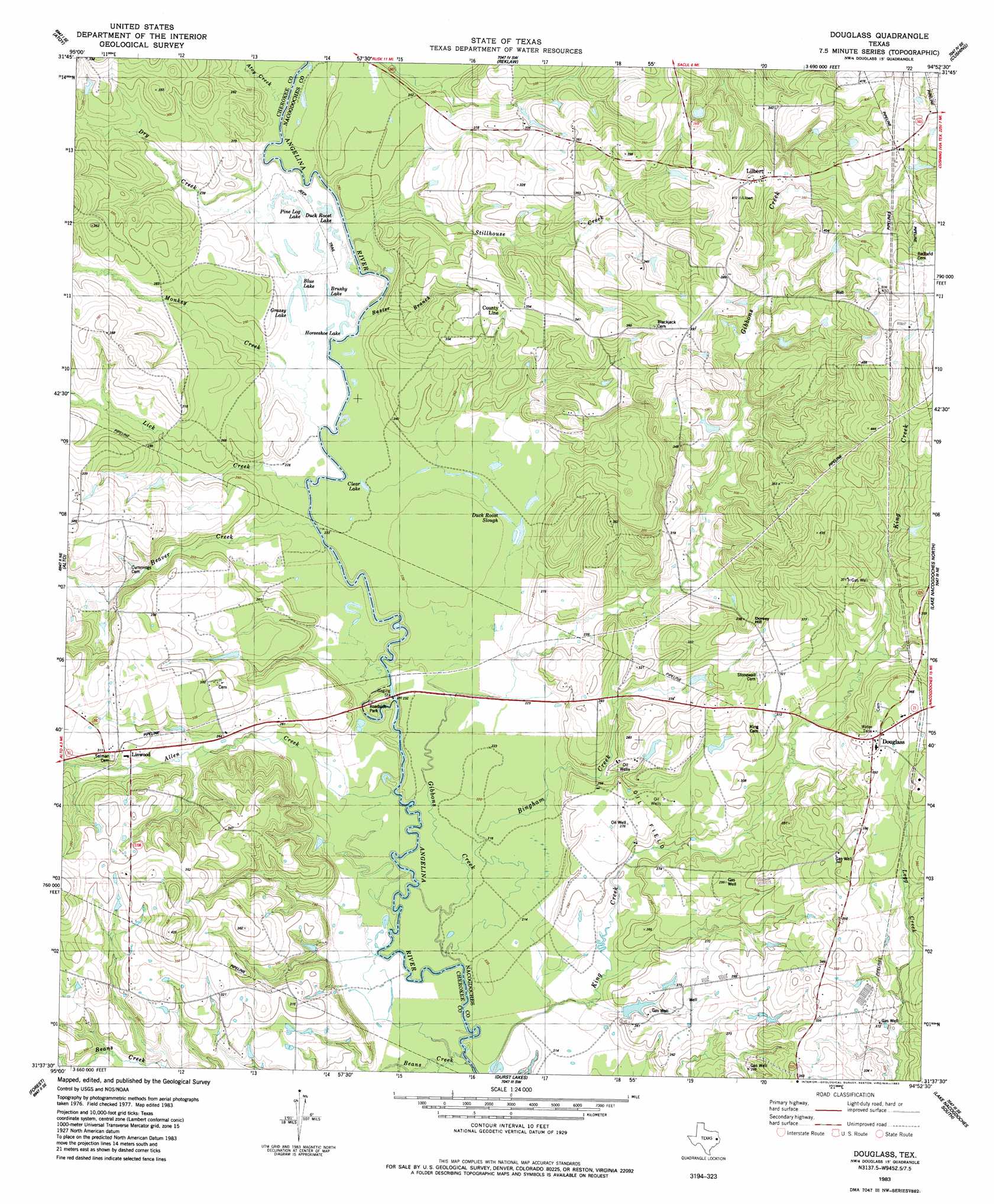
Douglas Topo Map Texas
To zoom in, hover over the map of Douglas
USGS Topo Quad 31094f8 - 1:24,000 scale
| Topo Map Name: | Douglas |
| USGS Topo Quad ID: | 31094f8 |
| Print Size: | ca. 21 1/4" wide x 27" high |
| Southeast Coordinates: | 31.625° N latitude / 94.875° W longitude |
| Map Center Coordinates: | 31.6875° N latitude / 94.9375° W longitude |
| U.S. State: | TX |
| Filename: | o31094f8.jpg |
| Download Map JPG Image: | Douglas topo map 1:24,000 scale |
| Map Type: | Topographic |
| Topo Series: | 7.5´ |
| Map Scale: | 1:24,000 |
| Source of Map Images: | United States Geological Survey (USGS) |
| Alternate Map Versions: |
Douglass TX 1983, updated 1983 Download PDF Buy paper map Douglass TX 2010 Download PDF Buy paper map Douglass TX 2013 Download PDF Buy paper map Douglass TX 2016 Download PDF Buy paper map |
1:24,000 Topo Quads surrounding Douglas
Jacksonville East |
New Summerfield |
New Salem |
Laneville |
Mount Enterprise |
Rusk |
Atoy |
Reklaw |
Cushing |
Trawick |
Pryor Mountain |
Alto |
Douglas |
Lake Nacogdoches North |
Nacogdoches North |
Weches |
Forest |
Durst Lakes |
Lake Nacogdoches South |
Nacogdoches South |
Ratcliff |
Kennard Ne |
Wells |
Clawson |
Redland |
> Back to 31094e1 at 1:100,000 scale
> Back to 31094a1 at 1:250,000 scale
> Back to U.S. Topo Maps home
Douglas topo map: Gazetteer
Douglas: Lakes
Blue Lake elevation 69m 226′Brushy Lake elevation 69m 226′
Clear Lake elevation 68m 223′
Duck Roost Lake elevation 70m 229′
Duck Roost Slough elevation 69m 226′
Grassy Lake elevation 69m 226′
Horseshoe Lake elevation 68m 223′
Pine Log Lake elevation 70m 229′
Douglas: Populated Places
County Line elevation 100m 328′Douglass elevation 106m 347′
Lilbert elevation 122m 400′
Linwood elevation 90m 295′
Douglas: Streams
Allen Creek elevation 64m 209′Atoy Creek elevation 70m 229′
Baxter Branch elevation 92m 301′
Beaver Creek elevation 66m 216′
Bingham Creek elevation 64m 209′
Gibbons Creek elevation 68m 223′
Lick Creek elevation 67m 219′
Monkey Creek elevation 67m 219′
Stillhouse Creek elevation 109m 357′
Douglas digital topo map on disk
Buy this Douglas topo map showing relief, roads, GPS coordinates and other geographical features, as a high-resolution digital map file on DVD: