Center Topo Map Texas
To zoom in, hover over the map of Center
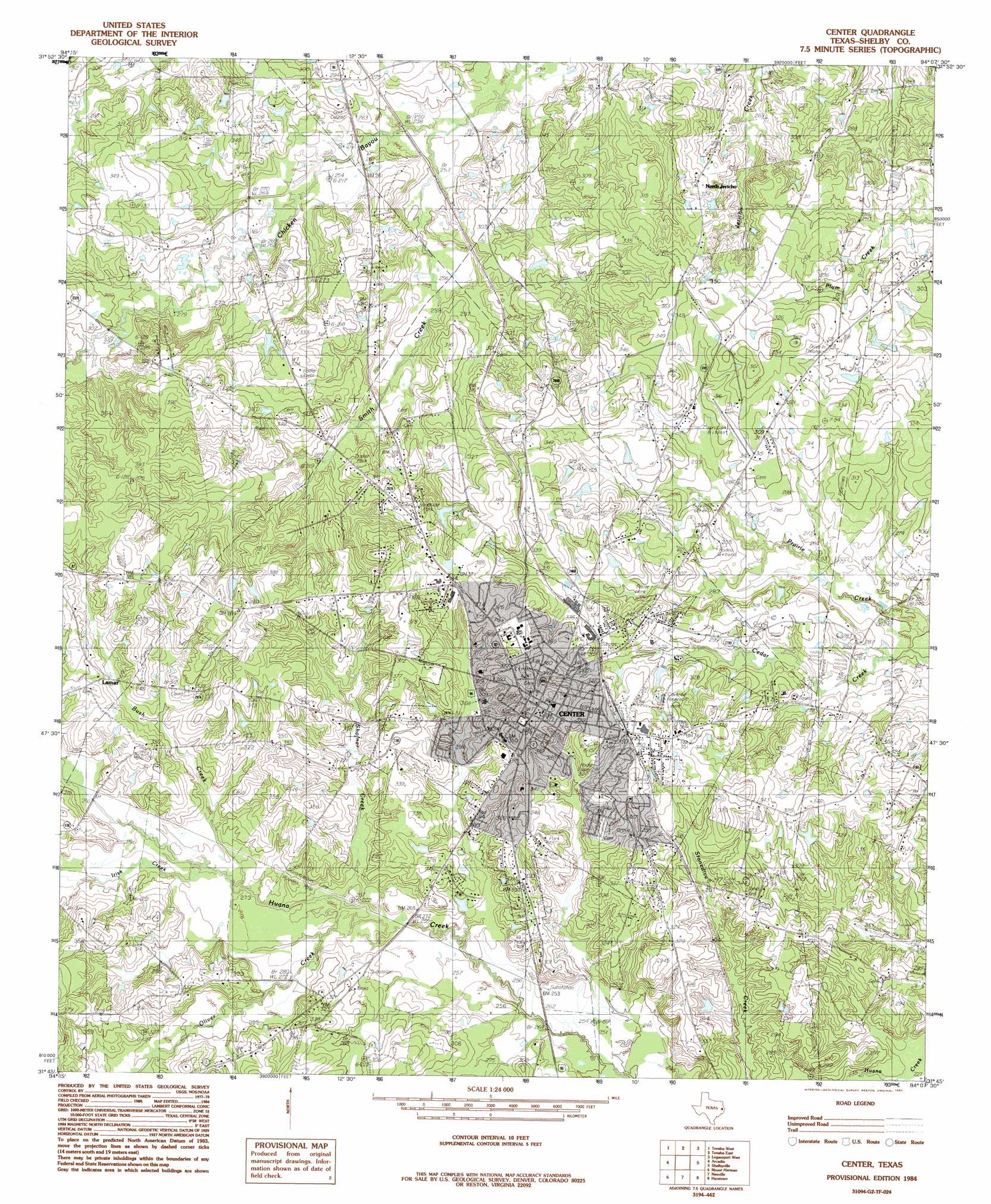
USGS Topo Quad 31094g2 - 1:24,000 scale
| Topo Map Name: | Center |
| USGS Topo Quad ID: | 31094g2 |
| Print Size: | ca. 21 1/4" wide x 27" high |
| Southeast Coordinates: | 31.75° N latitude / 94.125° W longitude |
| Map Center Coordinates: | 31.8125° N latitude / 94.1875° W longitude |
| U.S. State: | TX |
| Filename: | o31094g2.jpg |
| Download Map JPG Image: | Center topo map 1:24,000 scale |
| Map Type: | Topographic |
| Topo Series: | 7.5´ |
| Map Scale: | 1:24,000 |
| Source of Map Images: | United States Geological Survey (USGS) |
| Alternate Map Versions: |
Center TX 1984, updated 1985 Download PDF Buy paper map Center TX 2010 Download PDF Buy paper map Center TX 2013 Download PDF Buy paper map Center TX 2016 Download PDF Buy paper map |
1:24,000 Topo Quads surrounding Center
Lake Murvaul |
Gary |
Old Center |
Galloway |
Longstreet |
Timpson |
Tenaha West |
Tenaha East |
Logansport West |
Logansport East |
Garrison East |
Arcadia |
Center |
Shelbyville |
Huxley |
Martinsville |
Mount Herman |
Neuville |
Hurstown |
Patroon North |
Melrose |
Chireno North |
San Augustine West |
San Augustine East |
Patroon South |
> Back to 31094e1 at 1:100,000 scale
> Back to 31094a1 at 1:250,000 scale
> Back to U.S. Topo Maps home
Center topo map: Gazetteer
Center: Airports
Center Municipal Airport elevation 91m 298′Center: Parks
Shelby County Courthouse Square elevation 114m 374′Center: Populated Places
Center elevation 113m 370′Lamar elevation 101m 331′
North Jericho elevation 99m 324′
Webb elevation 87m 285′
Center: Streams
Bush Creek elevation 83m 272′Irish Creek elevation 84m 275′
Jones Branch elevation 82m 269′
Oliver Creek elevation 82m 269′
Shofner Creek elevation 78m 255′
Smith Creek elevation 72m 236′
Center digital topo map on disk
Buy this Center topo map showing relief, roads, GPS coordinates and other geographical features, as a high-resolution digital map file on DVD: