Cushing Topo Map Texas
To zoom in, hover over the map of Cushing
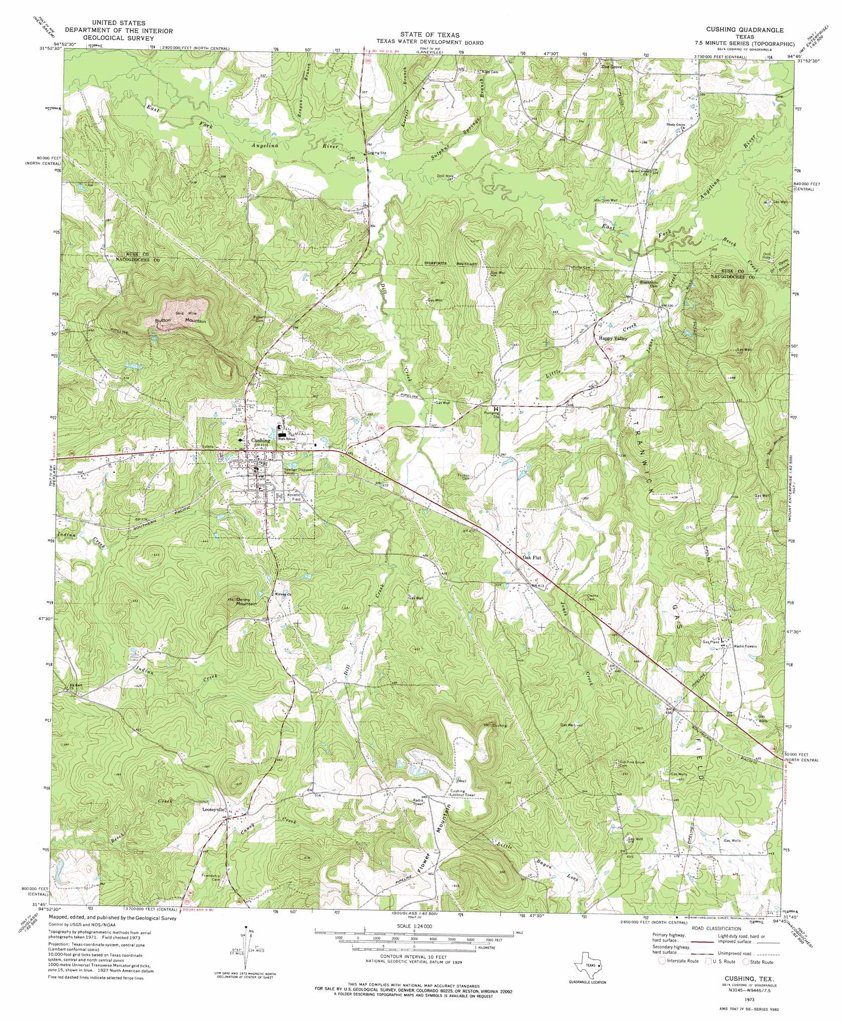
USGS Topo Quad 31094g7 - 1:24,000 scale
| Topo Map Name: | Cushing |
| USGS Topo Quad ID: | 31094g7 |
| Print Size: | ca. 21 1/4" wide x 27" high |
| Southeast Coordinates: | 31.75° N latitude / 94.75° W longitude |
| Map Center Coordinates: | 31.8125° N latitude / 94.8125° W longitude |
| U.S. State: | TX |
| Filename: | o31094g7.jpg |
| Download Map JPG Image: | Cushing topo map 1:24,000 scale |
| Map Type: | Topographic |
| Topo Series: | 7.5´ |
| Map Scale: | 1:24,000 |
| Source of Map Images: | United States Geological Survey (USGS) |
| Alternate Map Versions: |
Cushing TX 1973, updated 1976 Download PDF Buy paper map Cushing TX 2010 Download PDF Buy paper map Cushing TX 2013 Download PDF Buy paper map Cushing TX 2016 Download PDF Buy paper map |
1:24,000 Topo Quads surrounding Cushing
Griffin |
Gum Springs |
Berryhill Creek |
Minden |
Long Branch |
New Summerfield |
New Salem |
Laneville |
Mount Enterprise |
Caledonia |
Atoy |
Reklaw |
Cushing |
Trawick |
Garrison West |
Alto |
Douglas |
Lake Nacogdoches North |
Nacogdoches North |
Appleby |
Forest |
Durst Lakes |
Lake Nacogdoches South |
Nacogdoches South |
Woden |
> Back to 31094e1 at 1:100,000 scale
> Back to 31094a1 at 1:250,000 scale
> Back to U.S. Topo Maps home
Cushing topo map: Gazetteer
Cushing: Oilfields
Tranwick Gas Field elevation 111m 364′Cushing: Populated Places
Cushing elevation 125m 410′Happy Valley elevation 113m 370′
Looneyville elevation 146m 479′
Oak Flat elevation 123m 403′
Zion Grove elevation 132m 433′
Cushing: Streams
Beech Creek elevation 92m 301′Dill Creek elevation 88m 288′
Everett Branch elevation 88m 288′
Ike Owens Branch elevation 94m 308′
Jones Creek elevation 92m 301′
Little Creek elevation 97m 318′
Reagan Branch elevation 85m 278′
Sulphur Springs Branch elevation 88m 288′
Cushing: Summits
Button Mountain elevation 221m 725′Denny Mountain elevation 188m 616′
Flower Mountain elevation 211m 692′
Cushing digital topo map on disk
Buy this Cushing topo map showing relief, roads, GPS coordinates and other geographical features, as a high-resolution digital map file on DVD: