Logansport West Topo Map Texas
To zoom in, hover over the map of Logansport West
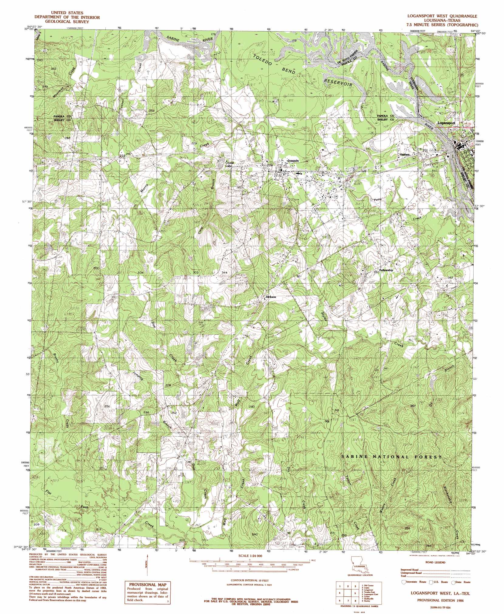
USGS Topo Quad 31094h1 - 1:24,000 scale
| Topo Map Name: | Logansport West |
| USGS Topo Quad ID: | 31094h1 |
| Print Size: | ca. 21 1/4" wide x 27" high |
| Southeast Coordinates: | 31.875° N latitude / 94° W longitude |
| Map Center Coordinates: | 31.9375° N latitude / 94.0625° W longitude |
| U.S. States: | TX, LA |
| Filename: | o31094h1.jpg |
| Download Map JPG Image: | Logansport West topo map 1:24,000 scale |
| Map Type: | Topographic |
| Topo Series: | 7.5´ |
| Map Scale: | 1:24,000 |
| Source of Map Images: | United States Geological Survey (USGS) |
| Alternate Map Versions: |
Logansport West LA 1984, updated 1984 Download PDF Buy paper map Logansport West LA 2003, updated 2004 Download PDF Buy paper map Logansport West LA 2010 Download PDF Buy paper map Logansport West LA 2015 Download PDF Buy paper map |
| FStopo: | US Forest Service topo Logansport West is available: Download FStopo PDF Download FStopo TIF |
1:24,000 Topo Quads surrounding Logansport West
Carthage |
River Hill |
Old Panola |
Keatchie |
Gloster |
Gary |
Old Center |
Galloway |
Longstreet |
Grand Cane |
Tenaha West |
Tenaha East |
Logansport West |
Logansport East |
Hunter |
Arcadia |
Center |
Shelbyville |
Huxley |
Union Springs |
Mount Herman |
Neuville |
Hurstown |
Patroon North |
Brushy Creek |
> Back to 31094e1 at 1:100,000 scale
> Back to 31094a1 at 1:250,000 scale
> Back to U.S. Topo Maps home
Logansport West topo map: Gazetteer
Logansport West: Dams
Crystal Lake Dam elevation 65m 213′Whiddon Lake Dam elevation 66m 216′
Logansport West: Populated Places
Fellowship elevation 92m 301′Haslam elevation 63m 206′
Jackson elevation 90m 295′
Joaquin elevation 69m 226′
Logansport West: Reservoirs
Crystal Lake elevation 71m 232′Whiddon Lake elevation 66m 216′
Logansport West: Streams
Brushy Creek elevation 61m 200′Cedar Branch elevation 69m 226′
Connell Creek elevation 52m 170′
Doe Creek elevation 59m 193′
Jumping Branch Creek elevation 59m 193′
Morris Creek elevation 53m 173′
Ox Branch elevation 61m 200′
Logansport West digital topo map on disk
Buy this Logansport West topo map showing relief, roads, GPS coordinates and other geographical features, as a high-resolution digital map file on DVD: